Owl Canyon Hiking Trail

Lake Mead National Recreation Area
Near Las Vegas, Nevada – January 6, 2024

Impounded behind the concrete and steel of the magnificent Hoover Dam, Lake Mead in southeastern Nevada and southwestern Arizona is, by volume (and when full), the largest inland reservoir of water in the United States. There are a couple of U.S. reservoirs that have a larger surface area, but they don’t have the depth of Lake Mead (when full). The reservoir, made by the result of damming the Colorado River, is the primary feature of Lake Mead National Recreation Area – the nation’s first NRA as well as its largest at 1.5 million acres, or just over 2,400 square miles. For perspective, Lake Mead NRA is a couple hundred square miles larger than Kit Carson County in far eastern Colorado.

When full, Lake Mead has a surface area of 247 square miles, a surface elevation of 1,229 feet above sea level, and a maximum depth of 532 feet. When it’s full.

Lake Mead is, at the moment, not full. Not even close, really. In fact, it’s a couple hundred feet below its capacity, and it hasn’t been this empty since it was first filled after the construction of the Hoover Dam in 1937. A multi-decade-long drought in the southwestern United States, as well as unprecedented demand for agricultural and municipal water in the multi-state region served by the reservoir, have led to a stunning drop in the water level of Lake Mead. The reservoir’s capacity is so large that one inch of water in the lake equates to about 2 billion gallons. Two billion multiplied by 2,400 inches (200 feet) means Lake Mead has 48 trillion fewer gallons of water since the reservoir was last full in the mid-1980s. That number is so large as to be effectively useless, but in terms of acre-feet (which is the amount of water needed to cover an acre with 12 inches of water), Lake Mead is currently a little over a quarter of its capacity.

Geologists and hydrologists, along with other concerned -ogists, are working, and have been working for several decades, to address this issue. Many millions of people rely on Lake Mead’s water to continue flowing through the reservoir, providing electricity as well as drinking, municipal, and agricultural water. Mother Nature, while a powerful force in her own right, will take a long time to refill the reservoir: even after the remarkable upstream snowpack of the 2022-2023 winter in the Rocky Mountains, the reservoir rose only a few inches. It would take many consecutive decades of consistently above-average snowpack to refill the lake. That’s highly, highly unlikely to happen.

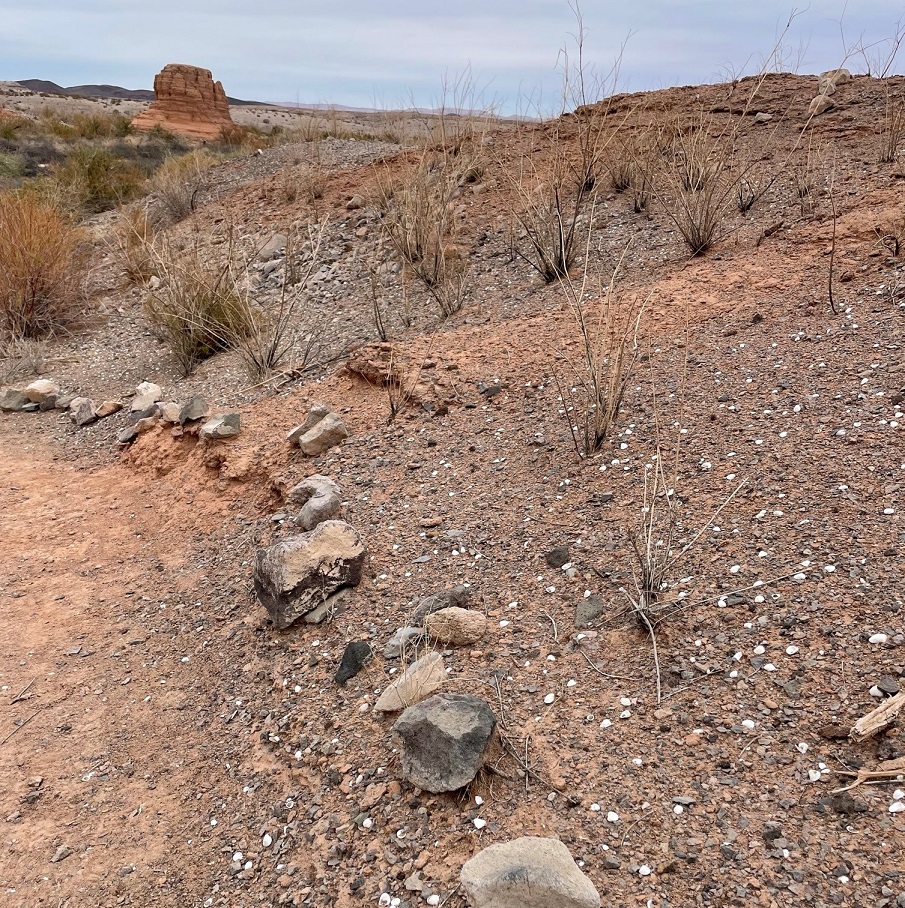
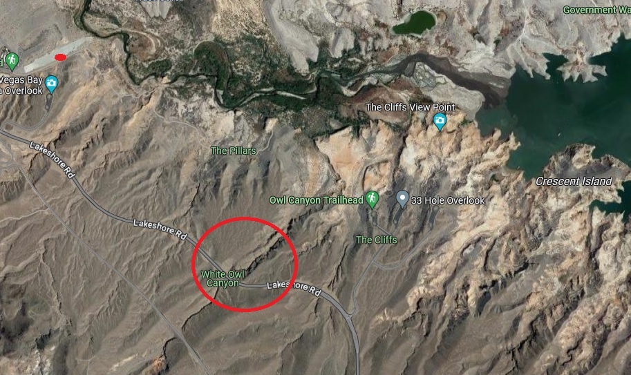
While the situation awaits a hopeful solution, that change in Lake Mead’s water levels also presents new opportunities for recreation: the receding water has left behind areas for great hikes. Recreation managers have developed at least 14 hiking trails all around the area, ranging from short and easy strolls to a 34-mile-long bike loop to strenuous hikes that are meant for the truly hardy among us.

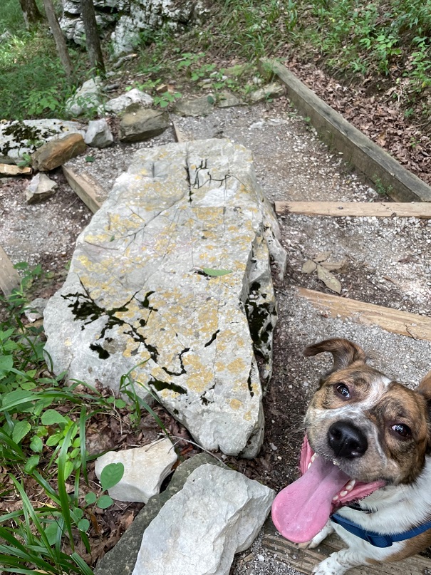
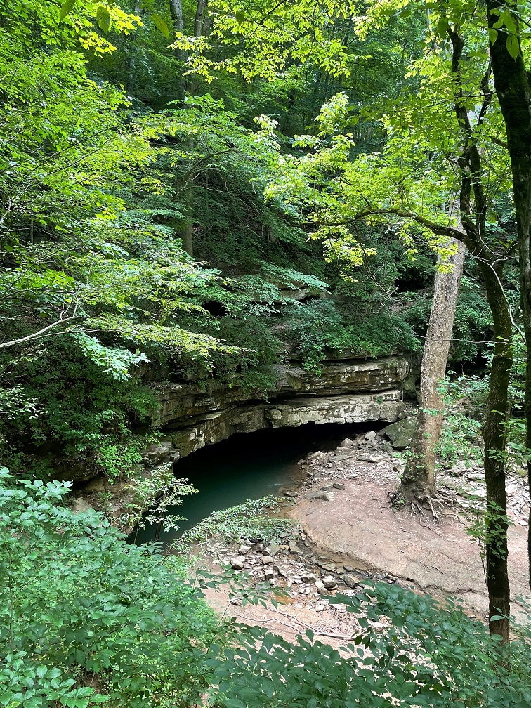
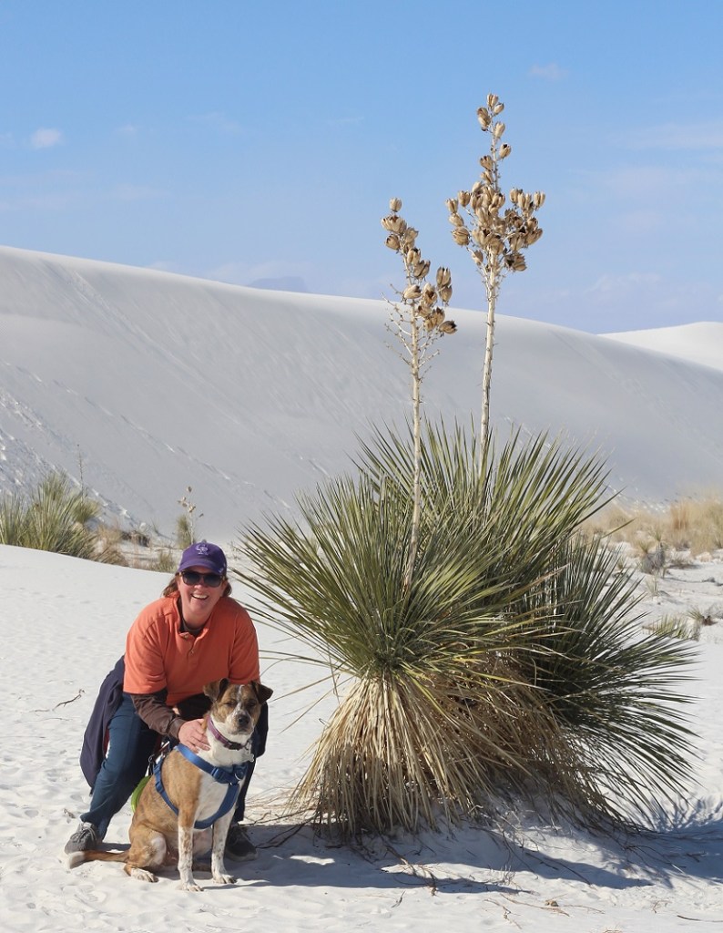
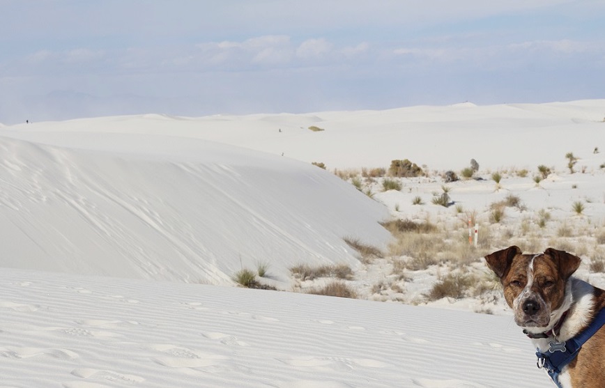
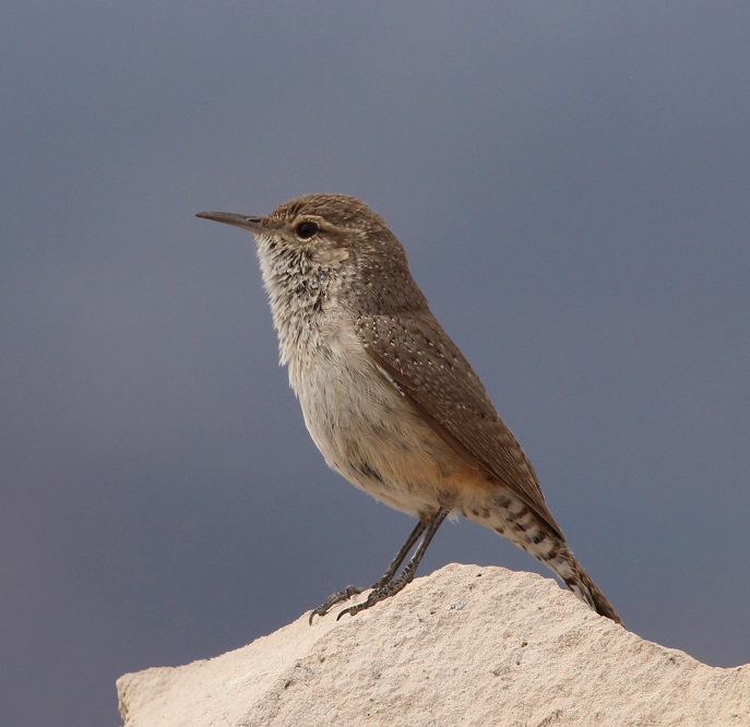
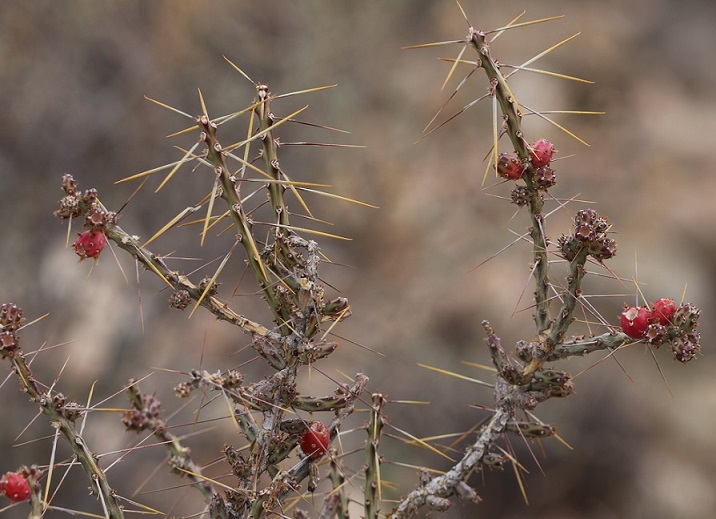
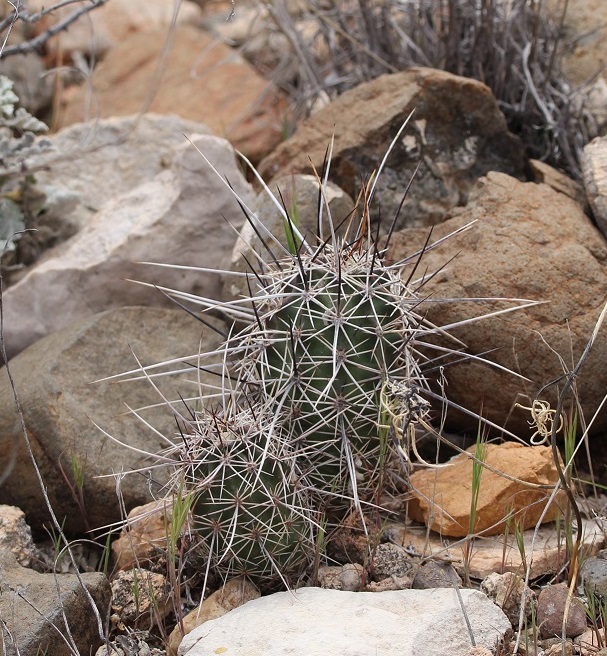
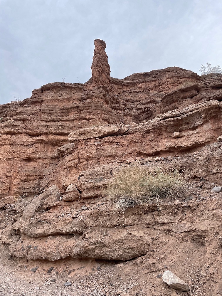
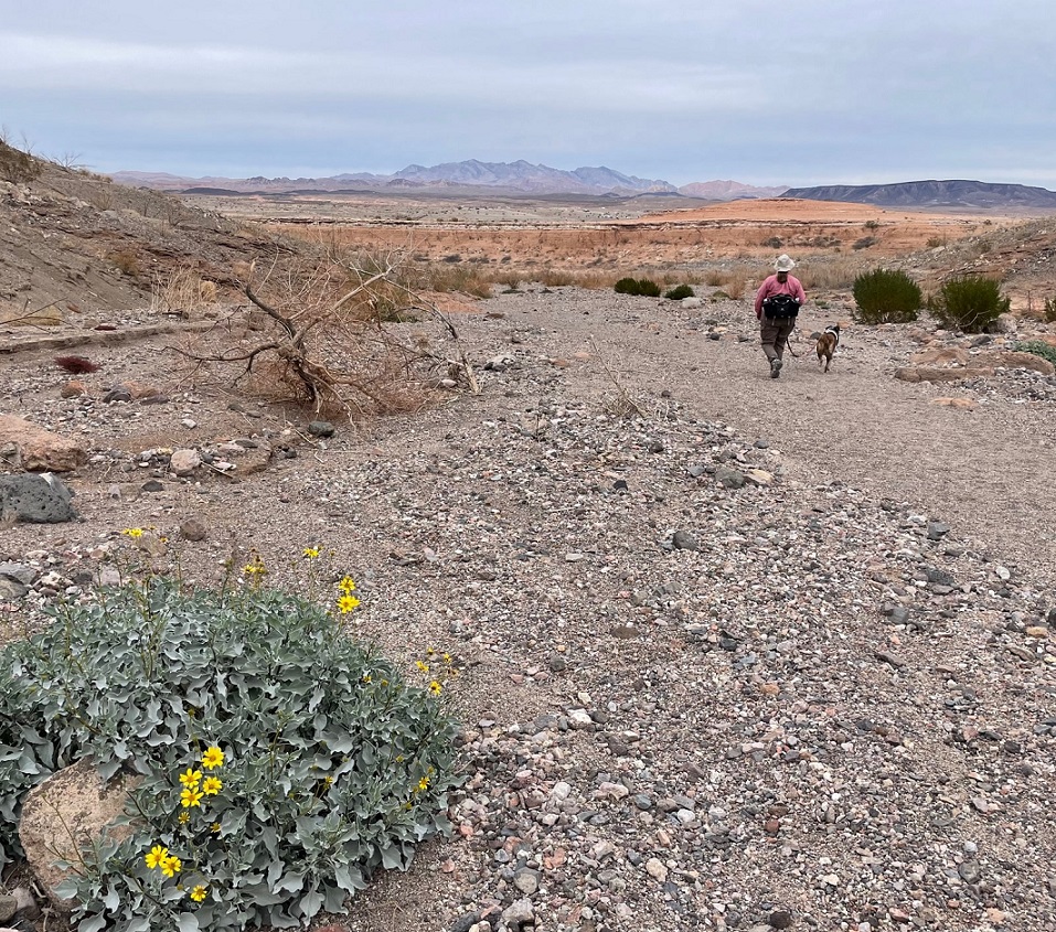
Which neither Nancy, nor Gunther, nor I, are. We lucked into a great hike called the Owl Canyon trail on the first weekend of 2024, and saw some pretty cool sights while enjoying a 4-mile out-and-back trail.

We saw several of these beautiful buttes along the trail to Owl Canyon. The creek flowing below the butte at lower left is Las Vegas Wash, a 12-mile-long arroyo that channels most of the excess water from the Las Vegas metropolitan area into Lake Mead. The wash contains water from urban runoff, reclaimed water from golf courses and parks, and stormwater; in short, it’s probably best to not dip your tin cup in it for a cool, refreshing drink – although the plants and rocks of the wash do filter a lot of the contaminants out of the water before it reaches Lake Mead. This photo was taken perhaps a half-mile from the trailhead, which was a boat ramp that used to provide watercraft with access to Lake Mead. More on that later.

Thousands of these small white mollusk shells can be found in several locations along the Owl Canyon trail. They point to a time, years ago, when this entire area was covered by a vast body of water: Lake Mead, which, when it’s full is about 60 percent bigger than the area covered by the city and county of Denver. As recently as the 1980s, mollusks like these were free to frolic or fritter away their days or whatever it is that mollusks do. Now, every foot of the trail we were on is high and dry.

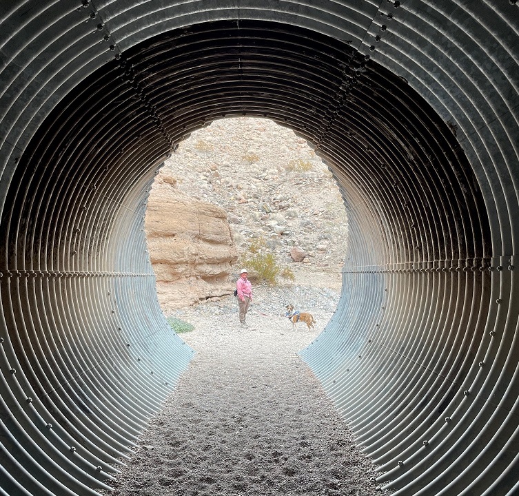
Here we see an intrepid hiker and her ill-behaved dog (it’s Nancy and Gunther) approaching the mouth of Owl Canyon, about a mile and a half from the trailhead on the boat ramp to the west. The canyon can also be accessed by a trailhead resulting in a shorter hike (2.2 miles out and back) coming from the northeast, but we wanted a bit more of a challenge for this first hike of 2024.

As you can probably tell from the earlier photos, it’s rather arid in the Lake Mead National Recreation Area (it’s in a literal desert, the Mohave, and the region is a convergence of the Mohave, Great Basin, and Sonoran deserts). Depending on which resource you use for reference, the area gets between 4 and 6 inches of precipitation each year. Except for a great blue heron, a small family of mallard ducks, and a large flock of goldfinches, we didn’t see much in the way in wildlife on the day’s hike. However, we did see some examples of desert plants that we hadn’t yet encountered on our travels. This is a specimen of desert stingbush (Eucnide urens), also known as velcro plant. It’s found in the desert regions of the southwestern United States and Baja California. It looks a lot like holly leaves seen around the December holiday, but, true to its name, the serrated leaves have stinging hairs to protect the plant from browsing animals. It’s yet another desert plant one wouldn’t want to lick (although the desert bighorn sheep native to the area seem to like them quite a lot).

The walls of the canyon, which were under the waters of Lake Mead for many years, is made of a conglomerate of many different kinds and sizes of rocks, ranging from particles of sand to basalt stones the size of footballs or larger. Owl Canyon existed before Lake Mead; it was carved by an intermittent watercourse to create a winding natural path through the desert.

The previous photo of the canyon walls’ conglomerate was taken near a spot in the canyon where we stopped for lunch. This photo was taken from the same spot. It shows Gunther alertly listening to Nancy about further instructions regarding the hike, especially to be constantly aware of impending threats from wildlife. (He’s really just waiting for Nancy to offer him some of her tuna salad sandwich; ultimately, he was disappointed to be denied the same.) The bandana he’s sporting around his neck was acquired gratis from a pet grooming service in Idaho over the summer; it looks like I neglected to iron it before we left on that day’s hike.

Owl Canyon gets its name from the many holes in the rock walls that have eroded away, providing perches for owls and other roosting birds. Walking through its winding course was a ton of fun, although Gunther appeared to be ready to leave at any time.

Of course, Gunther was right to be terrified. One drawback presented by the canyon’s winding rock walls was the inability to see anything around an upcoming bend, such as these remarkable multi-stone sculptures located just before a culvert in the canyon, until they suddenly appear before you. They were encountered on our return path through the canyon; they weren’t there when we walked through the culvert earlier and gave us something of a start. Their sudden appearance shall forever remain a mystery. (Seriously, a family also walking through the canyon must have put quite a bit of work into stacking these stones, and they did it in pretty short order. Park managers are strict when it comes to building even small piles of rocks: like graffiti on rock walls or otherwise defacing natural resources, despite how cleverly they’re designed, putting these formations together is forbidden.) That’s Lakeshore Road above the culvert.

Here are Nancy and Gunther on the other side of the culvert pictured above. Walking through its galvanized confines as we hiked underneath Lakeshore Road was an interesting experience. I found, to Nancy’s delight, that it provided quite an echoing experience. There are two culverts in Owl Canyon; they allow seasonal water runoff to continue on its natural course through the canyon on its way to Lake Mead.

Erosion from water and wind creates some spectacular rock carvings. Vertical formations like this, like the much larger butte pictured earlier, are created when the erosional forces of water and wind take away rock material surrounding a structure, but the formation itself is protected on its top by a layer of less permeable rock. I’d guess that this formation at the top of the canyon wall is 12 to 15 feet tall.

This image has an empty alt attribute; its file name is escape.jpg
Nancy and Gunther emerge from the canyon and prepare to return to the trailhead; Gunther, in particular, appears pretty happy to be out. That’s a brittlebush (Encelia farinosa) plant in the lower left, displaying its bright yellow blossoms on this early January day. Perhaps unsurprisingly, brittlebush is a member of the sunflower family.

On our walk back to the trailhead, we saw this striking shrub we hadn’t noticed while hiking to the canyon. I inset a closeup of the plant’s leaves in the lower right. It’s a pretty plant, isn’t it, with its deep red limbs and attractive dark green and juniper-like leaf structures? Don’t be fooled! This is the scourge of the southwest, an invasive plant called tamarisk (Tamarix ramosissima) that’s native to Europe and Asia. Land and river managers throughout the southwestern United States spend a lot of resources trying to control the spread of tamarisk, the flowers of which each contain thousands of tiny seeds. Younger tamarisk plants compete with native plants for water along riverways; tamarisk doesn’t grow well in shade, so if the native plants are able to outgrow tamarisk (which can grow to heights of 25 feet in full sun and with sufficient water), the natives will usually win out. This particular plant was growing quite a ways from Las Vegas Wash.

This is a view of the length of the boat ramp that now serves as a parking lot for a couple of hiking trailheads, including the Owl Canyon Trail. I took this photo as we were driving away from the trailhead. You can barely make out the white paint on a couple of vehicles parked on the right side of the ramp near its end. Las Vegas Wash is just beyond the end of the ramp. When the lake is full, a lot of this ramp would be underwater. Keep scrolling to see what it would take to get this boat ramp functional for launching boats into Lake Mead again.

Here’s some perspective of how low Lake Mead is. This is a screenshot from Google Maps, using satellite imagery taken from about 250 miles above the earth, of the area in which Nancy, Gunther, and I hiked. The boat ramp pictured in the photo above this screenshot is the small gray strip in the upper left corner; we parked the Goddard’s six-wheeled towing unit approximately where the red dot is. Owl Canyon is in the red circle; we hiked from the boat ramp, to and through the canyon, and back again. Las Vegas Wash is the creek at the top of the image flowing into Lake Mead in the upper right corner; when the lake was full, it extended west all the way to cover a lot of the boat ramp on the left side of the image. In short, the end of the boat ramp is at least three miles from the current waters of Lake Mead, and the lake would still need to fill much more in order to actually launch a boat from the ramp. When we finished our hike we happened to meet an construction engineer on the boat ramp who was doing some preliminary evaluation to prepare for its eminent demolition and extraction of the concrete, rebar, and other materials. As he told us, “This lake isn’t filling in our lifetimes.”

It’s easy to think that it’s not the end of the world if Lake Mead continues to dry up: the Colorado River flowed freely through this area for millions of years, supporting all kinds of native plant and animal life. But that’s not the world in which we currently live, and the disappearance of Lake Mead would be an absolute catastrophe: without constant flowing water to turn Hoover Dam’s turbines, many metropolitan areas in the southwest, like Phoenix, Las Vegas, and Los Angeles (to say nothing of the many thousands of smaller cities in the region), would suffer calamitous losses of electricity as well as a reliable source of water. Simply put, water impoundments like Lake Mead (and, to lesser but still vital extents, Lake Powell and Blue Mesa Reservoir upstream) make habitation of the southwest possible. Ain’t nobody living in Phoenix or Las Vegas in the 120-degree temperatures of July without air conditioning provided by electricity, to say nothing of being able to turn a faucet and expect water to come out.

It’s sobering to think that every step we took on this hike was once well underwater in Nancy and my lifetimes. Fortunately, smart and committed people are working on ways to continue developing and encouraging water conservation in the American southwest, but committed people will also need to actually take those steps in order to keep water flowing through Lake Mead.

Mammoth Cave National Park

Near Cave City, Kentucky – July 2022

From scenic Tennessee, the Goddard hurtled northward in the summer of 2022 – destination: Michigan, to visit Nancy’s sisters and their families. On the way, we stopped to visit a couple of national parks in Kentucky and Indiana. We’d visited Mammoth Cave, located in central-west Kentucky, some years ago (Nancy’s way into caves – like, way), but it was time for a return visit. We made not one, but two trips underground to visit different parts of the cave; on another day, Gunther also joined us for a fun hike above the surface of the earth.

Mammoth Cave’s story begins, as do so many of the tales recounted in this blog, 350 million years ago when this part of present-day Kentucky (and most of the rest of the current United States) was covered by a vast inland sea. Corals and shell-bearing organisms produced calcium carbonate (CaCO3), which precipitated out of the seawater to fall on the seabed below. There were a lot of corals and shellfish: the CaCO3 their bodies created gradually accumulated to develop a 450-feet-deep layer of sedimentary limestone at the bottom of the sea.

In the ensuing hundreds of millions of years, the sea retreated and the limestone was covered by more layers of shale and sandstone. Mammoth Cave is the world’s biggest example of a solution cave, meaning that it was created when rainwater percolated downward and picked up naturally occurring carbon dioxide in the air and soil to became very weakly acidic. Ten to 15 million years ago, the percolation dissolved enough of the limestone to allow greater volumes of water to flow through the crevices. The force of the Green River took it from there, cutting through the highly erosional limestone using both water pressure as well as a mild acidity present in the river. The passages of the cave closest to the surface are the youngest in the system: only about 2 million years old. While the protective layer of harder shale and sandstone is keeping the brakes on vertical erosion from rainwater, the Green River is still creating more Mammoth Cave under the earth today.

Our guide, National Park Service Ranger Matthew, a retired schoolteacher, welcomes the Star Chamber Tour group to the Historic Entrance of Mammoth Cave. Matthew is a retired schoolteacher. The tour, which started at 6 PM, allowed us to visit the cave as those who entered the cave a hundred years ago did: with oil lanterns. The Star Chamber tour is two miles long and lasted 2 1/2 hours; it was nearly full dark when we emerged from the cave. Ranger Quentin is behind the shrub in the center of the photograph; we talked with him a bit during the tour and he shared that he’d just been informed that he’d been named a full-time NPS ranger. As anyone who has spent time in national parks can imagine, it’s a very competitive position; Quentin is a native of the Cave City area, so it had to be especially rewarding.

Native Americans lived in the area around Mammoth Cave for thousands of years, exploring the cave and using it for mineral extraction. They entered the cave through what is now known as the Historic Entrance, and explored at least 14 miles of the system using only the flame from burning torches for light. Evidence shows that Native Americans stopped using the cave about 2,000 years ago, and the caverns were unknown for more than 200 years.

This is the Historic Entrance to the cave, accessed by a long stairway (the stairs seen at the right of the image above). There are about 30 entrances to the cave system, some of which are just small holes barely large enough to squeeze through.

Local history holds that the first European-American entered the cave in the late 1790s. A young boy named John Houchins was hunting black bear (no longer found in the area) and inadvertently came across the huge hole in the ground that is now the Historic Entrance.

During the War of 1812, the cave’s … significant … deposits of guano (there are 13 known bat species in the park, but not all use the cave) served our nation as a source of saltpeter, a component of gunpowder. Some of the wooden assets used in the guano mining operations are still to be observed in the cave, thanks to its cool and humid environment (54 degrees and 87 percent humidity, all day, every day, all the year round).

The site became a local tourist attraction but, because of the area’s remoteness, didn’t see much out-of-state visitors for many decades until the automobile was developed and popularized. The property was privately owned by different interests through the years, all of which conducted tours of the underground passages, until concern about preserving the caverns’ natural resources resulted in Mammoth Cave National Park being established on July 1, 1941. It is the country’s 26th national park. In its first year as a national park, Mammoth Cave saw about 58,000 visitors; we were two of about 663,000 people to visit the park in 2022.

True to its name, Mammoth Cave is pretty big: in fact, it’s the longest cave system in the world and fully twice as long as the next-longest system. Mammoth Cave is currently mapped to include more than 400 miles of caverns (the entire state of Colorado is 380 miles wide), and the scientists believe that as many as 600 miles of caverns remain to be discovered and mapped. The system has been likened to a bowl of spaghetti, with passages intersecting and moving up and down multiple levels .

Understandably so, flashlights and flash photography were forbidden on the cave tours so the photos I was able to take are terrible because the only light available came from lanterns (on the Star Chamber Tour) or electric lights along the cave passages (on the River Styx Tour). However, some of the photos give a sense of scale to the caverns. Much of the present-day caverns are completely dry – the river water that carved them disappeared quickly into deeper caverns many years ago – so there’s no dripping water to create stalagmites and stalactites, along with other formations familiar to spelunkers. To be honest, although there are some beautiful formations to enjoy, for me most of Mammoth’s impressiveness – and there is plenty of that – comes from its sheer size. Mammoth Cave is big, and it’s dark. I remember a ranger’s tale from the first time we visited the national park: in the mid-1930s, before the park was managed by the NPS, the mummified body of a Native American (who’d lived before Columbus reached the New World and was killed when he was struck by a large falling rock) was discovered on a ledge in one of the caverns. By that time, hundreds of guided tours had passed by the body and all of the people – numbering in the thousands, at least – in all of the tours were unaware that they were passing by the mummy, which was only a few feet above their heads. It was just too big, and too dark, in Mammoth Cave to know about the mummy until someone happened to come across it.

The pandemic limited the number of tours available; some of the tours that Nancy and I went on during our first visit weren’t available at the time of our visit in July (mostly because of a shortage of National Park Service rangers trained to lead the tours). However, we enjoyed the Star Chamber Lanternlight Tour one evening, as well as the daytime River Styx Tour on another day.

The cave’s corridors vary greatly in size: some passages require visitors to walk sideways in order to pass through, and other caverns are wide enough to accommodate a Boeing 747 jet (I didn’t see any aircraft on either tour, but it was pretty dark).

We saw this formation, called the Giant’s Coffin, on both of our tours (which shared a bit of the same trail). Located 175 feet below the surface, the Giant’s Coffin is a limestone nugget measuring nearly 50 feet long and 20 feet tall, and weighing a thousand tons. The rock separated from the limestone wall behind it sometime in the distant past; imagine the sound it made when it fell. Our NPS ranger guide is in the shadows at the left of the photo; if I remember right, she’s standing perhaps 50 feet in front of the Giant’s Coffin.

At one point on the Star Chamber Tour, Ranger Matthew asked us to place our oil lanterns in a row on the cave floor. He and Ranger Quentin then extinguished all of the lamps and used a flashlight to guide their way behind a rock wall, leaving us in total darkness (he’d mentioned they’d do this beforehand; they didn’t just sneak off and leave us). If you’ve never been in a completely darkened cave, you’ve never known true darkness: the absence of all light. Even being outside on a moonless night, well removed from city lights, isn’t the same because there’s still starlight to provide some illumination, however feeble. It’s a common occurrence on cave tours, this extinguishing of all artificial light, but it never fails to strike some primeval chord – to not be able to see your hand in an inch in front of your face, let alone across the room. It also gives one a better appreciation for those early explorers: modern spelunkers carry all sorts of redundant sources of light – there are only so many torches or lanterns one can carry.

This picture is from the River Styx tour, which was illuminated by electric lighting for most of the 2 1/2-mile trail. The tour includes a visit to the River Styx, an underground tributary of the Green River, but flooding in the cave in 2010 destroyed the electrical system along that part of the tour. We needed battery-powered lanterns to continue. (Incidentally, as of this writing in August 2023, the River Styx tour isn’t being offered – I wonder if the electrical system is being repaired.) Notice the scallop-shaped carvings in the rock ceiling above: those indicate the direction and velocity of the flow of water eroding the rock. Larger scalloped features (a meter or more wide) mean that the water was moving only a few centimeters per second, and smaller scallops indicate that the water was flowing in meters per second.

This is a pool known as the Dead Sea, created by the Green River. It’s about 15 feet below the point at which this picture was taken. Artificial lighting next to the river shows some details of the water erosion. The occasional blind cave fish or blind crayfish can be observed in these waters; alas, they were not to be observed on this occasion.

And here is the River Styx, which looks a lot like the previous photo of the Dead Sea. Bur remember, friends, that the River Styx is but a tributary of the Dead Sea’s Green River.

Here was another highlight of the River Styx Tour: seeing the incredible Mammoth Dome. Known in spelunking terms as a “vertical shaft,” Mammoth Dome was created when water followed the law of gravity to flow straight down vertical crevices in the limestone. The erosional activity results in shafts that, at Mammoth Cave, measure 30 feet or more. In Mammoth Dome’s case, that resulted in a vertical shaft measuring 190 feet in height. An impressive metal staircase provided a lot of viewpoints to see the dome (there’s still a lot of climbing to do; see the top of the staircase at the top of the photo).

River Styx Spring Trail

While there are a number of different tours available for anyone wanting to explore the bowels of the earth at Mammoth Cave National Park, it also features more than 80 miles of above-ground trails. Gunther joined Nancy and me for a hike on the River Styx Spring trail, which provided for some great views of the Kentucky countryside.

Because we spent most of our lives in Colorado, neither Nancy nor I are familiar with vistas like this: hardwood forests as far as the eye can see. Mammoth Cave National Park currently encompasses 53,000 acres, or about 80 square miles; while it’s justifiably most famous for its subterranean caverns, there are plenty of opportunities for above-ground adventures.

We encountered this whitetail fawn near the trailhead of the River Styx Spring trail. Its mom was less than 10 feet away. It must be pretty used to seeing humans; I don’t think I’ve knowingly ever been this close to a young fawn before. The speckled pattern on a very young deer’s sides act as a kind of camouflage, helping it to blend in with the sun-dappled undergrowth in forests. I would think that fawns would also be predominantly grass-green instead of brown, but I suppose evolution knows what it’s doing.

The River Styx Spring Trail passes by a historic cemetery that is the final resting place of Stephen Bishop, one of the first non-Native-American explorers of the cave system. Bishop’s story is very interesting: in 1839, the Mammoth Cave estate, along with several Black slaves including Bishop, were sold to Dr. John Croghan for the amount of $10,000 (about $275,000 today). Croghan began to explore making improvements to the property’s tourism assets, like the hotel, and Bishop began to explore the underground caverns. A gifted spelunker and popular guide, Bishop also named many features within the cave – including the River Styx. In 1844, he published a detailed map of the cave system; the map would remain the primary guide to the cave for 40 years. The map contained about 10 miles of passages within Mammoth Cave, half of which Bishop discovered himself. Croghan envisioned using part of the interior of the cave as a tuberculosis treatment facility – some of the stone housing built for tuberculosis patients in 1841 is still standing along present-day tours of the cave – thinking that the cave’s environment would provide helpful results, but the treatment failed. In fact, all 10 of the tuberculosis patients either died in the cave or later after they exited the cavern. Further, the widespread disease would claim the lives of both Croghan and Bishop: Croghan died in 1849, and had stipulated in his will that Bishop would be declared a free man seven years after Croghan’s death. Bishop did enjoy a few months of freedom beginning in 1856, but tuberculosis claimed his life in the summer of 1857. He was buried on the Mammoth Cave grounds but his grave remained marked only by a cedar tree until 1881, when a second-hand tombstone (it was originally intended for a Civil War veteran’s grave but the family never claimed it – explaining the appearance of a sword and flag on the headstone) was inscribed and placed at Bishop’s gravesite. The date of his death is incorrect on the headstone.

Look at this rock Gunther found on the hike! Look at it! In addition to seemingly endless hardwood forest vistas, neither Nancy nor me nor Gunther were used to the high temperatures combined with the high humidity of central Kentucky in July. This part of central Kentucky gets about 50 inches of rain each year.

Here is the terminus of the River Styx Spring hike: a view of the water feature we’d seen only underground. Presumably any fish or crayfish in this part of the river have the gift of sight.

A couple of birds

I’ll close with a couple of bird photos from our campground in Cave City, which is a little more than 10 miles from the Mammoth Cave National Park visitor center. This is, of course, an American robin (Turdus migratorius) that lit upon one of our campground’s picnic tables. They’re common birds but always fun to watch. They’re found throughout the United States but breed in Canada.

Here was a new bird to me: an indigo bunting (Passerina cyanea). They’re found in the eastern United States and the southern part of the country. The scientists discovered that indigo buntings, which, like many other species migrate at night, and navigate using the stars. The experiment involved placing some of the birds in a planetarium. The birds adjusted their orientation in the room as the projected stars above changed position. Their remarkable blue color is due to microscopic structures in their feathers that reflect and refract blue light – very similarly to why the sky above the bunting looks blue.

There are a number of NPS sites that prominently feature caves including a couple, perhaps improbably, in South Dakota, which we visited a number of years ago (did I mention that Nancy likes caves?) However, none are bigger than Mammoth Cave in Kentucky, and, thanks to the Green River, it’s getting bigger every day.

Thank goodness we were done with caves for the year.*

*We weren’t.

White Sands National Park

Alamogordo, New Mexico – November 24, 2022

(Editor’s note: alert readers may note that I haven’t posted any updates on this blog for several months. We did lots of things between visiting the Barbed Wire Museum in May and White Sands National Park in November, but I’m going to post this now and fill in the months in between.)

On Thanksgiving Day, Gunther and Nancy and I went to White Sands National Park. It’s near the town of Alamogordo (Spanish for “fat cottonwood”), New Mexico, where we camping for a week. We were a bit surprised at the number of people who’d also chosen to visit the park on Thanksgiving, but, judging from the languages and accents we heard, we think a lot of them were tourists from Japan.

White Sands was first declared a national monument in 1933 and was re-designated as a national park in 2019. Nancy and I visited the then-monument during a trek through New Mexico in 2015, but were happy to share the experience again with Gunther. White Sands is the most-visited of the two national parks in New Mexico; a typical year sees 600,000 people stroll, slide, stumble, and tumble down its dunes. During the last two years, the pandemic increased that visitation to more than 700,000 visitors annually. (Carlsbad Caverns National Park, the state’s other national park, receives about 440,000 visitors each year. Two of those were Nancy and me; more to come on that.)

White Sands National Park is on the northern edge of the Chihuahuan Desert, which encompasses about 175,000 square miles. This desert, the largest in North America, stretches 1,200 miles from Alamogordo southward well into Mexico.

We took a walk on the park’s Interdune Boardwalk, which provides a lot of introductory information about the park’s ecosystems, and then hiked a two-mile loop in the dunes themselves along a marked trail where backcountry camping is permitted. There’s not a path in the dunes; the wind would scour away any trail in the sand within a couple of days. Instead, the route is marked with tall posts.

That’s a grass known as little bluestem (Schizachyrium scoparium) in the foreground. Little bluestem is very common throughout the Great Plains and the intermountain west, and can survive in the desert here at White Sands National Park because the water table is typically only two or three feet below the surface. While on our hike, we noticed that the sand between the dunes was actually pretty wet. The Tularosa Basin, which includes the town of Alamogordo as well as the national park and White Sands Missile Range, is bordered by the Sacramento Mountains on the east (in the background of this photo) and by the San Andres and Oscuro mountain ranges on the west. The Tularosa Basin is about one-third larger than the state of Connecticut.

Some more rather staggering numbers regarding White Sands National Park: the sand has an average depth of about 30 feet, some of the dunes are 60 feet high, and the scientists figure that the dunefield contains about 4.5 billion tons of sand.

This photo, taken from the passenger seat of the Goddard’s six-wheeled towing unit, shows not snow, but sand. White Sands National Park features the largest gypsum dunefield in the world: at 275 square miles, it’s so big that it can be seen from space. (Great Sand Dunes National Park in southern Colorado measures about 30 square miles and contains several different minerals.) Only about 40 percent of the White Sands dunefield is in the national park; the rest is in the U.S. Army’s White Sands Missile Range (WSMR), which surrounds the park, and is strictly off-limits to the public. WSMR has an area of 3,200 square miles and is the largest military installation in the United States (it’s 32% bigger than Kit Carson County in eastern Colorado). The national park is occasionally closed to visitors because of missile testing on the range. The world’s first atomic bomb, Trinity, was detonated on the northern edge of the missile range on July 16, 1945, as a test prior to the United States releasing atomic bombs in Japan to bring World War II to an end.

Here we see a visitor to White Sands National Park and her ill-behaved dog (it’s Nancy and Gunther) on the Interdune Boardwalk, a short elevated trail with many exhibits along the way. A good variety of desert plants, including shrubs, grasses, and cacti and succulents, thrive in some parts of the dunes.

The sand is remarkably white, and remarkably fine – most of the grains are smaller than crystals of table salt or sugar. Where did all of the sand come from? The answer lies, as many do, with the fact that this part of the planet was covered by a vast inland sea during the Permian Period (about 300-250 million years ago). The waters eventually evaporated away and left immense deposits of gypsum (also known as the mineral calcium sulfate) in the former seabed. Tectonic activity then uplifted the mountain ranges on either side of today’s Tularosa Basin. Over tens of millions of years, rain slowly dissolved the gypsum deposits in the mountains and ancient rivers carried the minerals to today’s White Sands National Park. The dunefield is relatively new, geologically speaking: it’s only 10,000 years old.

Gypsum has a number of beneficial uses for humans: it’s the prime component of drywall, which is used in building construction, plaster of Paris, and toothpaste. It’s also found in all kinds of food, including canned vegetables, white flour, ice cream, and in the production of both beer and wine; people ingest almost 30 pounds of gypsum during their lifetimes.

The mineral’s usefulness led to the designation of White Sands as a national monument in order to protect the area, and its plants and animal ecosystems, from commercial development.

Soaptree yucca (Yucca elata) is a really interesting desert succulent. Native Americans had more than 100 uses for the plant, including as a source of food, fibers for the manufacture of textiles, and true to its name, soap. The stem of the soaptree yucca, which grows underneath the sand, can be many times longer than the height of the plant above ground. As sand moves and threatens to cover the plant, the soaptree yucca continues to elongate its stem so that the plant’s photosynthesizing leaves stay above ground.

The seed pods of soaptree yucca (shown here in their dried form at the end of November) had many uses for Native Americans, and they’re also important to the desert ecosystem. The park is home to 800 different animal species, 650 of which are moths. Thirty-five of the moth species are found only at White Sands. Several different types of moths are responsible for pollinating the soaptree yucca, and they also lay their eggs in the flower pods.

One thing the scientists don’t know is why Gunther enjoys running on the sand so much. He did this at Great Sand Dunes National Park in Colorado, and he’s done it on beaches at reservoirs and lakes. He’s kind of a nut.

The wind carves the sand on the dunes into all kinds of interesting patterns of ripples, shifting nearly imperceptibly but constantly with every gust. I included the footprint in this crop of the photo to provide some scale; who knows who left it, and how many thousands of years has it been imprinted in the sand? (I left it, about five seconds before taking this photo.)

Here was a fun little surprise: I wasn’t expecting to find rubber rabbitbrush (Ericameria nauseosus) in the desert sand, but here it is. We planted several of these at our home in Denver, and they were hosts to hundreds and hundreds of bees, along with lots of butterflies, during their late summer blooms. Rabbitbrush’s pollen is important source of food for butterflies during their migration. Native Americans used the yellow pollen to dye textiles, and they used other parts of the plants to make baskets and arrow shafts.

We saw a few invertebrate species of animals, including some beetles, but we didn’t see any mammals during our hike in the dunes. The park is home to American badgers, coyotes, black-tailed jackrabbits, desert cottontails, bobcats, and several different rodents. Most of the larger animals beat the heat by being nocturnal: staying in their burrows until nightfall. I think some kind of bird left the tracks on the left, and I’m fairly certain the photo on the right shows tracks from a northern Chihuahuan desert wolf. (I’m just kidding with you right now; they’re Gunther’s.)

The northern Chihuahuan desert wolf Gunther stopped running around long enough for me to take this picture on our two-mile hike on the dunes. The lower areas between the dunes provide a sheltered and well-watered place for plants to grow. The black dot at the top of the dune on the left side of the photo is another hiker.

White Sands National Park is an incredible treasure. A short hike up a 60-foot sand dune rewards one with a wonderful view of mountains, sky, and … more sand dunes. Nancy and I wondered, while on the two-mile hike, what it would be like to camp on the dunes. It would probably be an eerie experience — quiet except for the wind and occasional coyote yip. The stars would be beyond beautiful at night, though – something to consider for another trip to the park.

Petrified Forest National Park, Day 2

Near Holbrook, Arizona – March 26, 2022

We made our first visit to Petrified Forest National Park on March 25, 2022, restricting our time to only the northern, smaller section of the park. That part doesn’t have much in the way of petrified wood, but it has plenty of awe-inspiring views. We returned the next day, with Gunther, to experience the southern side, and we did see some fossilized wood. And how!

Petrified Forest National Park, which measures about 350 square miles, receives about 600,000 visitors per year. That number, while impressive, makes it just the third-most-visited national park in Arizona, following Saguaro National Park in Tucson (1 million visitors per year; Nancy and I were two of those people a couple of weeks earlier) and the most-visited park in all the land, Grand Canyon National Park (4.5 million). Incidentally, Rocky Mountain National Park in north-central Colorado is just behind Grand Canyon, at 4.4 million visitors per year. If you’ve been to Rocky Mountain National Park in the last 20 years and felt a bit cramped, it’s probably due to 4.4 million other people visiting a park measuring 415 square miles.

Wind and water erosion in the northern Arizona desert does some interesting things to rocks, like resting the one on the right side against the one on the left.

But we’re here to talk about rocks. A piece of petrified wood isn’t really wood any longer: it no longer contains any organic material and it is most definitely a rock. The process of petrification takes several important factors, including a tree, water, sediment, and time. Lots and lots of time.

Many of the rocks at Petrified Forest National Park represent trees that were quite large when they were living, about 220 million years ago. Here we see a park visitor with her dog observing a massive rock. (It’s Nancy, with Gunther, who appears ready to return home to The Goddard but we’d only been at the park for about 30 minutes at this point.)

Let’s start at the beginning. The scientists believe that the trees in Petrified Forest National Park were alive between 210 and 227 million years ago. At that time, the Late Triassic Period, the current area of the park was just north of the equator – in fact, it was close to where Costa Rica is today. The land was much different then: covered with forests of immense trees as well as large rivers and other wetlands. Huge amphibians and early dinosaurs roamed the forests and dwelled in the rivers. (Although there were many dinosaur species in the ensuing years, famous dinosaurs such as Tyrannosaurus rex and Triceratops wouldn’t appear until the Late Cretaceous Period, almost 160 million years later.)

There’s still a lot of detail from the former trees to be seen in their petrified logs. While it appears that the logs have been cut with a chainsaw to achieve those smooth sides, they’ve simply cracked along the crystalline structure of the quartz. That usually happens because of erosional processes: either geologic uplift over millions of years, or supporting materials below the log being removed through relatively quick wind or water action.

Many of these coniferous trees (there are nine species identified in the park; all are now extinct) grew to be enormous: some may have grown to 200 feet in height. When the trees died they lost their branches and bark, then eventually toppled over after being undercut by a river. If the tree fell into the river, it may have eventually been covered in sediment being carried by the waterway. This relatively rapid burial is critical to later petrification: the water sealed the dead tree away from both oxygen and bacteria, which helped prevent decay. That delay gave time for silicic acid in the rivers to percolate throughout the tree. This process chemically altered the wood into a mineral called opal that still retained the tree’s fine features, like the grain of the wood, or indications of where branches once sprouted from the trunk.

This is one of the biggest, if not longest, pieces of fossilized wood in Petrified Forest National Park. “Old Faithful” is 35 feet long and weighs about 44 tons. It’s also one of the relatively few logs that retained part of its root structure, which measures 10 feet across today, during the petrification process. In 1962, lightning struck and fractured this log. The National Park Service used mortar to reattach the pieces and added the retaining wall seen near the base of the former tree – a process that, in the name of resource management, the NPS would probably not undertake today. Old Faithful is located just west of the Rainbow Forest Museum and Visitor Center near the park’s southern entrance.
Here we see a park visitor with her faithful dog, standing next to the base of Old Faithful. (It’s Nancy, again, with Gunther, again; the dog appears to have perked up somewhat.)
While perhaps not quite as spectacular as the views we enjoyed in the northern part of the park the day before, there were still great vistas to enjoy on the Giant Logs Trail near the visitor center. One can see erosional forces still at work on the rocks at right.

Converting the wood into opal took only a few thousand years. Further layers of sedimentation over millions upon millions of years would cover the logs with tons upon tons of soil and rock. This process recrystallized the logs, converting the opal into quartz and a few other minerals. Over many other ensuing millions of years, erosion and geologic upheaval brought the logs back to the surface of the earth to once again see the light of day – this time as petrified wood.

Now that you know the factors involved in creating petrified wood, can you name the states in our country that contain it? The answer is below – keep on scrollin’!

The silicic acid in ancient waterways percolated through fallen logs, converting the trees’ organic material into opal. This closeup photo shows that the minerals retained the features of the trees, such as the grain of the wood.

The visitor center at the southern end of the park, which is part of the original monument created in 1906 (it was made a national park in 1962), contains some interesting fossils of both trees and animals. The fossilized remains of many amphibians and some dinosaurs dating to the time that the trees were alive have been discovered in the park (and the process for creating animal fossils is much the same as that used to create petrified wood). The museum also exhibits some handwritten letters: apparently, some visitors over the years were unable to withstand the temptation (and federal law) to leave the petrified wood where it lay within the park. Upon their return home with a fossilized wood souvenir, some of them inexplicably fell into bad fortune, such as personal or business relationship issues, and returned the rocks via mail, with an apologetic letter, to the national park.

Some of the many trails within the southern part of the park feature these helpful fossilized logs to help keep hikers on the path. Walking beside them gives an idea of just how tall these trees were.

After going to the visitor center and museum, and walking the Giant Logs Trail behind the building, we decided to go on a longer walk to see some more rocks. The Long Logs Trail, located a short distance from the visitor center, is so named because some of the petrified wood is more than 180 feet in length.

We saw this horned lark while on the Long Logs Trail. It had a very pretty song. We had never seen one before, and were happy to watch and listen to it for a while. (I write “we,” but Gunther couldn’t possibly have cared less.)
More than 1,200 archeological sites, indicating prior human habitation as long as 12,000 years ago, have been found in the park. The Native Americans arrived first as nomadic cultures, then over the centuries began to occupy the area on a seasonal basis. Eventually, the cultures lived in what is now the park year-round. A short spur from the Long Logs Trail leads to Agate House, a building that was reconstructed by the NPS to represent an actual seven-room dwelling built by ancient Native Americans, using the only construction material available, petrified wood, about a thousand years ago. Although centuries of weathering caused the original structure to collapse, park service staff used the same rocks to rebuild the house.
Realizing it’s a reconstruction, Agate House is still very pretty and was probably fairly resistant to the elements when it was first built.

About the states that contain petrified wood: were you able to name them? If you named all 50, you’re correct. Although each U.S. state contain some amount of petrified wood, northern Arizona is able to display one of the largest concentrations in the nation because of the geologic upheaval processes that brought the logs to the surface of the earth.

This particular log caught my eye because of the many colors it features. It’s simply spectacular. The different mineral composition within the petrified wood contributes to the varied coloration. The rocks can contain natural quartz, which is nearly clear and translucent, as well as varying amounts of iron, copper, manganese, and chromium, all responsible for the reds, yellows, purples, and greens. I would never take any rocks from Petrified Forest National Park. It would have meant that someone else wouldn’t have been able to see this one. However, if I was going to take a rock home, this would have been the one. But we have a weight limit, for towing safety purposes. on The Goddard. Also, I like my luck the way it is.

Petrified Forest National Park, Day 1

Near Holbrook, Arizona – March 25, 2022

Progressing east and west, Interstate 40 divides Petrified Forest National Park into northern and southern sections. The interstate generally follows the path of historic U.S. Route 66, which connected the midwestern United States to the country’s west coast in the first half of the 20th century. Although Route 66 stretched more than 2,200 miles from Chicago to Los Angeles, Petrified Forest is the only national park with former segments of the historic highway within its boundaries. The area south of the interstate, much larger in size than the northern part, contains most of the petrified wood specimens in the park. The northern area, however, boasts incredible roadside vistas of the Painted Desert and a sizable national wilderness area. Nancy and I visited the northern part of the park in late March. Gunther stayed with Rusty in the Goddard, but Nancy and I would enjoy the dog’s company when we returned to the park the following day.

We briefly stopped in at the northern visitor center, which was undergoing significant renovation at the time, then proceeded to drive along a route that included a number of overlooks of Petrified Forest National Park.

I decided to use my 14mm wide-angle lens for taking pictures the day we visited the Painted Desert. I got it a couple of years ago to primarily take pictures of the night sky but thought its properties would help capture the feeling of the vast open landscapes of Petrified Forest National Park. There is a disadvantage to using this lens, though: it’s not automatic, so the aperture, ISO, and other settings all must be set manually. I’m no good at any of that. Many of the photos I took were over- or under-exposed, and I had to make manual adjustments using a couple of pieces of photo editing software.

One gets a different perspective of time and distance when visiting this part of Petrified Forest National Park. The different colors in the gullies in the center of the photograph represent 200 million years of sediment being laid down by rivers and then being eroded by later rivers, and the rock formation on the horizon at left, Pilot Rock, is nearly seven miles away. The horizon in the center is much further – perhaps a hundred miles.
This view of a deep basin formed from erosion is from one of the first overlooks on a road that goes through the Painted Desert. One can see for, literally, a hundred miles to the horizon. They’re not visible in this photo, but we could see many, many tractor-trailers traversing Interstate 40 on the other side of this huge basin. Sharp-eyed viewers will, however, note a distinct lack of petrified wood in this view; that’s because most of the petrified logs are well south of this part of the park.

Petrified Forest National Park contains only a small part of the Painted Desert, which stretches across almost 8,000 square miles of northeastern Arizona. The colorful rocks, primarily mudstone and sandstone, of this region are called the Chinle Formation. Deposited from 227 to 205 million years ago during the Late Triassic Period while most of the land area on Earth was on the single supercontinent Pangaea, the rocks have been buried, lifted, and eroded during Pangaea’s breakup and shift into today’s major continents.

There are still living trees to be found in Petrified Forest National Park, but they’re nothing like the towering conifers that grew 200 million years ago when the area was located at about present-day Costa Rica. The park’s overlooks are built on a layer of basaltic rock that was ejected from volcanic eruptions only between 16 and five million years ago, forming a protective layer that is much more resistant to erosion than the sedimentary layers of rock below.

During the Late Triassic Period, the land comprising Arizona’s Petrified Forest National Park was located just north of the equator and supported a much different environment (different enough, for example, to support a forest of 180-foot-tall trees that would later become petrified). As Pangaea divided, the land mass migrated north and the land itself underwent massive changes.

The different colors seen in the Painted Desert are quite impressive. Large river systems flowed through this area hundreds of millions of years ago, depositing many layers of gravel, silt, and sand. The different colors of the layers are created by varying mineral content of the soils, which have been exposed through geologic movement as well as water and wind erosion.

The Chinle Formation is itself divided into five members: Mesa Redondo, Blue Mesa, Sonsela, Petrified Forest, and Owl Rock. Each member represents a transition of the land from wet to dry environments over millions of years: the Mesa Redondo, the oldest layer and therefore the one underlying the rest of the formation, consists of red sandstone originally laid down 226 million years ago, and the youngest, Owl Rock, includes pink and orange mudstone at the top of the formation that was deposited 207 million years ago.

Here we see a visitor to Petrified Forest National Park (it’s Nancy) contemplate more than 200 million years of geologic change that resulted in these magnificent views.

Older rock formations in the Painted Desert are at the bottom of the geologic column, and the layers of rock grow younger in age as the elevation increases. The colors of these rocks come from the iron they contain. Drier climates allow the minerals to become exposed to oxygen, causing the iron to rust and develop distinctive red, brown, and orange colors. When the climate is wet, moisture essentially covers the sediments and prevents their oxidation. Those layers are colored blue, gray, and purple.

I think a lot of people might underestimate just how wide-open the American West can be. This picture, taken from the Pintado Point overlook at the national park, gives an idea of how far one can see in the northern Arizona desert. For instance, Turkey Track Butte is nearly 23 miles away from this viewpoint but is still distinctly visible. Behind the butte, the San Francisco Peaks are barely discernable, but they’re more than a hundred miles away. Pilot Rock is the highest point in the park, and Lithodendren Wash is a seasonal stream.

Nancy and I took a short hike along the rim of the basin, and one of the highlights of that walk was a stop at the Painted Desert Inn, which was originally built as a respite for travelers on Route 66. The highway passed just a short distance south of the building, and a spur road brought visitors to the inn for refreshments.

Records are unclear regarding exactly when the building was first constructed, but descendants of the original owner say he built it in the late teens of the 20th century. The Painted Desert Inn had several owners during the course of its life as a place of rest for Route 66 travelers, but the U.S. government bought the building and four surrounding square miles of land in 1936. Petrified Forest National Monument had been established 30 years earlier, and the area became a national park in 1962.

The interior of the Painted Desert Inn now serves as a visitor center for the Painted Desert as well as a museum with artifacts from the inn’s heyday. It’s all very impressive and you’re going to have to take my word on that because none of the pictures I took inside turned out.

Despite my photographic foibles, we really enjoyed this first visit to Petrified Forest National Park. I grew up on the eastern plains of Colorado, and I know long, uninterrupted distances. They are nothing compared to what can be seen in northeastern Arizona.

We’d see more of the park, and a little bit of actual fossilized wood, the next day. (Actually, we’d see a lot of fossilized wood. So. Much. Fossilized. Wood.)

Tuzigoot National Monument

March 19, 2022 – Clarkdale, Arizona

We enjoyed a one-week stay in Camp Verde, Arizona, in mid-March of 2022, which allowed easy access to two National Park Service (NPS) sites. The first was Montezuma Castle National Monument, a cliff dwelling on which construction began a thousand years ago and which we visited on a couple of consecutive weekday late afternoons. The second was Tuzigoot National Monument, another ancient Native American dwelling site located about 20 miles northwest of Camp Verde. Tuzigoot was declared a national monument on July 25, 1939. Nancy and I visited the monument on a pleasant but overcast Saturday in mid-March.

Look closely at the top of the tower: that’s a group of about a dozen people. Tuzigoot is a big place.

Like the nearby Montezuma Castle, the Sinagua Native Americans began construction on Tuzigoot pueblo about a thousand years ago. Also like Montezuma Castle, Tuzigoot is misnamed: it’s a corruption of the Tonto Apache phrase “Tú Digiz,” which means “crooked water” and refers to a bend in the nearby Verde River. The pueblo, located on a hilltop with 360-degree views for miles around the area, featured 110 rooms.

The proximity to Montezuma Castle, and to other pueblo communities like those in New Mexico’s Aztec Ruins National Monument and Bandelier National Monument, as well as Colorado’s Mesa Verde National Park, points to the fact that the residents traveled frequently between the dwellings and traded ideas and goods with each other. Again, much like the other pueblos in the area, the dwellings were abandoned beginning in the 1300s most likely due to a variety of reasons (depletion of natural resources, climate change, possible threats from other native cultures) rather than just one. Also, the Hopi, who count themselves among the Sinagua culture’s descendants, believe their forebears were naturally nomadic and didn’t like to stay in one place for too long.

The Tuzigoot National Monument experience begins with the site’s visitor center, which is itself a historic structure (although not as historic as the pueblo, since the visitor center dates only to 1936). The visitor center was built as a museum by local Clarkdale residents, who also helped professional archeologists with the initial excavation of the Tuzigoot pueblo. The center contains actual artifacts – not reproductions – that were found during the site’s excavation in the 1930s.

Here we see a Tuzigoot visitor (it’s Nancy), freshly armed with knowledge gained from the visitor center as well as a pair of binoculars, ready to begin her 1/3-mile trek to the pueblo. The center is a really cool building, both on the inside and the outside.

The visitor center is on the National Register of Historic Places and has a collection of 3,158 objects, not all of which are on display. The collection includes ollas (large pottery pieces serving as bowls or baskets), woven baskets, projectile points, and jewelry.

The visitor center has an extensive collection of artifacts from the Tuzigoot pueblo as well as from other ancient communities. Men and women from Clarkdale logged more than 34,000 hours excavating and conserving more than 150 pieces of pottery. These pieces, acquired back in the day by trading with natives from neighboring pueblos, date from the years 800 to 1375.
I really enjoyed these twig figures that represent mammals – they date from 4,000 to 2,000 years ago, but you probably read that. They’re each about four to six inches wide.
This example of a reconstructed wall from the pueblo shows how thick the structures were. That NPS flyer, placed helpfully by a visitor (me), is 8.25 inches wide. As anyone who’s ever built a pueblo knows, thick walls make for good insulation. Summer temperatures in the Verde Valley reach into the 90s, and wintertime lows commonly dip into the 30s.
We were happy to have some excellent birdwatching opportunities at Tuzigoot. This lesser goldfinch (Spinus psaltria) was singing a happy tune just outside the monument’s visitor center. These may be the smallest finches in the world: males generally range from 3.5 to 4 inches long and weigh between a quarter ounce and four-tenths of an ounce. Much of their diet consists of dandelion seeds.
The visitor center also has a nice native plant collection. This is a specimen of ocotillo (Fouquieria splendens), which translates to “stay far, far away” in Spanish (not really). Although it looks like a cactus, it’s genetically related more closely to tea and blueberries (really). Ocotillo can grow up to 30 feet tall and is sometimes planted as a living fence.
Desertbroom (Baccharis sarothroides) is a flowering shrub native to the Sonoran Desert of the southwestern United States and northern Mexico. Tea made from steeping the twigs helps alleviate pain from sore muscles. The plant is rich in compounds that reduce cholesterol and serve as an antioxidant. However, there’s also evidence showing that ingesting the compounds has its share of negative side effects so don’t go drinking that tea just yet.

The Tuzigoot site was first described by Anglo-Americans in the 1850s but wasn’t professionally excavated for nearly a century after that. Following the departure of the Sinagua, centuries of neglect, along with countless rain- and snowstorms, freezing temperatures, and the desert heat, left the pueblo in severe disrepair. The site was first excavated in the early 1930s and Portland cement was used to stabilize the rocks. Unfortunately, that material can, over time, damage the original rocks used in the buildings. In the late 1990s, researchers began to replace the Portland cement with mortar that is a better match with the bonding materials that were used a thousand years ago during initial construction.

This is from the top of the highest tower in the pueblo, looking southeast. The trees just on the other side of the meadow indicate where the Verde River flows. A couple of visitors to the left of the fence on the right side of the image provide a sense of scale. The pueblo was built on a hill that’s 120 feet higher than the surrounding terrain.
Nancy and I are fond of pointing out signs like this, which are necessary for exactly one reason.
This rock wren (Salpinctes obsoletus) was also happily singing, but on the rocks of the pueblo. They are also a very small bird, about 5-6 inches long and weighing half an ounce. Rock wrens are known for laying down a pathway of small stones outside their nests, which are located in rock crevices or in tree stumps.
Tuzigoot visitors are allowed to enter some of the rooms. This one allows access, via a steep set of stairs, to the top of the tower shown in the first photograph. The ceiling shows the viga-and-latilla (large logs crossed with perpendicular smaller logs) ceiling that also served as the supporting floor for the upper story.
Looking southwest from the high tower of Tuzigoot, the town of Jerome, Arizona, is visible from the top of the pueblo. Five centuries after the Sinagua left Tuzigoot, Jerome was founded at this location because of the nearby hill featuring a large capital letter “J.” I’m just kidding with you right now: the town was founded there because of the presence of immense amounts of copper underneath it. The copper mines have since played out. In 1930, Jerome had a population of close to 5,000 people and it now has around 500 residents. Also note the snow on the nearby mountains; Jerome is about 100 miles north of Phoenix and lies at an elevation of about 5,000 feet.

The 190-mile-long Verde River, which flows to the north and east of the Tuzigoot pueblo, drains an area of almost 6,200 square miles. The Verde flows just a few feet from where our campsite was in Camp Verde, which derives its name from the river. It eventually empties into the Salt River east of Phoenix, which in turn flows into the Gila River west of the city. A nice trail leads north from the Tuzigoot visitor center to a natural area called Tavasci Marsh (named after the family that once owned a dairy there). About 10,000 years ago the marsh was part of the river but it has since been separated through erosion and other geological forces to become a separate, but connected, wetland. There were, hundreds of years ago, many marshes in the Verde Valley. They’ve since been drained for human development and pasturelands, and today marshes are very rare in Arizona. The trail is a half-mile walk to an observation deck that overlooks the marsh, and there are more opportunities for birdwatching and plant appreciation.

I really like this plant, which we’d also seen at Saguaro National Park outside of Tucson, Arizona. It’s desert Christmas cactus (Cylindropuntia leptocaulis), and its pretty red berries were used by Native Americans to create an intoxicating beverage.
Sparrows aren’t generally thought of as especially attractive birds (I disagree), but the black-throated sparrow (Amphispiza bilineata) is definitely an exception. These desert natives are 4.5 to 5.5 inches long and weigh about half an ounce. Black-throated sparrows are extremely well-adapted to their desert habitat (they’re also known as desert sparrows in the southwest); while they get a lot of their moisture from water sources during wet times, during dry periods they derive almost all of their necessary moisture from eating insects. This handsome sparrow was hanging out near the trail to Tavasci Marsh.
It wouldn’t be a visit to a Sonoran Desert site without seeing the strawberry hedgehog cactus. They just have ridiculously long thorns compared to their body size.
This is Tavasci Marsh, one of the few remaining wetlands of its type in Arizona. Nearly 245 species of birds have been documented in this riparian area and the marsh attracts plenty of other wildlife – none of which happened to be visiting during our time overlooking the area, but that’s totally alright because we saw plenty of other birds on the trails during our visit.

Tuzigoot National Monument is a fine example of the diversity of ancient Native American pueblos. As conserved by the National Park Service, the monument is a great opportunity to not only learn about its former residents, but to also see some great natural attractions.

Website Built with WordPress.com.

Up ↑