Homolovi State Park, near Winslow, Arizona April 16, 2025
We’re camping for two weeks in Homolovi State Park, just a couple miles east of the town of Winslow, Arizona (pop. 9,005; perhaps you’ve heard of it – one of its street corners is mentioned in the Eagles’ first major hit from 1972, “Take It Easy”). This is our third time staying here in three years – we really enjoy it. After spending five months wintering in Las Vegas, Nevada, and then a couple of campgrounds on Interstate 40 in Arizona, we’re appreciating the quiet environment and dark skies of this state park (not that we didn’t have a good time in Las Vegas; in fact, we’ve reservations to be back there beginning this November).
The main feature of this state park is a cluster of four major ancient Native American villages, several miles apart and all built and occupied around the years 1290-1400. The villages were then abandoned, but it’s generally understood that the people who lived here eventually became what is now the Hopi nation – one of the tribe’s reservations is about 60 miles north of present-day Homolovi State Park. The four villages are designated Homol’ovi I-IV; the name of the state park doesn’t include the apostrophe of the village names. “Homol’ovi,” in Hopi, translates to “place of the little hills,” and the Hopi also refer to the city of Winslow as “Homol’ovi.”
The Hopi call the people who lived here – most likely their ancestors – the Hisatsinom, which means “the people of long ago.” During the period in which the Hisatsinom lived in this region, they built and occupied four or five large villages – some comprising hundreds of rooms – using rocks gathered from the ground.
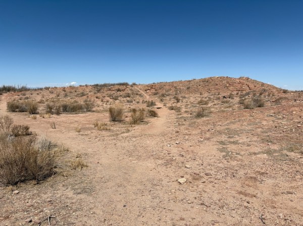
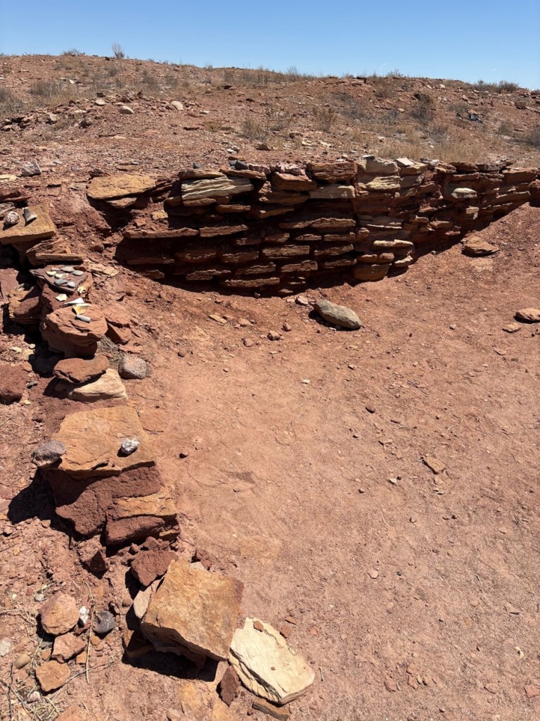
The Little Colorado River, a watercourse that drains the Painted Desert area of northeastern Arizona, flows through Homolovi State Park. I took this photo while Nancy and I were driving to Winslow; the perspective is looking north from a bridge on the former U.S. Route 66 (and now Arizona State Highway 87). The trucks and trailers just on this side of the horizon are on Interstate 40. The Little Colorado River’s headwaters are in the mid-eastern region of Arizona, very near the state’s border with New Mexico. It then flows almost 340 miles in a northwestern direction until it empties into the Colorado River in the Grand Canyon. The river flows from its headwaters all the way to the Grand Canyon only during periods of flash flooding or heavy snowmelt; much of the year it’s a braided and puddled wash. I took this photo the day after the area got some appreciable rain and snow, and the water level rose only marginally. The occasional flash flooding of the Little Colorado River, which swept away crops and structures, is probably why the Homol’ovi sites were abandoned in favor of the area further to the north and which the Hopi call home today.This is the site of a major native American village, known now as Homol’ovi I, that was last occupied about 600 years ago. At its peak, it contained about 1,100 different rooms constructed of rocks. Some of the rooms included three stories. Over the ensuing six centuries, a lot has happened to destroy these unoccupied villages. Dependable northern Arizona winds have covered the village with dirt and sand, but some structures, such as the one on the mound at the right, can still be discerned. Many of the rocks in the structures were taken by members of a nearby Mormon community in the late 1800s for use in their own buildings, and vandals have also destroyed the buildings and looted the pottery.
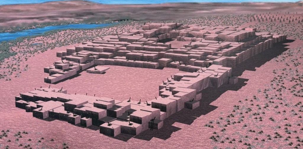
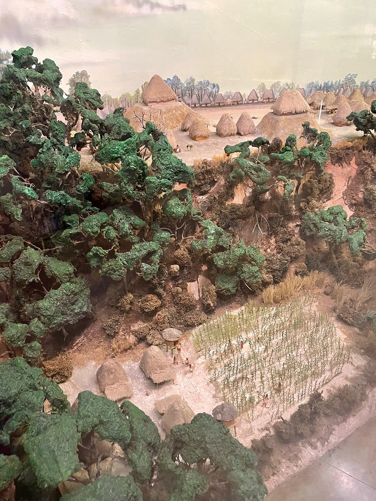
Take a look at the tall plants on the horizon at far left: directly to the right of them, you’ll see some white splotches (not the clouds, which are further to the right; the smaller white splotches of which I write are immediately to the right of the tall plants). Those are the San Francisco Peaks, still snow-covered in mid-April. The town of Flagstaff, Arizona, is at their feet. Those mountains are about 65 miles west of Homolovi State Park.I took a picture of this image, an artist’s depiction of what Homol’ovi I looked like at its peak, at an information kiosk near the site of the former village. That’s the Little Colorado River in top right. The original image gives credit to Douglas Gann of the Center for Desert Archaeology.
From about 1290 to 1360, it’s believed that Homol’ovi I grew from a village of 200 rooms to more than 700. Around the year 1360, the village now known as Homol’ovi II was established about 3 miles, or 5 kilometers, north of Homol’ovi I; that second village quickly became the biggest one in the cluster at 1,200 rooms. Homol’ovi I, however, benefited from the second village’s success, and grew to a maximum of 1,100 rooms.
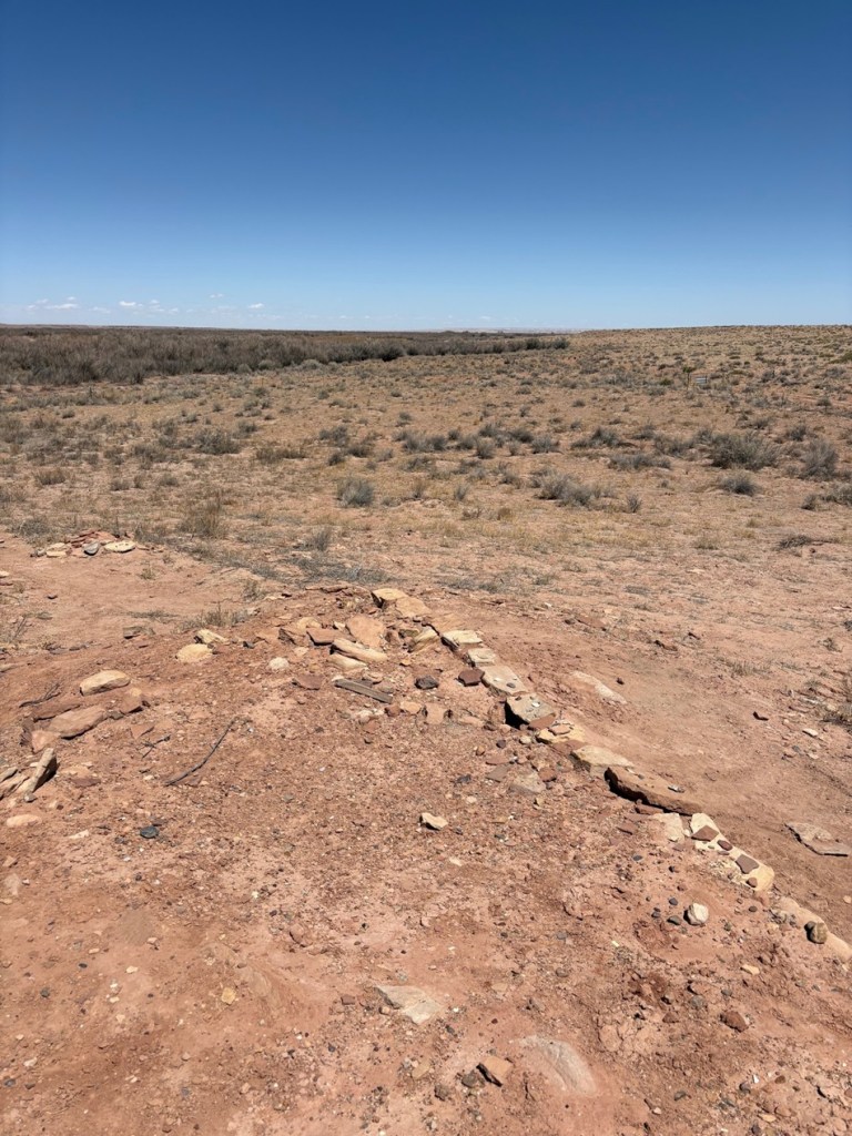
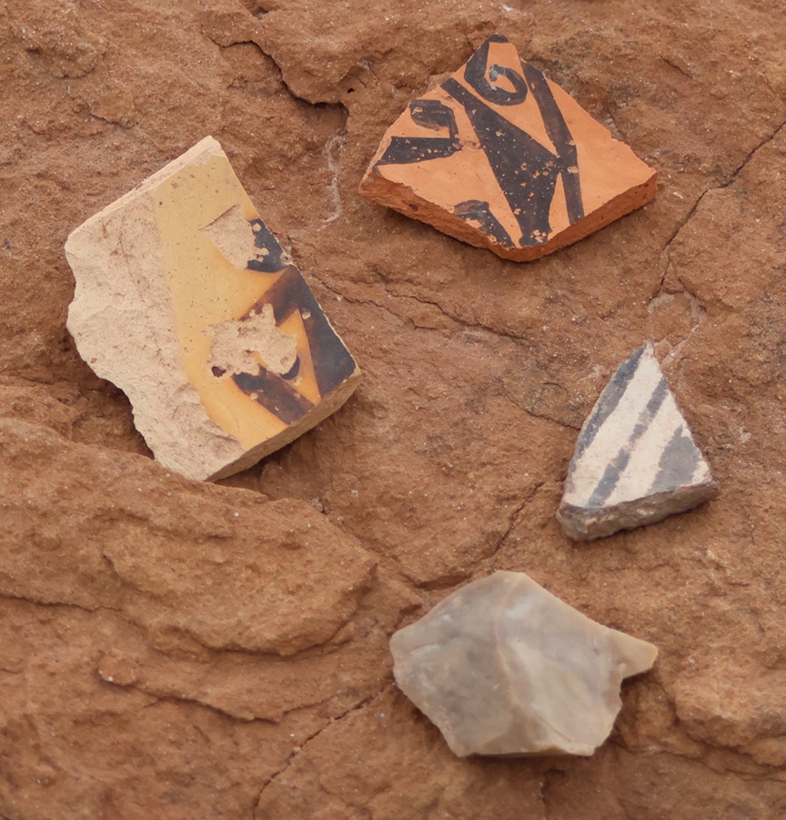
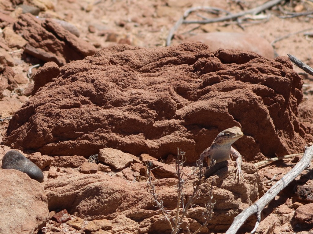
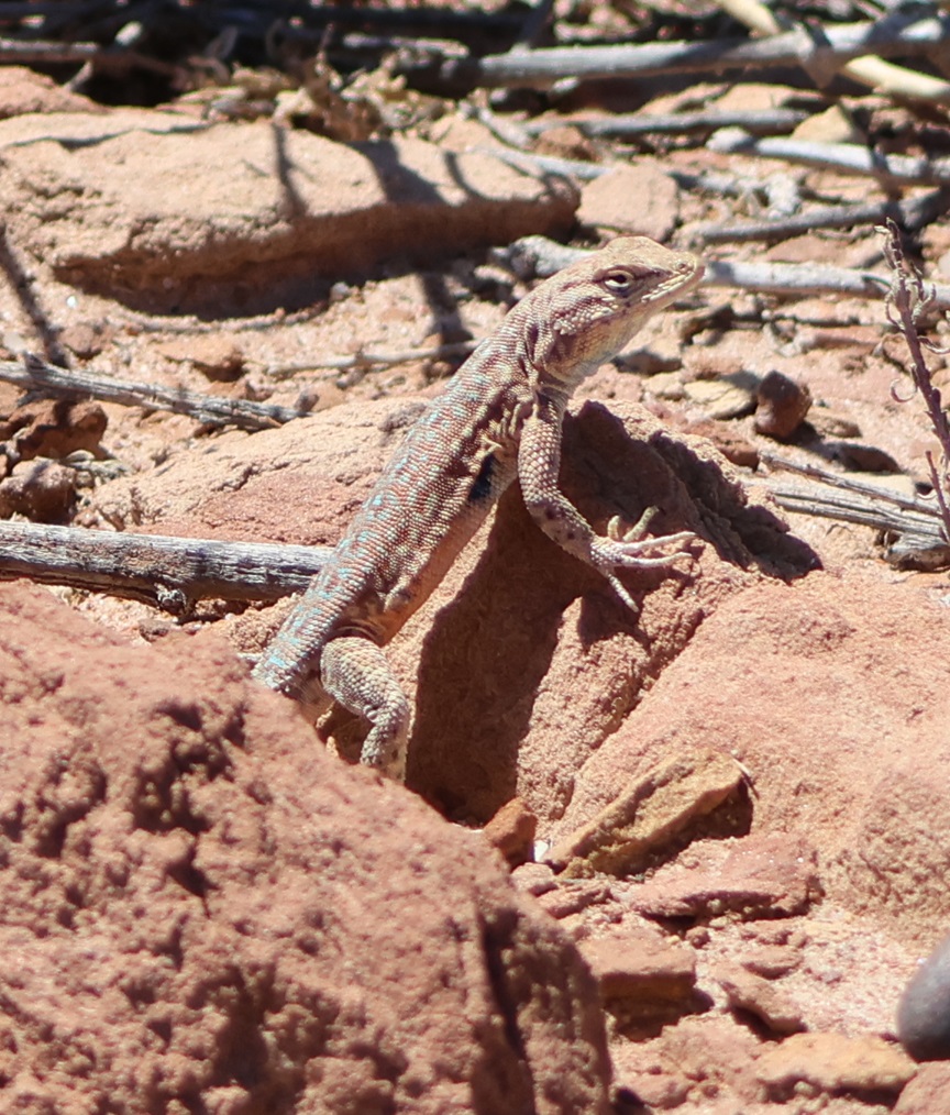
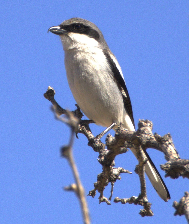
This photograph was taken from the top of the hill shown in the previous photo, still looking to the northwest. The rocks in a line are the former wall of a room. The trees near the horizon are on the east bank of the Little Colorado River; it was that river’s occasional flash flooding that likely led to the abandonment of Homol’ovi I and the other villages 600 years ago.This is a small grouping of pottery shards and what appears to be a hand-shaped rock, taken from the ground at Homol’ovi I and placed on a larger rock. The pieces of pottery are roughly the size of an American half-dollar. There are thousands of shards like these at the site, and most of them are on larger rocks like this. Archeologists and conservationists prefer that people don’t do this; instead, simply leave the shards on the ground.This is the largest exposed wall still standing at Homol’ovi I, and it’s been almost entirely rebuilt by archeologists. Note the small collections of pottery shards on some of the rocks at left: don’t do that.THIS IS A TALES OF THE GODDARD LIZARD ALERT. This little guy (and he is a guy, and I’ll tell you why I know shortly) caught my eye as he scampered across the rocks and sand of Homol’ovi I. He is a side-blotched lizard, a genus (Uta) of which there are now seven species, and he and I were to have kind of a neat interaction. This photo of my new reptile pal shows why the genus is called side-blotched lizard – observe the dark mark (or, in scientific terminology, “blotch”) on its side just behind its front leg. The turquoise-blue dots on the back are also a defining characteristic of the genus. These lizards grow to a length of about six inches, including the tail. Their diet includes insects, spiders, and other arthropods such as the occasional scorpion. They are themselves predated upon by larger lizards and roadrunners.In an attempt to give the reptile some space, I continued walking down the path through Homol’ovi I – but the beast pursued me. Observe the very pretty light-blue dots on its back. I was about six feet from the lizard when I took this photo (using a 400mm telephoto lens).Here’s a cropped version of the previous photo. Behold those beautiful blue dots as well as some detail of its fearsome front claws. After I took the photo, the lizard continued to approach me: in fact, it got to about six inches from my left foot – and then it scampered away. Turns out, that’s a common behavioral trait of male side-blotched lizards. The scientists don’t know if the behavior is intended to scare away possible intruders from its mate, or to defend its territory. At any rate, I got the hint and moved along (even though my course on the path took me in the same general direction of the lizard, who at that point was many yards away). I later described my interaction with the side-blotched lizard to Nancy, who did not at all appreciate when I poked her under her armpit to show her where the blotch on the lizard’s side was. We also shared the same belief that she would have absolutely and completely freaked out if the lizard had gotten to within six inches of her left foot.More wildlife: I always like to include some bird photos in these postings, so here are a couple of images I took in our campground at Homolovi State Park. This is a black-throated sparrow (Amphispiza bilineata), a species found in the southwestern United States and much of Mexico. They are absolutely beautiful little birds. I’ve seen them only here at Homolovi State Park and at Tuzigoot National Monument, further west in Arizona.This is a loggerhead shrike (Lanius ludovicianus), on a tree just a few feet from the Goddard’s campsite. I remember reading about shrikes when I was young, but I didn’t see one in the wild until a couple of years ago at McDowell Mountain Regional Park east of Phoenix, Arizona. I also saw some over this past winter at Clark County Wetlands Park, very close to the campground where we spent the winter near Las Vegas. Loggerhead shrikes are found nearly all over the United States.
We’re planning to join a ranger-led tour of Homol’ovi II, which has been partially excavated and reconstructed, on Saturday, April 26. I’ll write and post photographs from that experience afterwards. We were on the same tour a couple of years ago, but, because of our travels and opportunities to see ancient Native American sites in the southwestern United States since then, we have a better perspective of what we’ll see.
With the Goddard back in tip-top shape after a visit to an RV service center in Tishomingo, Mississippi, we headed back north to the east side of the Mississippi River and Memphis, Tennessee. Gunther and Rusty had both been boarded in Memphis during the Tishomingo work, and all four of us spent a little over a week camping at T.O. Fuller State Park in the southwestern corner of the city (it’s one of the rare state parks in the country that’s contained entirely within a major city).
The city of Memphis, Tennessee, was founded in 1819 and named after the ancient capital of Egypt, which, like the Tennessee city, is located on a prominent river. Nancy and I like Memphis a lot; we’d traveled to the city for a few days several years prior to our 2022 visit and really enjoyed the city’s cultural history, music, and food (which, in a great place like Memphis, all get kind of wondrously mixed up together).
Memphis is home to the National Civil Rights Museum, which incorporates the Lorraine Motel where Dr. Martin Luther King was assassinated in 1968. Memphis is home to Graceland, where Elvis Presley and his family lived, and where he recorded much of his music. Memphis was home to Sun Records, the recording company founded by Sam Phillips in which Presley, Carl Perkins, Johnny Cash, Jerry Lee Lewis, and so many others got their start. Memphis was home to Stax Records, the studio that released incredible music by Carla Thomas, Booker T. & the M.G.s, Otis Redding, and Isaac Hayes, among many others. Memphis is home to world-renowned barbecue restaurants, and it’s home to a lot of establishments that offer the best of live rhythm & blues and soul music – many of which are on the famous Beale Street, which is itself an open-air celebration of music and food. I should mention here that Nancy and I like Memphis a lot, or maybe I already did.
When planning our trip north in the summer of 2022, then, it was an easy decision to include Memphis in our travels. We decided to park the Goddard at T.O. Fuller State Park – one of the few state parks in the country to be fully inside a major city.
The Goddard’s first destination following warranty repairs (bathroom pocket door back on track, gray water valve operational, and other minor things) in Tishomingo was the heavily forested T.O. Fuller State Park in Memphis, Tennessee, a short distance from the mighty Mississippi River – and directly across the river from our previous campground in West Memphis. It was, by far, the campground with the most overhead tree coverage we’d stayed in to that point, or since. It was so dark inside the Goddard in the daytime that we turned the interior lights on. It was also very, very humid in late June and early July, and the bugs were very, very loud — at times it was nigh impossible to carry on a conversation outside.The 1,138-acre T.O Fuller State Park is very near the east bank of the Mississippi River, and its forest provides habitat for a large variety of birds and animals. A number of hiking trails wind through the forest, which gave Nancy and me, who had both spent most of our lives in Colorado, an opportunity to see a number of plants and trees that were new to us. There were plenty of insects and birds, although, thanks to all of the dense foliage, I didn’t get any good photos of the latter – I did see my first-ever Mississippi kite, though, as it soared over the campground.
The park was a Civilian Conservation Corps project begun in 1938, and was opened as Shelby County Negro State Park – the first state park east of the Mississippi open to African Americans. In 1942 the park was renamed in honor of Dr. Thomas O. Fuller (Oct. 25, 1867 – June 21, 1942), an African-American educator, clergyman, and civic leader.
Dr. T.O. Fuller was the son of a North Carolina carpenter who’d had to purchase his freedom from slavery. Both of Fuller’s parents could read, and they encouraged their children to become educated as well. Fuller earned a master’s degree from Shaw University in Raleigh, North Carolina, and moved to Memphis in the early 20th century. He became an important leader in Memphis religious and political activities, and founded a real estate company that helped many African-American Memphians to purchase their own business properties in the city. Fuller also wrote a number of books that chronicled little-known histories of African Americans. (Photo courtesy of T.O. Fuller State Park.)
Preserving the park’s history as a CCC project, T.O. Fuller State Park today also offers a wealth of recreational activities, including hiking trails, playgrounds, an Olympic-sized swimming pool, and ballfields as well as basketball and tennis courts.
A couple of state park rangers were kind enough to take Nancy and me on a nature hike one early afternoon. We saw quite a few butterflies, including this black swallowtail (Papilionidae polyxenes). In addition to being absolutely lovely to observe, nsects like this species are important pollinators for flowering plants.
Chucalissa
When we made our plans to camp at T.O. Fuller State Park, we had no idea that an important archeological site is within its borders. While digging in the earth for the park’s construction in the 1930s, workers uncovered evidence of a Native American culture that had lived on the bluffs overlooking the Mississippi River. Archeologists called the site Chucalissa, a Choctaw word that means “abandoned house,” for the site. A Memphis Press Scimitar article from 1940 related that Chucalissa “was literally ankle-deep in crumbling bones, bricks, and ancient pottery.”
A research team from the Works Progress Administration began excavating the site and found the remains of a large village with ceremonial and burial mounds. It’s believed that Chucalissa was built beginning around the year 1000, and was occupied until around the time of European exploration of the American continent in the 1500s. The Spanish explorer Hernando de Soto visited other villages along the Mississippi, but it’s thought that Chucalissa had already been abandoned by the time he reached the area around present-day Memphis.
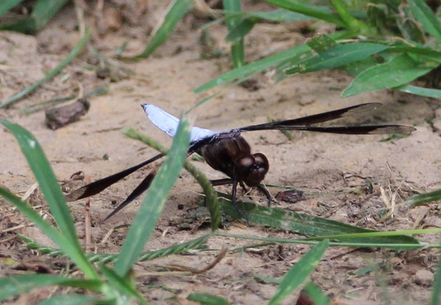
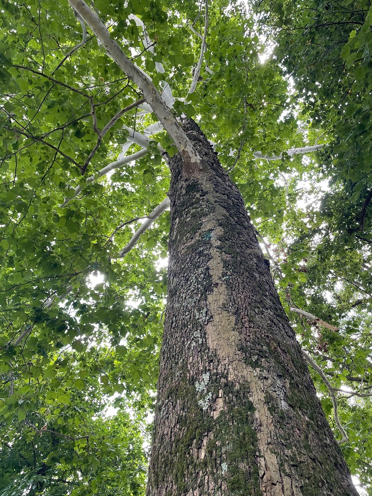
The museum at Chucalissa includes this interesting diorama representing what the scientists believe the village looked like, complete with homes and other buildings, as well as crops growing next to the Mississippi River.This view, looking west toward the Mississippi River on the other side of the trees, is the site of the village’s plaza as it looked on the day Nancy and I visited Chucalissa. The area is defined by three residential ridges. Archeologists believe construction of the large mound on the right side of the photo started around the year 1350, when Chucalissa’s population was at its peak. Researchers rarely find any artifacts in open areas like this. That lack of materials, along with the European explorers’ documentation of how southeast Native American peoples used open spaces in the 1500s, leads to the belief that the plaza was used much as town squares and parks are used today: a shared place for people to gather.We saw a lot of these dragonflies, called common whitetail skimmers (Libellula lydia), while walking around Chucalissa. The species, which measures about 1 3/4 inches long, prefers to perch on the ground. Male common whitetail skimmers, like this one, develop a white powdery substance, called pruinosity, on their abdomens; the females have brown abdomens. The males raise their bright abdomens to warn other males against intruding on their territories. This species is apparently found all across the country, but I’d sure never seen one.We’ve enjoyed seeing new animals in different parts of the country, and we’ve also had the opportunity to see plants that are new to us. This beautiful tree growing near the Chucalissa visitor center is an American sycamore (Platanus occidentalis). They can grow up to 100 feet tall and have the largest trunks of any native American tree, with some specimens having trunk diameters up to 15 feet. To accommodate that growth, the tree often sheds its bark in large pieces. The American sycamore is very common in the eastern part of the country, but the furthest west it grows is the eastern parts of Kansas, Oklahoma, and Texas. American sycamores commonly live for 200 years, and some can grow for more than twice that. The wood is used to make butchers’ blocks, as well as furniture and musical instruments.
It’s interesting to note that when archeologists were excavating the thousand-year-old Chucalissa site, they happened to pull some much more recent artifacts from the ground: farming tools and household goods from the 1800s. They were left by African-Americans homesteaders, who built their lives in the area now known as T.O. Fuller State Park. I like to think that it’s entirely possible that their descendants were aided in bettering their lives by T.O. Fuller himself.
Chucalissa was designated a National Historic Landmark in 1994. The grounds include a very fine museum, named after a prominent archeologist at Chucalissa, C.H. Nash, and a visitor center operated by the University of Memphis.
Seeing Chucalissa was a pleasantly unexpected aspect of our trip to Memphis. Having spent most of our lives in Colorado, Nancy and I are much more familiar with nomadic Native American tribes like the Arapahoe, Cheyenne, and Ute; since seeing more of the southwest, we’ve learned about the Apache, the Hopi, and the Navajo, as well as their ancient forebears. Chucalissa was our first experience of a culture that lived next to a tremendous river – and for nearly twice as long as the United States has been established.
More Memphis
Having visited the National Civil Rights Museum, the Stax Museum of American Soul Music, Graceland, the Memphis Rock ‘N’ Soul Museum on our previous trip to Memphis, Nancy and I concentrated our attention in 2022 on barbecue, Beale Street, and baseball. There’s a particular barbecue restaurant in downtown Memphis that we really like, and we made time to visit it twice while we were there last summer (and I’d go again, twice, right now). Beale Street was a little more muted than when we’d previously been in Memphis, but the pandemic and the fact that it was daylight outside probably had a lot to do with that. Then there’s baseball.
We took the opportunity to take in a Memphis Redbirds game at the ol’ AutoZone Park. The Redbirds are the AAA affiliate of the St. Louis Cardinals, who play their home games at the ol’ Busch Stadium 300 miles north of Memphis (it’s not really the “ol'” Busch Stadium; the current one opened in 2006, replacing the kinda ol’ Busch Stadium which had been built in 1966). AutoZone Park isn’t really ol’ either; it opened in 2000 with a seating capacity of 14,000 that has since been reduced to 10,000. The park offers great views of downtown Memphis buildings, as well as lovely cloud formations over western Tennessee.The Redbirds began play in 1998 as an expansion team of the Pacific Coast League. Memphis has a long history as a home of minor-league baseball teams, most notably the Memphis Chicks from 1901 through 1960. The Chicks started as the Memphis Egyptians, and then from 1909–1911 were the Memphis Turtles before changing their name to the Chickasaws – which was nearly always shortened to Chicks. AutoZone Park is a wonderful venue for baseball, and, because of the lack of outfield seats, it’s sometimes called “one-third of a major league ballpark.” The video scoreboard in this photo is the largest in the minor leagues, and it can be seen from many sites in downtown Memphis. Sadly, the Jacksonville Jumbo Shrimp bested the Redbirds that evening by a score of 5–1, but it was still a fun ballgame to watch.Finally, a bird photo. Memphis is home to the historic Peabody Hotel, which opened in 1925 and is on the National Register of Historic Places. Among the lovely building’s more famous attributes is the daily appearance of the ducks who spend the day cavorting in the lobby fountain. That’s a solid piece of Italian marble in the fountain. The mallard ducks live on the hotel’s roof (in very nice quarters; Nancy and I visited them when we were in Memphis several years ago) and descend to the lobby via the elevator (I’m not kidding) at 11 AM and waddle to the fountain on a red carpet (I’m still not kidding). They return to their penthouse digs, via the red carpet and elevator, every evening at 5 PM. If you’re in Memphis, it’s definitely worth seeing – but plan to arrive early for the arrival or departure, because the lobby gets pretty packed with Peabody Duck enthusiasts. I took this photo when Nancy and I ducked (!) into the Peabody last June while we were downtown to get some more barbecue.
It’s often said of many cities across the country and the world that “they’re nice places to visit, but you wouldn’t want to live there.” Despite having an abundance of things that make Nancy and me happy, like interesting history, lovely live music, and delectable food, we could never live in Memphis – neither of us do well in heat and humidity.
But Memphis remains a great place to visit, and I’m looking forward to the next time we’re there. And now I’m hungry for some barbecue.
One day – I think it was a Tuesday but I could definitely be wrong – about 35 million years ago, a volcano began erupting in what is now southwestern New Mexico.
Somewhat later, on January 8, 2023, Nancy, Gunther and I visited City of Rocks State Park, located about 20 miles south of the caldera that produced the eruptions. The pumice and other rocks produced by the volcano’s eruptions 35 million years ago form the main feature of the state park, which also has a number of interconnected hiking trails, developed campsites, a botanic garden, and even an astronomical observatory.
We’d planned to visit he park, which is located halfway between Deming and Silver City, New Mexico, just a few miles east of U.S. Route 180, several times in 2021 and 2022 when we were camping in Deming and Silver City. However, the 35 mile-per-hour winds each of those days convinced us to find something else to do. The morning of January 8 was bright and calm, and we made the short trip to the state park. We’re all glad that we did.
You’ll find plenty of prickly pear cactus at City of Rocks State Park in New Mexico, along with a wide variety of other plants. In the background, a vehicle provides a sense of scale for the namesake rocks near the park’s visitor center.
The park, at an elevation of just over 5,200 feet, gets its name from several tall outcroppings of rock that have eroded over the past 35 million years into pinnacles and other formations, separated by lanes that resemble city streets between tall buildings.
Here we see an amateur geologist, with her professional dog, on one of the park’s trails. They appear to be in disagreement about which direction to proceed. The park has about five miles of trails, some of which wind directly through the rock formations. Many of the pinnacles are 40 feet tall.
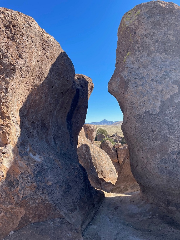
Paths between the rocks can get pretty tight. During the main phase of the volcano’s eruption, more than 240 cubic miles – about twice the volume of Lake Erie – of pumice and ash were ejected. This eruption also resulted in the “Kneeling Nun” formation east of present-day Silver City, 20 miles to the north. The pointed mountain seen between the two rocks is Cookes Peak (elev. 8,408 feet), a significant landmark in southwestern New Mexico. The mountain is directly north of the city of Deming.
The volcanic eruption that formed the formations of City of Rocks likely lasted several years and was about a thousand times larger than the Mt. St. Helens event in Washington on May 18, 1980. The eruption blanketed this area in a deep layer of hot ash and pumice. As those volcanic materials cooled into a rock called tuff, it shrank somewhat and vertical cracks in the stone were created.
They still haven’t agreed on a direction in which to hike. The park has a huge variety of succulents, like the soaptree yucca at the left of the trail, as well as many grasses common to the southwestern United States.
Over the last several tens of millions of years, the erosive forces of nature – water, wind, and organic growth – broadened the small fissures between the rocks into larger and larger crevices until the natural pathways seen today were created.
Now they’re both headed the same direction. The amateur geologist is standing in a crevice that is a conduit for water flowing through the rock formation. It’s that water, which carries abrasives like sand, that helped carve the rocks into the shapes we see today. Other contributors to the erosion include wind, which can also carry sand, as well as plant (and non-plant) life and the cycle of freezing and thawing water.
Many different groups of native Americans have lived in, or at least passed through, the area now known as City of Rocks. About 12,000 years ago, the last of the Ice Age glaciers were retreating and large mammals like mammoths and mastodons roamed this region. It’s likely that Paleoindians, like Clovis or Folsom peoples, hunted the large animals. Between 8,000 and 1,000 years ago, small bands of the Desert Archaic culture lived in the area and, toward then end of that era, began to build pit houses. Finally, the Mimbres culture occupied the area between the years 200 and 1150 AD. In addition to hunting animals and gathering food from plants, the Mimbres cultivated crops like beans, squash, and maize. They also built one-story above-ground dwellings.
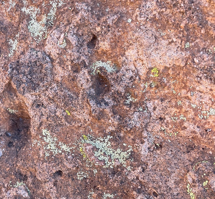
Do you like lichen as much as I’m likin’ this lichen? There are about 20,000 known species of lichen in the world, and at least four of them can be seen in this photograph. Lichen, which is plant-like but not an actual plant, contributes slowly but significantly to the erosion of rocks by chemically degrading the stones’ minerals. The scientists estimate that between 6-8 percent of the earth’s land surface is covered by lichen. Actual plants, like succulents, grasses and shrubs, also contribute to erosion by their seeds finding purchase in small crevices in the rock and then, as the plants mature, the growing roots of the organism can cause further fracturing of the minerals.
Getting up-close and personal with the rocks allows one to see some pretty fascinating natural patterns caused by erosion. I sure hope that whoever dropped those keys comes back by to pick them up! (Just kidding – they’re mine. Still need to go back and pick them up.)
Because the park is 25 miles from the nearest city of any size, it’s a popular site for stargazing at night. This structure is an astronomical observatory located near the main campground in the park. The roof slides back onto the supports in the back to reveal the telescope. It was not in operation during our visit (as you can see, it was daylight), but the park does host regular star parties during which the observatory is open and other amateur astronomers bring their own telescopes to share views of the night skies.
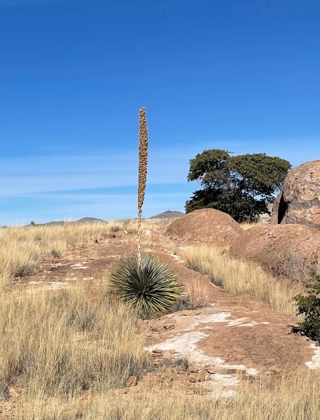
This magnificent succulent specimen, about 20 yards off the trail, is desert spoon (Dasylirion wheeleri). I didn’t want to get off the trail to take a closer picture, so this will have to do. The fronds of desert spoon were used by native Americans to weave baskets and mats, and its inner core can be fermented into an alcoholic drink, similar to tequila, called sotol. It is found in southern New Mexico and Arizona, as well as parts of Texas and Mexico. The plants themselves grow to about 5 feet tall, but the flowering spike can soar 16 feet into the air.
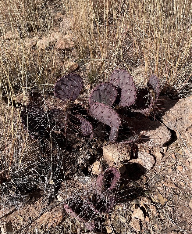
Here’s another interesting succulent found along the trail. This long-spined, purplish prickly pear is called long-spined purplish prickly pear (really) (Opuntia macrocentra). It, too, is found in Arizona, New Mexico and Texas, along with Mexico. Like other prickly pears, the fruit of this cactus is edible and is enjoyed by animals and humans alike.
But it wasn’t simply succulents we saw – we also spied several species of sparrows! Here’s a chipping sparrow (Spizella passerina) perched in some mesquite. We’ve enjoyed seeing plenty of these pretty little birds in southern New Mexico this winter.
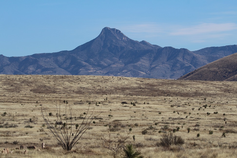
While most of the pictures in this posting were taken with the camera on my phone, I used my digital camera to take this photo of Cookes Peak. The tall spindly shrub in the lower left corner is ocotillo (Fouquieria splendens), which can grow to more than 30 feet in height. It is native to the Chihuahuan and Sonoran deserts in the United States and Mexico. Native Americans used different parts of the plant to address a variety of ailments, and ocotillo can also be planted to serve as a natural fence.
A short spur off the main trail took us to the top of a 300-foot hill that provided a tremendous 360-degree view of the area. In this photo, the rock formations of City of Rocks are in the midground (the white streaks above the center of the photograph are campers’ recreational vehicles parked amongst the rocks, and the light brown building to the left of the RVs is the park’s visitor center). The tallest mountains on the left horizon are the Cobre Mountains, 16 miles away, and the Pinos Altos range, 30 miles in the distance, is just to the right of the Cobre Mountains.
This eye-catching grass is cane bluestem (Bothriochloa barbinodis), a valuable forage for ranchers but one of the first grasses to disappear if a pasture is overgrazed. The seed heads catch the sun in such a way as to look absolutely illuminated from within.
When we walk by a creosote bush (lower left), I like to rub my fingers on the leaves – they smell just like the air outside after a rainstorm. Along with seemingly every other plant, Native Americans found many medicinal uses for creosote. In the background is Table Mountain, the tallest point in City of Rocks State Park. The distinct layers of rock seen on the mountain’s slopes are due to different volcanic ashflows more than 30 million years ago..
If you plan to visit City of Rocks State Park, you’ll want to do make plans to do so soon-ish. The erosional forces that created the cracks between the rocks continue to degrade the stones even today (I mean, you saw all the lichen), and in several million years the whole area will just be flat.
Nancy and I definitely enjoyed our time in the park – it was a lovely day, with highs in the low 60s and very calm breezes, and the 4-mile hike gave all of us some great views and good exercise (Monday, January 9, was a day of relaxation and recuperation for Gunther). We plan to take the Goddard to the park in the next few years for some actual camping – it has more than 40 developed sites – and it has some other trails that we haven’t yet enjoyed.