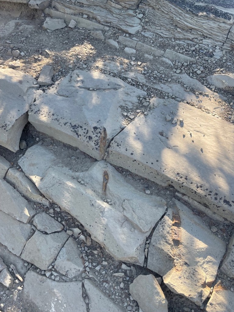
Norris Geyser Basin, located in the northwest quadrant of Yellowstone National Park, is one of the most active hydrothermal regions in the park and contains rare types of geysers within a geologically active earthquake area. The basin is located near the intersection of three major ground faults, helping to create the conditions for Norris’s significant geothermal activity. It’s outside the huge Yellowstone Caldera, the basin that remains after a titanic volcanic eruption 631,000 years ago, but within another 2.1-million-year-old caldera.
Nancy and I spent nearly all of Friday, Sept. 12, 2025, at Norris Geyser Basin. Named after Philetus W. Norris, the second superintendent of Yellowstone National Park, the geyser basin has two decidedly different trails: a short 3/4-mile (1.2 km) loop through the Porcelain Basin, and a longer 1.5-mile (2.4 km) loop with stops at geothermal features in the Back Basin. Both geyser basins are at an elevation of about 7,600 feet (2,316 m). Both trails involve the use of many boardwalks to keep visitors from walking too close to the heated features, and the ground is very thin in many spots and bad things would happen if someone broke through (and bad things do happen when someone decides to ignore the rules). I’ll write a posting detailing the Porcelain Basin later; for now, here are some of the sights to see and smell at Norris’s Back Basin, which includes the world’s tallest active geyser.
Before we get started though, let’s review hydrothermal features. Yellowstone National Park’s hydrothermal features are created by magma, which is partially molten rock, remarkably close to the park’s surface. Water, either from snowmelt or rain, percolates downward through faults and fractures in the earth’s surface and then, after making contact with the hot rock formation, rises back toward the surface and collects in open channels that serve as the hydrothermal features’ water supplies.
Geysers, perhaps the most familiar type of hydrothermal feature, form if the channel has a constriction of some type that pressurizes the water. Temperatures in the superheated and pressurized water below the constriction create steadily amounts of steam, which is eventually pushed through the constriction and an instantaneous drop in water pressure below the steam creates an eruption. These events can be fairly predictable, as in the case of Yellowstone’s Old Faithful, or irregular, with intervals between eruptions lasting unpredictable numbers of days, weeks, or even longer.
If a channel doesn’t have a pressurizing constriction, a hot spring is formed as superheated water comes to the earth’s surface, cools somewhat, and is replaced by hotter water beneath it.
The hottest hydrothermal features in Yellowstone National Park, fumaroles, are steam vents in which channel systems have little access to water, and whatever does reach the surface is immediately converted to steam with a temperature greater than that of water’s boiling point (212 degrees F, or 100 degrees C, at sea level).
Finally, mudpots are created when rock around a hydrothermal feature is converted, by acid, into clay. When it mixes with water, the clay forms mud of different colors and viscosities. Gases in the feature bubble up through the mud to make interesting sights, sounds, and smells.
All hydrothermal features are susceptible to changing environmental conditions. If access to water is changed, or the fissures around a feature are altered because of seismic activity, the feature’s activity could change dramatically or even cease altogether. Many geysers, for instance, that were active in years past are now quiet.
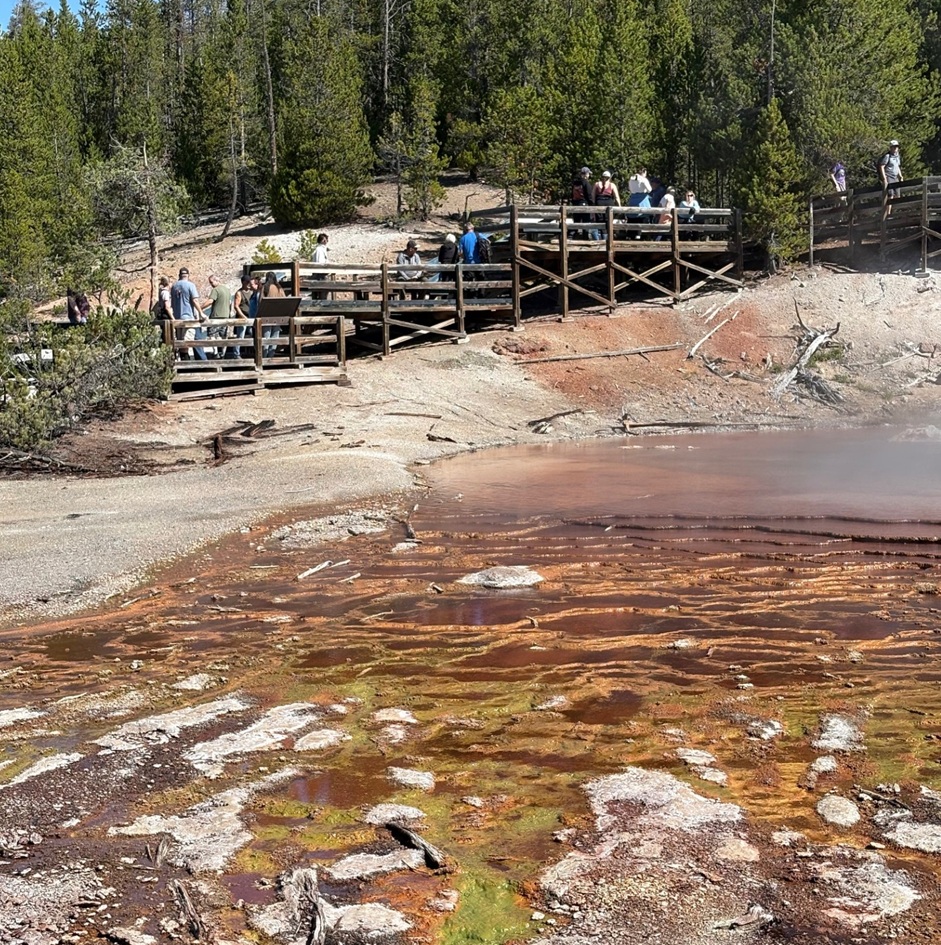
The first stop on the Back Basin Loop is this very pretty 27-foot-deep pool, Emerald Spring. The color of a particular hot spring can help determine what minerals that spring contains. Water in a relatively mineral-free clear blue spring, for instance, absorbs all of the colors of sunlight except for blue. Emerald Spring contains significant deposits of the mineral sulfur, the yellow color of which combines with the reflected blue sunlight to create this beautiful shade of green. The temperature of the water in this spring is close to the boiling point, ensuring that only the most heat-tolerant microorganisms, or thermophiles, can survive in this environment. There’s plenty of sulfur in this spring, which is used by some thermophiles as a source of energy. The byproducts from the sulfur’s usage in turn are used by other thermophiles, resulting in a kind of recycling process that creates something like thermophile interdependence.Next up is the world’s tallest active hydrothermal feature, Steamboat Geyser. Although there was a lot of steam evident, Steamboat Geyser on the day of our visit was relatively quiet with just a few intermittent spurts of water measuring a few feet high. When it goes, though, Steamboat really goes: it is capable of shooting steam and water up to 300 feet (91 m) into the air. That’s the distance of a football field. Prior to 1904, Steamboat was not the tallest geyser in the world. That honor belonged to a geothermal feature in New Zealand, Waimangu Geyser, which shot water a mind-blowing 1,600 feet (488 m) into the air. A landslide changed the water table around Waimangu, however, and it hasn’t erupted since.
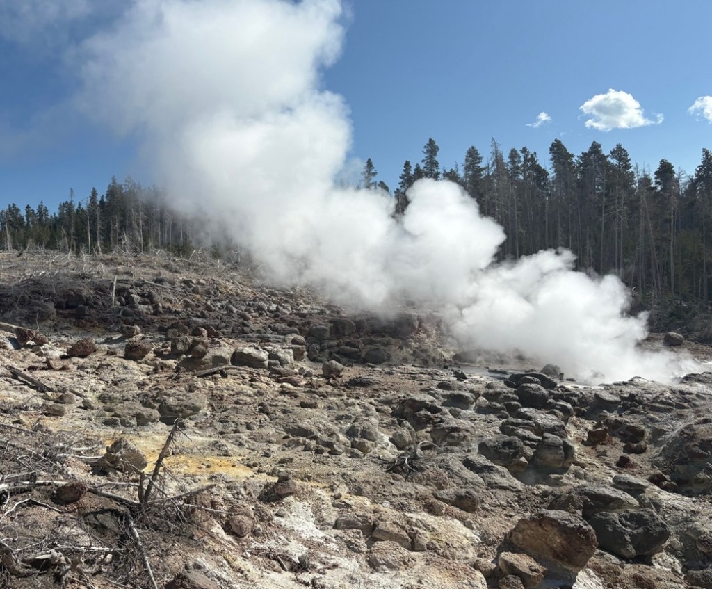
Here’s the thing about Steamboat that’s really wacky: its eruptions are extraordinarily erratic. In the nearly 30 years between 1990 and 2017, Steamboat erupted 12 times (including one interval between eruptions that lasted almost 9 years). Between March 15, 2018, and May 7, 2023, a little over five years, the geyser erupted 165 times. We visited in mid-September 2025, and Steamboat’s last major eruption had occurred on April 14 – five months earlier. Before then, it erupted on Feb. 2, 2025, a little over two months earlier. In all of 2024, Steamboat erupted six times. Nature is chaotic sometimes, and it’s beautiful. Note the huge desolated treeless area in the photo above. The geyser’s eruptions, helped by prevailing southerly winds, caused that destruction.
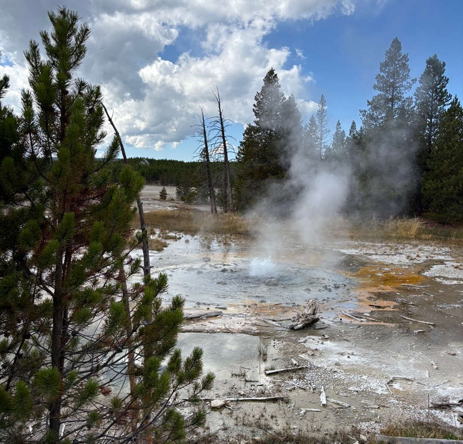
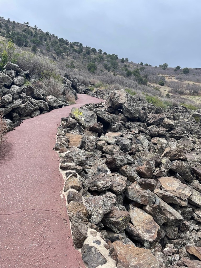
Cistern Spring is located downhill from Steamboat Geyser – I didn’t measure the elevation change, but it’s at least 50 feet lower, and the boardwalk trail has a couple of switchbacks. However, Cistern Spring is connected underground to Steamboat because it empties completely whenever the larger geyser erupts. The brown, green, and orange colors in Cistern Spring are created by different species of thermophiles. The dead trees around the spring were killed by the silica in Cistern Spring’s water: conditions around the spring were once healthy enough for the trees to germinate, grow, and mature, but then the conditions changed. We saw that a lot all over Yellowstone National Park: big areas of trees that had been killed by changing hydrothermal features.This feature has one of the best names in the Back Basin. It’s Black PitSpring, and it started off about half a century ago as a group of steam vents. Water now continuously bubbles with very small eruptions at its surface.Here’s a closeup, using a telephoto lens, of the little eruptions from Black Pit Spring. It’s a pretty mesmerizing hydrothermal feature, with a great variety of colors (not so much black, though).This is Echinus (pr. e-KI-nus) Geyser, perhaps my favorite feature in the basin. It is named for its mineral deposits, which apparently look the spins of sea urchins (neither Nancy nor I are overly familiar with echinoderms like sea urchins, but we didn’t see anything that resembled sea urchin spines). The red color is due to high concentrations of iron oxide (rust) in the feature. Echinus’s eruptions, which can reach 60 feet in the air, are unpredictable and are now months and even years apart. From 1878 to 1948, the geyser rarely erupted but then moved to periods of relative high activity alternating with dormancy. Prior to 1998, it was on an eruption schedule of about every half-hour to 90 minutes. The scientists believe that something happened underground in 1998 to affect the geyser’s water source. For now, it’s a fairly large and very pretty pool of water (see the guy emerging from the trees on the boardwalk just right of center for scale).This photo was taken on the other side of the geyser from where the previous photo was taken, i.e. just to the right of the guy on the boardwalk in the photo above. Echinus Geyser is a beautifully complex hydrothermal feature, even if we can’t make out the sea-urchin-ish spines.Here’s one of the reasons why Echinus Geyser appeals to me so much: these are terrace formations on the geyser’s southwest side where water leaves the geyser. I took this photo at about the same spot as the photo above, but used my telephoto lens again. These terrace mats are formed by unthinkably large numbers of a microorganism called Archaea (pr. aar-KEE-ah), which is a an immense domain of life that precedes kingdoms (you remember, from high-school biology, the memory aid “Kings Play Chess On Fine Green Sand,” or Kingdom, Phylum, Class, Order, Family, Genus, Species; domain is a step above kingdom). Water coming from the geyser is 176.5 degrees F (80.3 degrees C), and has a pH of 3.3 to 3.6 – it’s nearly as acidic as vinegar. At this point in the terracing, the temperature drops to between 140 and 160 degrees F (60 to 71 degrees C). Archaea absolutely love this hot and acidic water, and survive on the energy produced by iron oxidizing in the geyser’s water then bind together to build these ridges, pools, and ripples. Archaea are very common in nature: different types are found everywhere on the planet, including other features in Yellowstone National Park, and your gut, mouth, and skin are covered in them right now (not the same ones in this picture; remember that Archaea covers a lot of different species, let alone all of the other Kings Playing Chess). It’s extremely likely that when the scientists do find irrefutable evidence of extraterrestrial life, it will be in the form of Archaea or something close to it. This is a view a little further down the boardwalk from Echinus Geyser. That small river of water is flowing northwesterly from the geyser – it’s a pretty desolate landscape in the river bottom, but remember that the river has a pH nearly equal to that of vinegar. Notice also the steam rising from the ground where the river meets the trees in upper left; as the scientists say, this is a geothermally active area, and that is evidence of yet another geothermal feature.This is Porkchop Geyser, so named because of its shape when viewed from above and which only intermittently erupted until 1985 when it started spouting on a continuous basis. Those eruptions wasn’t enough to keep the geyser’s constriction from building up tremendous pressure and four years later, on Sept. 5, 1989, this feature exploded with a violence sufficient to throw large rocks more than 200 feet (61m). Fortunately, the tourists present for this surprise event weren’t injured. Porkchop’s vent hole at times has been the diameter of a garden hose; after the explosion, it’s about 7 feet in diameter. After that event, Porkchop became a gently bubbling hot spring with only occasional – and unpredictable – geyser eruptions.Even if it didn’t erupt while we were there, Veteran Geyser was a lot of fun to listen to. The area in shadow in the lower right corner of the picture is a vent through which Veteran exhaled with what sounded like someone in severe respiratory distress. A couple with whom I’d briefly spoken at Steamboat was here admiring Veteran as well, and, realizing that we were nearing the end of the Back Basin loop, the woman asked what our favorite hydrothermal feature was. I quickly answered with Echinus Geyser, and asked what her favorite was. She said it was Black Pit Spring, but mostly because of the name. I couldn’t disagree with her. In a basin filled with features named Green Dragon Spring, Puff ‘n Stuff Geyser, and Black Hermit Caldron, Black Pit Spring does still manage to stand out.At the time when Yellowstone’s visitors toured via stagecoaches, Minute Geyser erupted every 60 seconds to heights of 40 to 50 feet (12-15 meters). Inexplicably, many of those tourists tossed rocks into one of the geyser’s vents and eventually plugged it. While it continuously spouts water about 3 feet (0.9 meter) now, it’s unknown whether the feature will ever fully erupt again. Signs warning tourists to not throw rocks, coins, or other objects into park’s hydrothermal features were all over Yellowstone. I just can’t wrap my head around why someone would want to do that in the first place.The Back Basin loop trail ends with a short hike up a hillside, resulting in this magnificent view of Norris’s other geyser area, the Porcelain Basin. I’ve got pictures of the features within Porcelain Basin as well, and will post those in the near future.
There are about 25 named features within Back Basin, so this was a look at less than half of what’s there. Walking around any of Yellowstone National Park’s hydrothermal areas gets you really close to all kinds of aspects of our natural world, and it’s easy to think that it’s always looked the way it appears today. But conditions underground, like earthquakes, heat changes, mineral buildup, and more, ensure that these features are anything but timeless: a geyser can become a hot spring (and vice versa), for instance, because of subtle and usually unseen geologic changes.
It was a fun day at Norris’s Back Basin, and one that Nancy and I will appreciate for a long time – especially because the next time we go, it may be significantly different.
Works Consulted
Lynne, Bridget Y. “The Geothermal Guide to Yellowstone National Park.” 2017.
National Park Service. “Norris Geyser Basin Trail Guide.” March 2024.
National Park Service interpretive signage at features throughout Back Basin.
Wikipedia, articles on Archaea, Echinus Geyser, and Steamboat Geyser. Accessed September 2025. If you use Wikipedia, please support it.
September 28, 2024 – Near Pagosa Springs, Colorado
At the entrance to Chimney Rock National Monument, one can see Chimney Rock (center horizon), Companion Rock (to the left of Chimney Rock), and the mesa on which an ancient Puebloan great house still stands (at far left).
The scientific pursuits of geology, archeology, and astronomy combine in a number of interesting ways at Chimney Rock National Monument, located about 20 miles of Pagosa Springs in southwestern Colorado. In late September 2024, the Goddard was parked for a couple of weeks in Pagosa Springs, allowing us to enjoy the spectacular fall colors of aspen trees as well as a visit to Chimney Rock National Monument. We joined a geology-focused tour of the monument led by a volunteer guide, a former geologist in the oil and gas industry. In addition to learning about the rock features of the monument, we also learned about the history of the human habitation of Chimney Rock and visited the highest-in-elevation ancient Pueblo in the American Southwest, the Great House.
I took this photo from the road entrance to Chimney Rock National Monument using a telephoto lens. For perspective, Chimney Rock on the right rises more than 300 feet above the dark gray shale layer below it.
Between the years 925 and 1125, more than 2,000 Pueblo Native Americans lived in the Chimney Rock region and, although no more than about 250 people called it home at one time, they made it a substantial settlement for two centuries. The inhabitants built a number of stone and timber structures that are still standing today, and they traded goods with other Pueblo communities up to 150 miles away. Today, archaeologists know of 200 ancient structures collected within eight distinct villages at Chimney Rock.
Initial archeological investigations began in the 1920s by J.A. Jeançon, a Smithsonian Institution-trained archeologist working on behalf of the Colorado Historical Society, and his assistant, Frank Roberts; they and their crew surveyed and mapped dozens of structures and found thousands of artifacts.
Today, the U.S. Forest Service, which manages Chimney Rock National Monument, is leaving many archeological sites undisturbed out of respect for existing Puebloan and other Native American cultures, and with the understanding that less-invasive archeological techniques may be developed in the future. More than two dozen Native American tribes have an affiliation with Chimney Rock.
The monument, surrounded by the Southern Ute Indian Reservation, is closed to the general public each year from September 30 to May 15. The closure allows Native Americans to access the site for private ceremonial purposes, and the Chimney Rock area is also a major thoroughfare for elk migration.
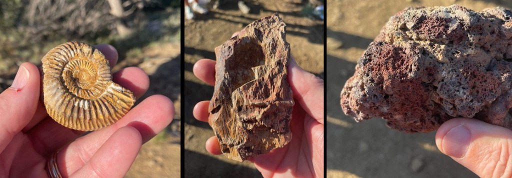
Geology! These three rocks, all of which were collected earlier at Chimney Rock by the volunteer geologist conducting our tour, tell a really interesting part of the story of the area. The ammonite fossil at far left shows that Chimney Rock, which today gets about 14 inches of precipitation annually, was once covered by an inland sea. Ammonites were incredibly diverse and numerous aquatic cephalopods (related to modern squid and octopi) that flourished for hundreds of millions of years until the Earth’s collision with an asteroid 65 million years ago. The petrified wood in the center indicates that large trees used to grow on shorelines left when the land rose and the sea receded. Finally, the basalt at right was ejected from an erupting volcano in the area. (Yes, I know the ammonite photo also demonstrates that I was, at the time, in gruesomely desperate need of my semi-annual mani-pedi.)
The true importance of Chimney Rock lies, of course, in its ties to ancient and current-day Native Americans. But from a geologic perspective, the story of Chimney Rock begins, seemingly as do so many on this website, with a great inland sea. One hundred million years ago, much of present-day North America was under a shallow but vast sea that connected the Gulf of Mexico to the Arctic Ocean. At its largest size, the Western Interior Seaway stretched from today’s Rocky Mountains in the west to the Appalachian range in the east. At its deepest points, it was only about 3,000 feet from the waves on top to the sea bottom – very shallow for a sea. The size of the sea varied widely over the course of its 34 million years of existence; it finally drained away for good about the time of the end of the Cretaceous Period, or 65 million years ago when dinosaurs ceased to rule the earth.
While it was relatively shallow, the Western Interior Seaway’s 3,000 feet of water depth carried a lot of compression capability. Clay at the bottom of the sea, as well as dead plants and animals, accumulated over the eons to build a 1,000-feet-thick layer of mud. That layer would solidify, over millions of years of water weight pressing upon it, into a dark gray layer of rock called Lewis Shale. When the western part of the American continent began to rise, the waters of the inland sea drained away to leave shorelines of sand and tidal flats. Dry periods alternated with years upon years of wetter conditions, leaving layers of coal and fossilized animal skeletons.
About 40 million years ago – 26 million years after an asteroid impact killed all of the non-flying dinosaurs as well as a goodly amount of other life on Earth – volcanoes began erupting in the Four Corners area of Colorado, Utah, New Mexico, and Arizona. This activity built the Colorado Plateau, a huge high-desert expanse of the southwestern United States covering 130,000 square miles of those four states, roughly centered in the Four Corners area.
The erosional forces of wind and water began to have their way with the soil covering today’s Companion Rock and Chimney Rock, and then glaciers from the last Ice Age of 4 million years ago carved deeply into the former mud of the inland seafloor, now compressed into shale. Finally, the glaciers melted and the resulting floodwaters exposed sandstone – formerly the beaches of the receding inland sea from tens of millions of years earlier but compressed into a rocky layer – and eroded away nearly all of that sandstone layer with the exception of Companion Rock and Chimney Rock. The scientists believe that the two sandstone features have been exposed for about 25,000 years, protected by what was probably the thickest and hardest layer of sand during the time of the Western Interior Seaway and is now a layer of sandstone more resistant to erosion than other rocks had been. However, they too, with the relentless work of water and wind, will gradually fall to the valley below.
This view, looking east on a hazy late-September morning, shows the dark-gray Lewis Shale layer below the light-brown Pictured Cliffs Sandstone layer, of which Companion Rock and Chimney Rock are the tallest remnants. This valley was carved by glaciers and the flooding of the melted glaciers as well as the Piedra River. To the immediate left of the two natural rock towers is the Great House, built by ancient Puebloans . The San Juan mountains, volcanic in origin, are on the far horizon.This is the trail leading to the monument’s Great House, one of the square exterior corners of which can be seen at the top of the photo. This is the same trail that was used by the ancient Puebloans to make their way from the valley floor to the Great House. The trail is situated on a relatively thin ridge of sandstone. Everything brought to the Great House – building materials, foodstuffs, water – was carried by the ancient Puebloans, by hand, up this trail.These sandstone rocks are on the trail to the monument’s Great House. Our geologist guide noted that the natural fracturing of the sandstone made selection and collection of the rocks much easier for the Puebloan builders of the structures in the monument. Note also the brownish markings in the rocks: they’re about 6-8 inches long, and are the fossilized burrows of a prehistoric crustacean that lived in the sand of the inland sea that once inundated much of North America. The animals dug these burrows into the existing shoreline sand, and the holes gradually filled with clay and mud containing iron to leave behind the brown fossils seen on the trail today.Archeology! This south-facing exterior wall of the Great House has an interesting story. Most of the rocks comprising the Great House and other structures were replaced, in place, over the last century by archeologists and during a major project in the 1970s involving Native Americans. The structures had simply fallen victim to the forces of erosion over the course of 10 centuries of non-occupancy. However, the modern-day wooden shelf in the center of this photo is protecting part of a stone wall that was laid by Puebloan hands a thousand years ago and managed to stay intact. Note the different size and color of the rocks surrounding the original work.The rock formations are still quite a good distance from the Great House; Chimney Rock itself is 315 feet tall. Scientific analysis of some of the wood beams still left at the Great House shows that construction began in the year AD 1076 and then expanded in AD 1093. Those particular years would prove to be significant in discovering why Great House was built where it was.This picture was taken looking southwest from atop one of the Great House’s walls. Many of the rocks in the walls have been replaced over the years, but some parts of the walls feature the original masonry and stonework. It’s estimated that the Great House was built using up to six million stones, all of which were hand-selected, hand-shaped, and hand-carried to this site. All of these walls were once taller, and roofs covered the buildings. On the far horizon, in the center of the photo and between the left and right hillsides, lies New Mexico. Visitors from Chaco Canyon, 90 miles away, would approach the Chimney Rock villages through that low valley. Similarities between the architectural styles of the buildings at Chaco Canyon and Chimney Rock, as well as those of cultural artifacts, such as pottery designs, stone tools, and projectile points, demonstrate that the two communities shared many ideas over the two centuries of Chimney Rock’s existence. Similar artifacts show that the residents of Chimney Rock may have traded with still other Native Americans living up to 150 miles away.
Jeançon began his excavation of the Great House Pueblo in 1921. He noted that some of the walls were still 14 feet tall. The building contained at least 35 rooms and two kivas, the round structures believed to be the center of the ancient Puebloans’ spiritual and perhaps social lives. An archeologist has estimated that to build a structure of this size and complexity, in addition to the 6 million rocks, the builders would have needed 5,000 log beams, 25,000 tons of water, and 25,000 tons of dirt to make an adobe mortar. All of these materials would have had to have been carried up the steep trail by hand.
Considering all of the labor needed to build Great House and the many other structures, one is left with the question of why the residents stayed here for only two centuries. There are three prevailing hypotheses for the ancient Puebloans’ departure: it’s possible that the area was depleted of food and other resources; societal changes or perhaps warfare made it in the residents’ best interests to leave; or the community, representative of other Puebloan cultures of the time, simply decided that it was time to find a new home. Whatever the reason for their departure, it’s believed that the residents of Chimney Rock, along with many other ancient Puebloan communities, moved south into present-day New Mexico and Arizona; their descendants can be found today among the members of the Navajo, Hopi, Zuni, and other Native American tribes.
While at the Great House, I took a picture of Companion and Chimney rocks with my telephoto lens. The distance from the Great House to the rock formations makes them look smaller than they actually are; as I noted earlier, Chimney Rock, the structure furthest away, is taller than a football field is long. The top of Companion Rock is a nesting area for peregrine falcons. Because of their spiritual significance to Native Americans and to protect the birds’ nests, both rock formations are off-limits to hikers and rock climbers.
That covers some of the geology and archeology at Chimney Rock National Monument; let’s move on to the skies above. Nancy and I learned a new word the day we visited the monument: archeoastronomy. This vowel-heavy construction refers to the study of the ways in which ancient cultures studied the skies and how they used that information to guide many of their day-to-day and seasonal decisions, including when to plant crops and conduct spiritual ceremonies. Around the world, very old cultural sites, like Stonehenge in England and hundreds of temples in Egypt, show that ancient peoples were keenly aware of the movement of the sun, moon, planets, and stars.
Observing the skies and the objects contained in the vast expanse above also played a major role in the ancient Native Americans’ religious lives. In North America, evidence of the significance of celestial movement to Native American cultures can be found in many places, including at Chaco Canyon and at Chimney Rock.
The most significant alignment of celestial objects and Earth-bound structures at Chimney Rock is known as the Northern Major Lunar Standstill. (That was another term and concept new to Nancy and me, neither of whom are anywhere close to unfamiliar with astronomy, but I guess that’s a big reason that we’re doing this: each time Nancy and I leave the Goddard to visit a museum or national park, we ask each other, “Are you ready to do some more learnin’?”)
Many will be aware that the rising and setting of the sun appears to move across the horizon as the year progresses: on the day of the summer solstice it appears to rise and set in its northernmost latitude (and makes for the longest day of the year in the northern hemisphere), and then the sunrise and sunset appear to occur further south each day until the winter solstice, making for the shortest day of the year. It then appears to move north again to complete the second half of the solar cycle.
The moon has a similar cycle, appearing to rise at different locations from north to south like a pendulum over the course of a month. The Northern Major Lunar Standstill, or MLS, occurs on a recurring cycle of 18.6 years when that pendulum of the moon’s rise appears to stay in the same location on the horizon for a period lasting about 16 months.
Here’s the significance of the MLS to the manmade and natural stone structures at Chimney Rock: during the lunar standstill and when viewed from the Great House Pueblo, the moon appears to rise between Companion Rock and Chimney Rock. Archeoastronomers don’t know this for an absolute certainty, but it appears that the Great House was built where it was so that its ancient Puebloan residents could observe this event that occurs on a cycle of just under two decades. The years AD 1076 and 1093, when the structure was built and later expanded, were both years in which lunar standstills occurred. It’s quite possible that many ancient Puebloans from around the Four Corners region traveled to the Great House to view this powerful spectacle alongside the residents of Chimney Rock.
As it happens, in late 2024 the MLS was nearing the end of its cycle at Chimney Rock – our U.S. Forest Service geologist guide showed us pictures on his cellphone he’d taken of the moon rising between the two rocks just a few nights before our visit. We briefly lamented not being able to see the event ourselves, but the guide noted that very few people are allowed to be at the Great House at night. It’s of extraordinarily powerful spiritual significance to modern Puebloans, of course; it’s also incredibly dangerous to walk the trail to the Great House at night because of the trail’s position on a very thin ridge. The Forest Service and its academic partners in astronomy have a camera situated at the Great House, and the transmission showing the moon’s rise between Companion Rock and Chimney Rock is seen by many people down at the monument’s visitor center.
I’ve long had an affinity for this wildflower, desert paintbrush, so I was happy to see this specimen blooming just a few steps from the Great House.Astronomy, again! While researching the information for this posting, I happened to notice that the Griffith Observatory, based in Los Angeles, was hosting a livestream of the moonrise from Chimney Rock on the evening of October 21, 2024. Nancy and I were very happy to watch this event from our living room in the Goddard as it was parked in Flagstaff, Arizona, three weeks after our visit to Chimney Rock National Monument. To sum up, we watched an astronomical observatory in southern California conduct a livestream of the moon rising between Companion Rock and Chimney Rock, 350 miles away from where it was happening in southwest Colorado while we were camping in northern Arizona. As I often say, we’re living in the future.
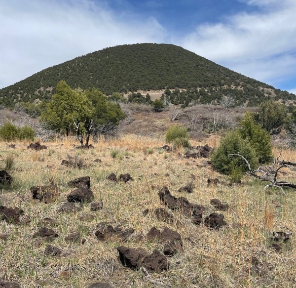
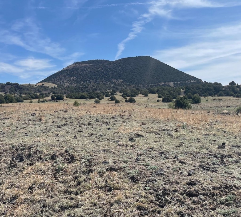
Our country’s national monuments and parks provide opportunities to appreciate nature in a variety of forms: mountains and cliffs, seashores and inland beaches, forests and grasslands, along with the animals, plants, and rocks that provide those landscapes with so much interest. The really good monuments and parks, however, present those opportunities along with an introduction to the cultural forces that helped shape them as well. Despite its small size, Capulin Volcano National Monument in far northeastern New Mexico (it’s less than 20 miles south of the border with Colorado) is a shining example of the best that the National Park Service has to offer.
The 1.25-square mile national monument is located in the Raton-Clayton Volcanic Field, an eight-thousand-square-mile area containing dozens upon dozens of volcanos that erupted over the last nine million years. We visited Capulin Volcano National Monument, featuring the region’s best-known volcano, during our stay in Raton, New Mexico, in May, 2024
This is a region where the grasslands meet the mountains – the Great Plains end and the Rocky Mountains begin. Along with its relatively recently created cinder cone volcano, Capulin (pr. kah-poo-LEEN), the monument preserves an incredibly diverse environment for plants and animals, and interprets the area’s human influence extraordinarily well. This is an area through which a great many people passed, whether they were on foot pursuing giant Ice-Age mammals in search of food, in horse-drawn wagons making their way from Missouri to New Mexico on the Santa Fe Trail, or on horseback following great herds of cattle on their way from Texas to northern pasturelands and railroads.
But let’s forget about people for a while and talk about volcanoes. Just below the now-quiet surface of the Raton-Clayton Volcanic Field, the Earth’s crust is relatively thin and unstable, so, in the distant past, magma roiling near the surface of the planet made its way upward in a variety of ways. Volcanic features are everywhere you look in the region: it’s home to about 125 cinder cones, volcanic necks, and a single shield volcano. Chances are that if a geologic structure rises higher than the surrounding grassland, it was once an active volcano.
The cinder cone of Capulin Volcano rises almost 1,300 feet – about the height of New York City’s Empire State Building – above the northeastern New Mexico plains . The crater’s rim measures about a mile in circumference, and the crater itself drops 400 feet below the rim. The highest point on the volcano is 8,142 feet above sea level, and standing at different points on that rim affords views not only of a goodly part of New Mexico, but of Colorado, Oklahoma, and Texas as well (they all kind of look the same, to be honest – someone should probably repaint the states’ borderlines).
Erupting about 60,000 years ago, Capulin is the youngest large volcano in the Raton-Clayton Volcanic Field. Geologists consider Capulin extinct, but the rest of the field is considered only dormant and the potential exists for additional volcanic activity in the future. Considering, however, that Capulin erupted that long ago, it’s unlikely that we’ll see anything happening anytime soon.
Capulin Volcano National Monument: By The Numbers
Date established as a national monument
August 9, 1916
Total area
793 acres (1.25 square miles)
Yearly visitors
67,000
Highest point
8,142 feet (top of cinder cone)
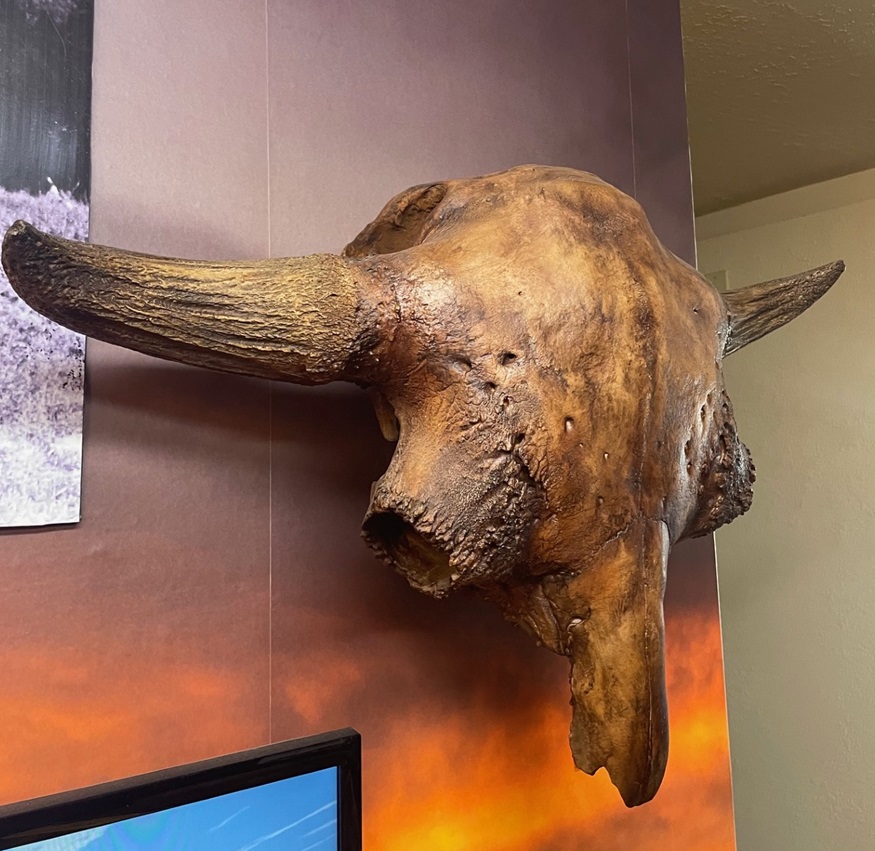
The monument has a very fine visitor center with a number of interesting displays that explain the geological, biological, and cultural history of the area. This is a recreation of the skull of a Bison antiquus, which lived in the region about 10,000 years ago during the Pleistocene Epoch . They were about 30 percent larger than modern-day bison (and I don’t know how close you’ve been to a bison, but they’re pretty good-sized themselves; bulls regularly weigh more than 2,000 pounds). Fossilized bones from Bison antiquus were first discovered in 1908 by George McJunkin, a former Black slave who became a bronco-busting and bilingual ranch hand in New Mexico. That find would become one of the most important archeological discoveries in the nation’s history. McJunkin was inspecting pasture conditions following a torrential rainstorm when he happened upon the fossils. He knew he’d discovered something important, but couldn’t get any experts interested in the discovery and he died in 1922 without realizing exactly what he’d found. In 1927, an expedition from the Denver Museum of Natural History (now Denver Museum of Nature and Science) found, in the same area, fossils of the same species. However, those newly discovered fossils had projectile points embedded in them, which proved that humans lived in this area during the Ice Age – about 7,000 years earlier than first believed. The projectile points and the native American culture that used them were named after the New Mexico town near where they were discovered: Folsom, which is about six miles north of Capulin Volcano National Monument.Located where the northeastern New Mexico grasslands meet the Sangre De Cristo mountain range, Capulin Volcano National Monument provides habitat for a wide variety of wildlife. Spotted towhees (Pipilo maculatus) were by far the most plentiful birds we saw while visiting Capulin, but the national monument is home, either year-round or for migratory stopovers, to more than 70 bird species. Spotted towhees are more commonly seen on the ground, scratching through leaf litter in search of insects, but in the springtime males especially will make their way to the tops of shrubs to let loose with their pretty call. This fellow was hanging out near the parking lot on the crater’s rim.
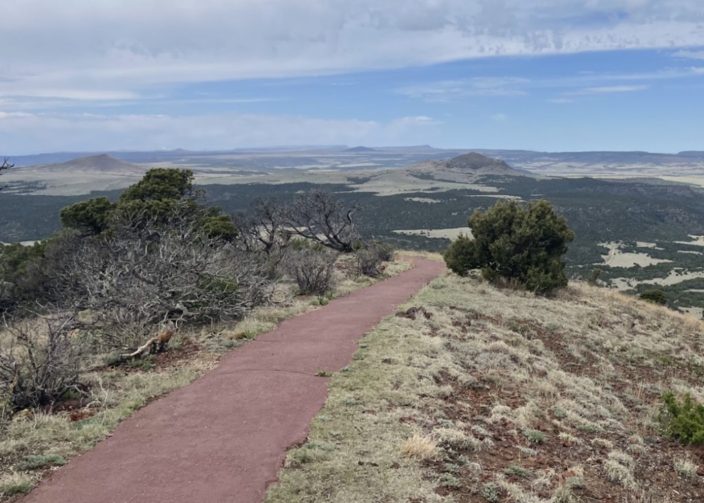
After enjoying the visitor center, Nancy and I drove the Goddard’s six-wheeled towing unit up a road that spirals around and up the Capulin cinder cone. It’s an interesting drive that brought us to a small-ish parking lot at the top of the crater, with a trailhead for the one-mile Crater Rim loop. The easy hike provides great views of the Raton-Clayton Volcanic Field, and many of its geologic features.
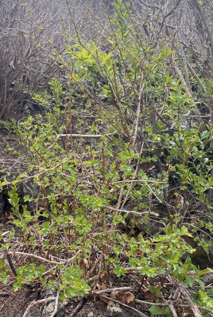
During its 10-year-long eruption history, Capulin ejected volcanic ash as well as small gravel-sized cinders and larger rocks, called bombs, thousands of feet into the sky. In all, the ejected material covered almost 16 square miles of what is now New Mexico. The cinders, which measure 2-64 millimeters in size, built the majority of the cone’s structure by falling back to earth and piling up around the eruption site. Volcanic bombs measure in excess of 64 millimeters (2.5 inches). Upon its return to the ground, this bomb, roughly the size of a car engine block, landed on the rim of the crater. This spot, then, would have been a good one to avoid at the time. The western side of the rim (where the parking lot is located) is about 300 feet lower than the opposite side; the scientists believe that’s due to wind gusts picking up cinders and then dropping them while Capulin was erupting. The Goddard’s six-wheeled towing unit can be seen on the right side of the parking lot on the other side of the rim. On the left side of the photo, on the farthest horizon, you can see the snow-capped Spanish Peaks, located a few miles west of Walsenburg, Colorado. We’d move the Goddard to camp at Lathrop State Park, very close to the Spanish Peaks, following our stay in Raton. This is a variety of chokecherry (Prunus virginiana), a large shrub or short tree that was formerly found all over the volcano but now grows primarily in the crater. It blooms between April and June, and its fruit is used for jellies and teas. Spanish-speaking ranchers who settled in this area called it by its Spanish name, “capulin.”Viewed here looking southeast from the rim of Capulin, Sierra Grande (elev. 8,720 ft.) is the only shield volcano as well as the largest volcano in the Raton-Clayton Volcanic Field. Rather than an eruption of ash, cinders, and lava rocks, the mountain was made over the course of many fluid lava flows from 3.8 to 2.6 million years ago. The panhandle of Oklahoma is about 50 miles east of Sierra Grande (to the left in this image). The ripples in the land between Sierra Grande and Capulin are called pressure ridges; they’re formed when flowing lava on the surface begins to cool while hotter lava continues to move underneath the hardened rock.From 1821 until 1880, the Santa Fe Trail connected Independence, Missouri, with Santa Fe, New Mexico. Traders, settlers, and the military used the trail to move through what was then the homeland of several different native American cultures, including the Comanche, Cheyenne, and Jicarilla Apache. This is looking east from the top of Capulin; the dark streak on the horizon on the left side of the image is Black Mesa, Oklahoma, about 80 miles from the volcano. When travelers heading west on the Santa Fe Trail saw geologic features like Black Mesa or Capulin, they knew they were approaching their destination in northern New Mexico and their journey across the Great Plains was nearing an end.This pretty yellow flower, prairie thermopsis (Thermopsis rhombifolia), was growing next to the Rim Trail on Capulin. It is one of the first flowers to blossom in the national monument each spring.
Charles Goodnight and Oliver Loving, two Texas cattlemen, wintered their herds near Capulin Volcano in the 1860s while driving cattle from Texas to Colorado and Wyoming. More than a quarter million head of cattle found their way north over the Goodnight-Loving Trail. The outstanding novel “Lonesome Dove,” by Larry McMurtry, which was adapted into a very good miniseries, was inspired by the development of Goodnight-Loving, the greatest of the western cattle trails..
This is looking north from the rim of Capulin. Folsom was once a robust town with many businesses and a railroad, but a flood on August 27, 1908, destroyed most of the community’s buildings. That damage, however, was why George McJunkin was out inspecting pastures in the area and came upon the unusually large fossilized bison bones that would upend American archeological thought. Baby Capulin (elev. 6.870 ft) is another cinder cone that was probably formed from the same magma chamber as Capulin Volcano, but perhaps 10,000 years later. A violent meeting of magma and groundwater resulted in the creation of Mud Hill, the structure topped with a crescent of evergreen trees just this side of Baby Capulin. The horizon in this photo is in the state of Colorado, the border of which is about 20 miles away.Each of the hills, mesas, and mountains in this view looking northwest from the Rim Trail on Capulin is the result of volcanic activity. Beginning with the first eruptions about 9 million years ago, magma from the eruptions flowed down valleys and then hardened as it cooled. Over the ensuing millions of years, the pre-existing sedimentary rock eroded away, through the action of water and wind, much faster than the harder volcanic rock, leaving behind the exposed buttes and mesas of the Raton-Clayton Volcanic Field.
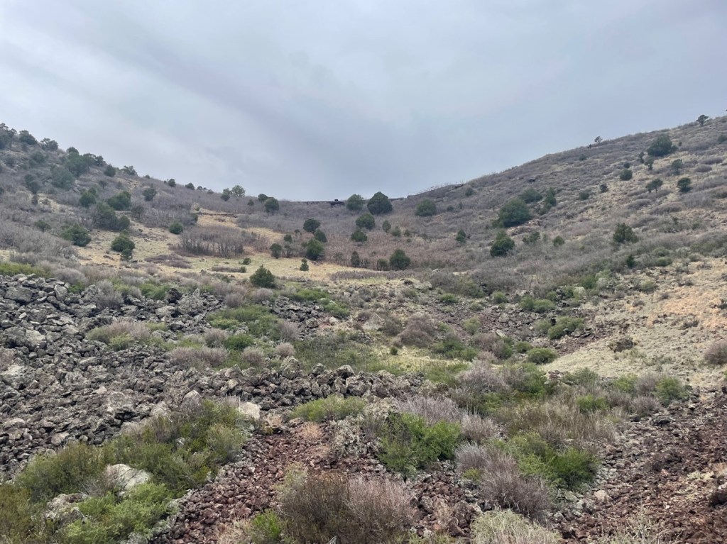
Upon returning to the rim’s parking lot, Nancy and I decided to take a picnic lunch into the bottom of the crater. It’s a very pleasant hike as well, with many interesting rock formations and chances to see additional wildlife.
If you’re into basalt, you could do worse than enter the crater of Capulin Volcano. This picture was taken near the vent of the volcano, at the bottom of the crater.This image was taken at the lowest part of the Capulin crater. The rim parking lot is just over the crater’s far side.When we were hiking on the rim trail, we saw what were clearly six or eight mule deer, along with some lighter-colored animals, down in the crater. We thought the other animals were perhaps desert mountain sheep. During our lunch inside the crater, however, we discovered, upon being much closer to them, that the lighter-colored animals were also mule deer – they are the lightest-colored deer I’ve ever seen. A ranger at the visitor center (yes, we went back with questions after lunch) said that several years ago, a blond-colored mule deer showed up in the national monument. It must have some strong DNA. A Spanish-speaking family happened to be at the bottom of the crater at the same time as us, and I asked them what the Spanish words for mule deer are; they replied, “venado bura.” ¡Ese es un venado bura muy rubio!Following our lunch in the bottom of the crater and our fact-finding mission back to the visitor center, Nancy and I went on a third hike at the foot of Capulin. You can see the start of the road that spirals up the side of the volcano, along with a few of the tens of thousands of volcanic bombs that erupted from Capulin.
We’d been to Capulin Volcano National Monument before, but we can’t remember when – it was at least 15 years ago and probably more. Nancy and I did agree, however, that we got much, much more out of our visit in 2024, but we don’t know why. It’s not like we were desperate for volcanos; we’d seen plenty in the summer and fall of 2023, and the spring of 2024, in Idaho and western New Mexico. I wonder if those experiences, along with visiting other national parks and monuments that don’t happen to feature volcanos, helped us appreciate Capulin all the more. It’s a great, great national monument, filled with opportunities to learn about our planet’s violent past as well as see some really beautiful plants and animals.. Raton, New Mexico, is less than five hours directly south of Denver, Colorado, via Interstate 25, and then Capulin is about half an hour from Raton.