Capulin Volcano National Monument

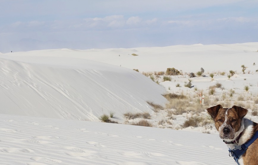
Near Raton, New Mexico – May 4, 2024

Our country’s national monuments and parks provide opportunities to appreciate nature in a variety of forms: mountains and cliffs, seashores and inland beaches, forests and grasslands, along with the animals, plants, and rocks that provide those landscapes with so much interest. The really good monuments and parks, however, present those opportunities along with an introduction to the cultural forces that helped shape them as well. Despite its small size, Capulin Volcano National Monument in far northeastern New Mexico (it’s less than 20 miles south of the border with Colorado) is a shining example of the best that the National Park Service has to offer.

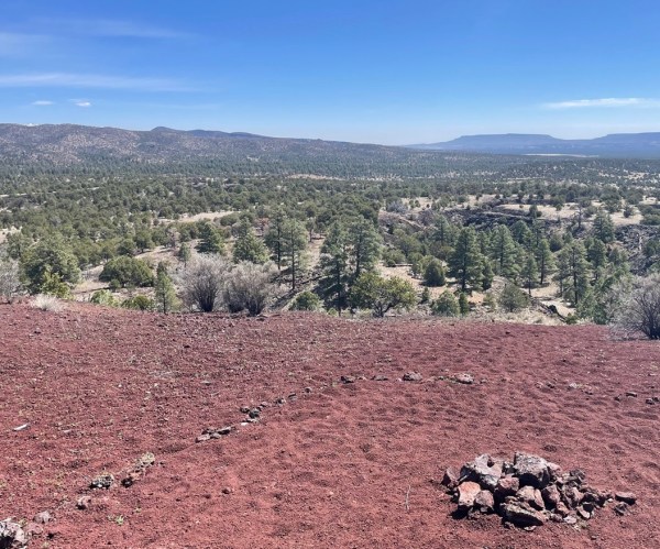
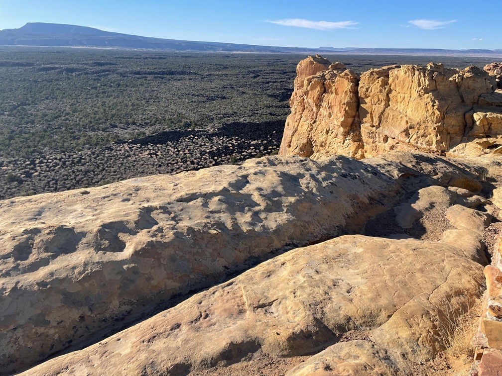
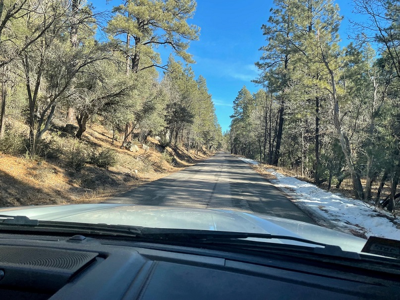
The 1.25-square mile national monument is located in the Raton-Clayton Volcanic Field, an eight-thousand-square-mile area containing dozens upon dozens of volcanos that erupted over the last nine million years. We visited Capulin Volcano National Monument, featuring the region’s best-known volcano, during our stay in Raton, New Mexico, in May, 2024

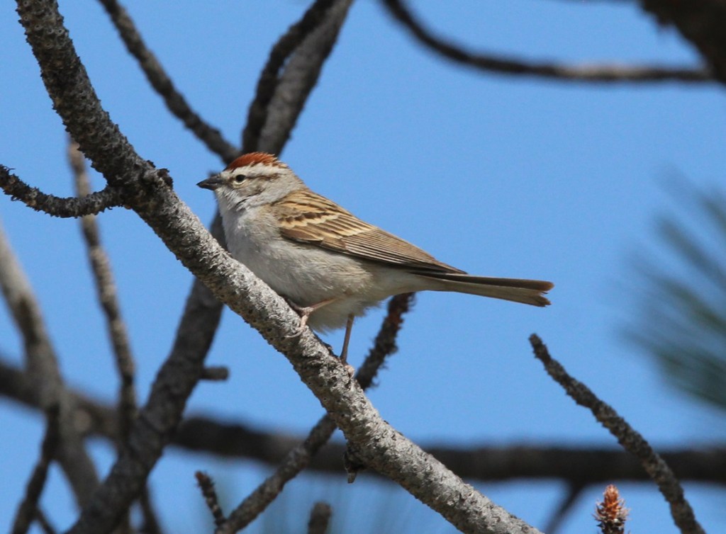
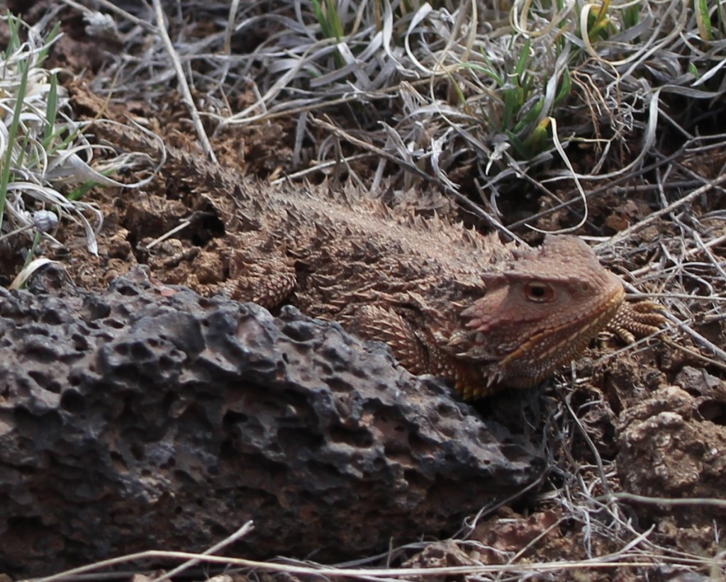
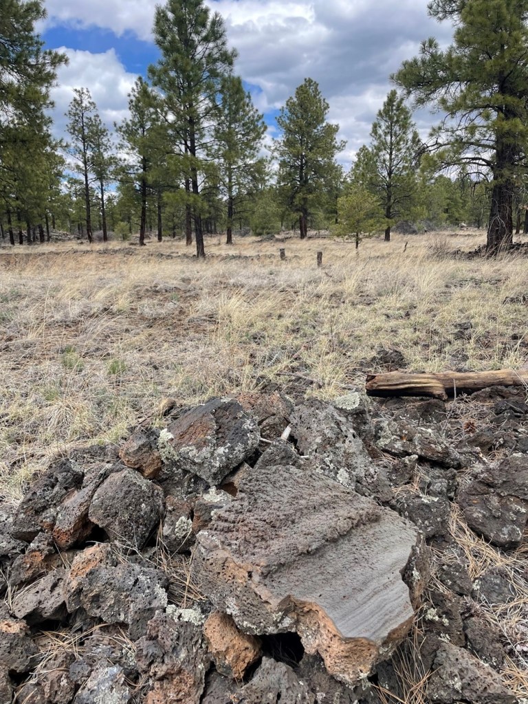
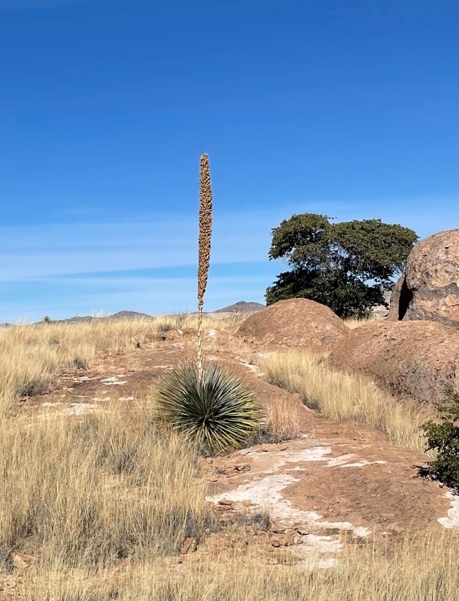
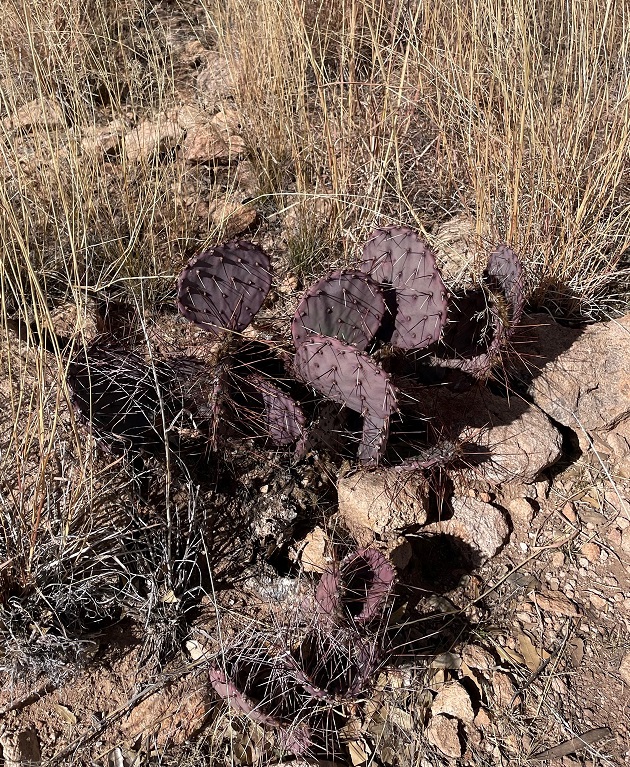
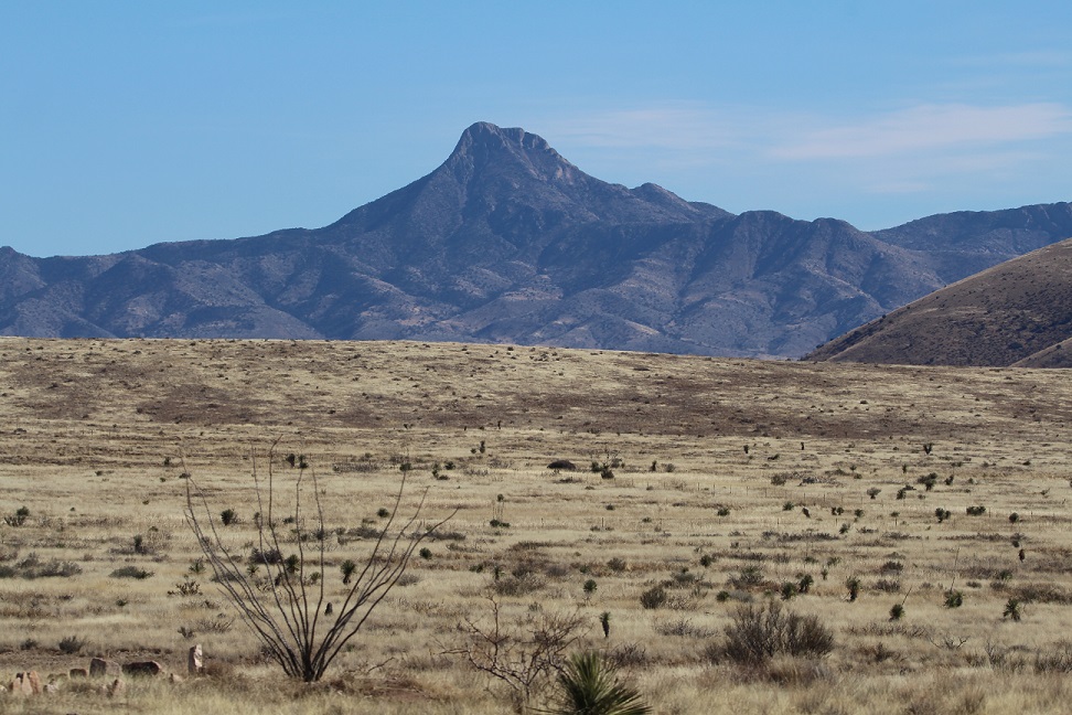
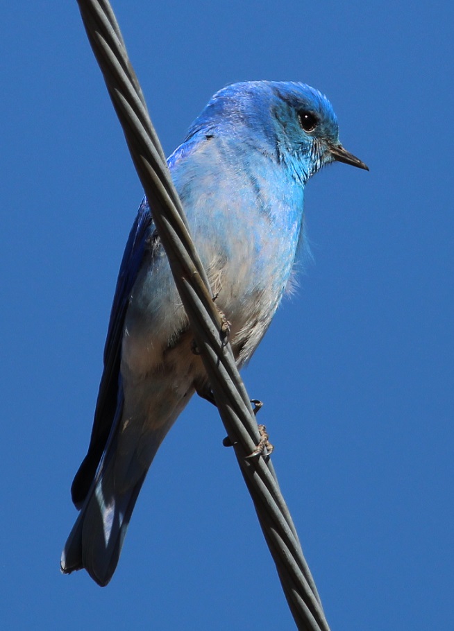
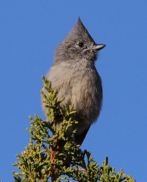
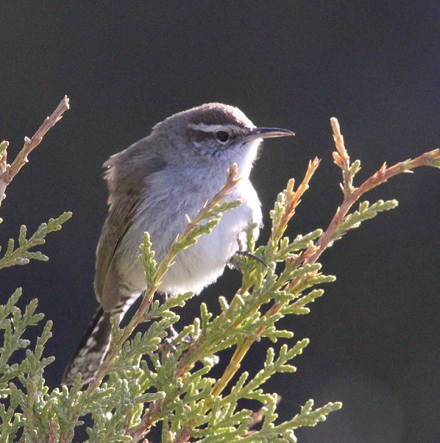
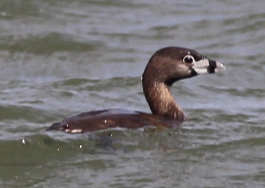
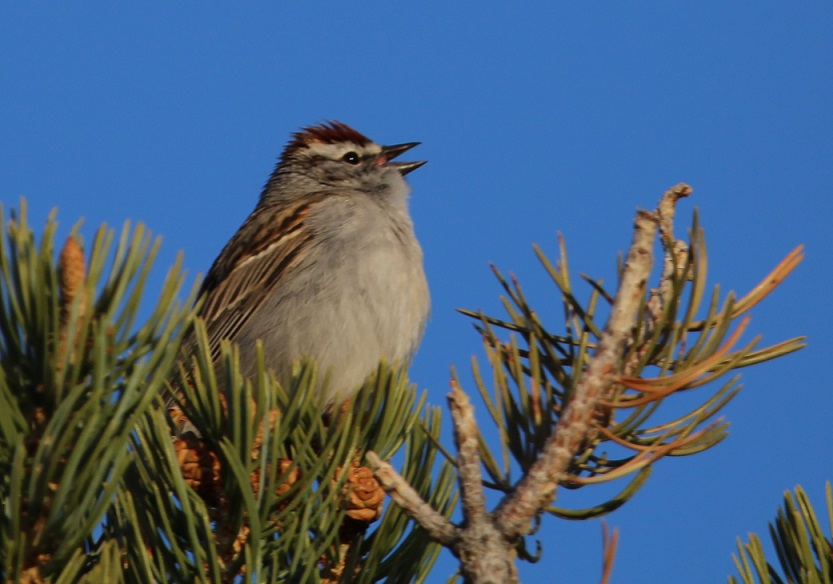
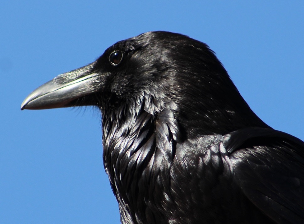
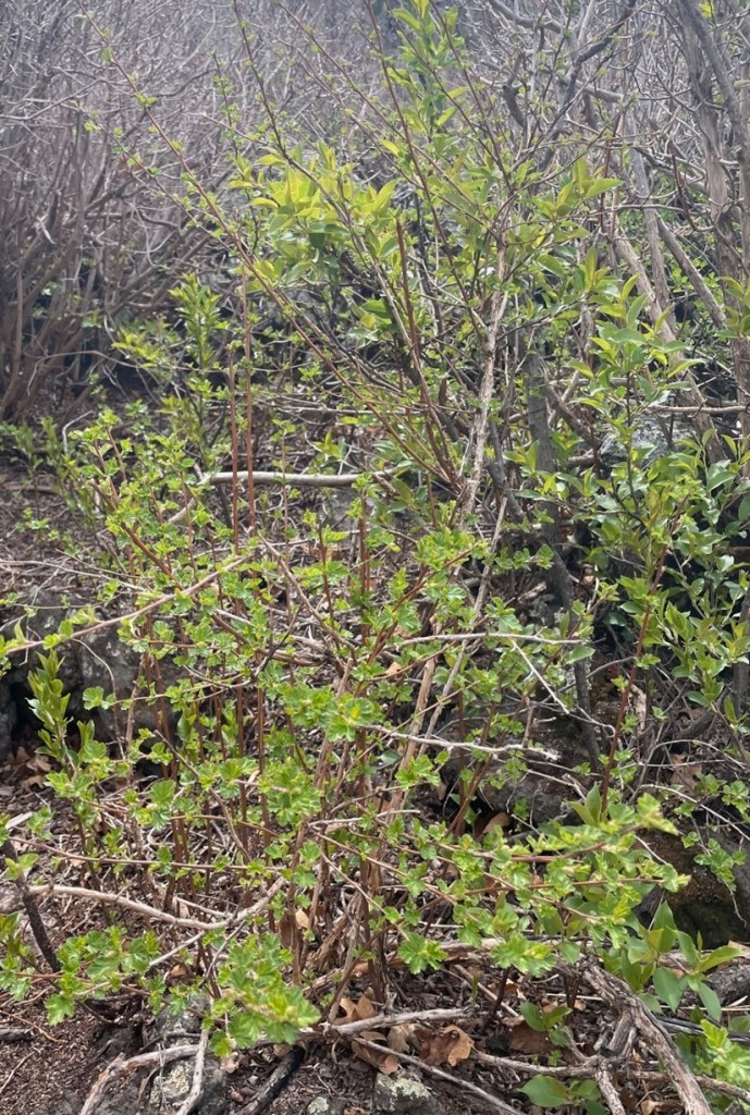
This is a region where the grasslands meet the mountains – the Great Plains end and the Rocky Mountains begin. Along with its relatively recently created cinder cone volcano, Capulin (pr. kah-poo-LEEN), the monument preserves an incredibly diverse environment for plants and animals, and interprets the area’s human influence extraordinarily well. This is an area through which a great many people passed, whether they were on foot pursuing giant Ice-Age mammals in search of food, in horse-drawn wagons making their way from Missouri to New Mexico on the Santa Fe Trail, or on horseback following great herds of cattle on their way from Texas to northern pasturelands and railroads.

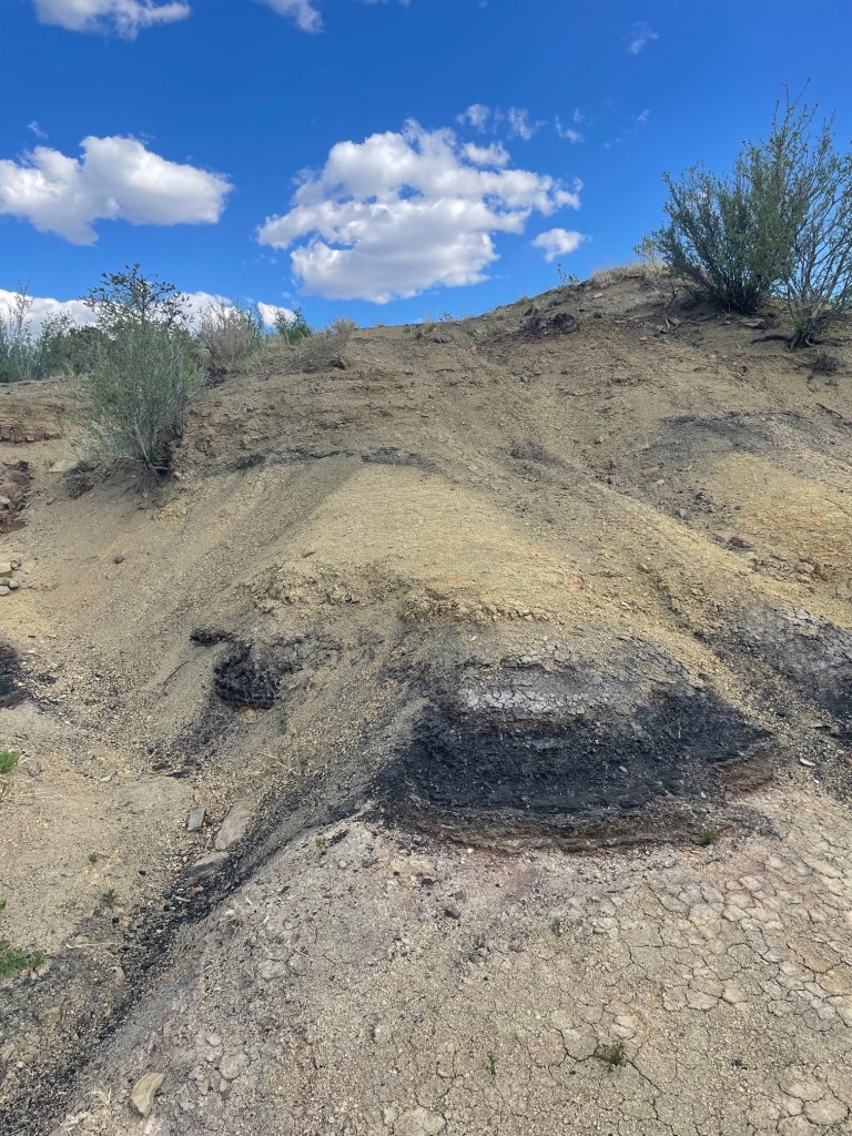
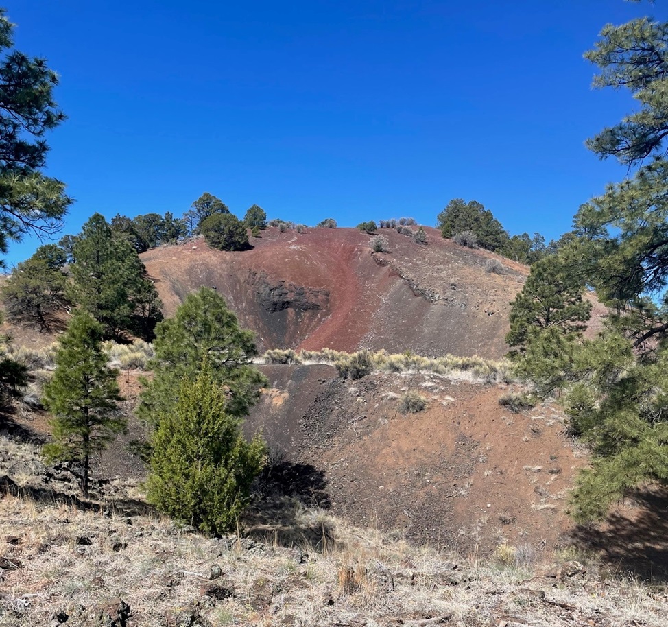
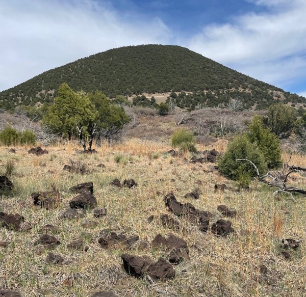
But let’s forget about people for a while and talk about volcanoes. Just below the now-quiet surface of the Raton-Clayton Volcanic Field, the Earth’s crust is relatively thin and unstable, so, in the distant past, magma roiling near the surface of the planet made its way upward in a variety of ways. Volcanic features are everywhere you look in the region: it’s home to about 125 cinder cones, volcanic necks, and a single shield volcano. Chances are that if a geologic structure rises higher than the surrounding grassland, it was once an active volcano.

The cinder cone of Capulin Volcano rises almost 1,300 feet – about the height of New York City’s Empire State Building – above the northeastern New Mexico plains . The crater’s rim measures about a mile in circumference, and the crater itself drops 400 feet below the rim. The highest point on the volcano is 8,142 feet above sea level, and standing at different points on that rim affords views not only of a goodly part of New Mexico, but of Colorado, Oklahoma, and Texas as well (they all kind of look the same, to be honest – someone should probably repaint the states’ borderlines).

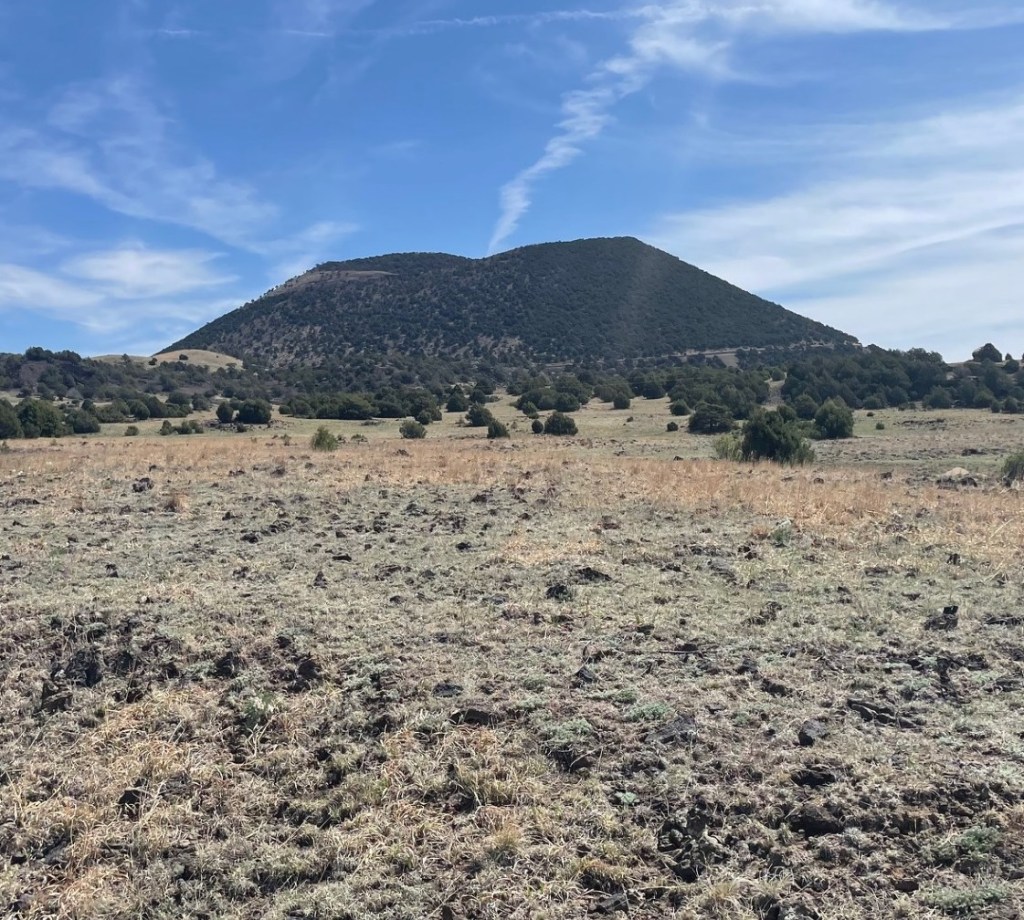
Erupting about 60,000 years ago, Capulin is the youngest large volcano in the Raton-Clayton Volcanic Field. Geologists consider Capulin extinct, but the rest of the field is considered only dormant and the potential exists for additional volcanic activity in the future. Considering, however, that Capulin erupted that long ago, it’s unlikely that we’ll see anything happening anytime soon.

Capulin Volcano National Monument:
By The Numbers
Date established as a national monumentAugust 9, 1916
Total area793 acres (1.25 square miles)
Yearly visitors67,000
Highest point8,142 feet (top of cinder cone)

The monument has a very fine visitor center with a number of interesting displays that explain the geological, biological, and cultural history of the area. This is a recreation of the skull of a Bison antiquus, which lived in the region about 10,000 years ago during the Pleistocene Epoch . They were about 30 percent larger than modern-day bison (and I don’t know how close you’ve been to a bison, but they’re pretty good-sized themselves; bulls regularly weigh more than 2,000 pounds). Fossilized bones from Bison antiquus were first discovered in 1908 by George McJunkin, a former Black slave who became a bronco-busting and bilingual ranch hand in New Mexico. That find would become one of the most important archeological discoveries in the nation’s history. McJunkin was inspecting pasture conditions following a torrential rainstorm when he happened upon the fossils. He knew he’d discovered something important, but couldn’t get any experts interested in the discovery and he died in 1922 without realizing exactly what he’d found. In 1927, an expedition from the Denver Museum of Natural History (now Denver Museum of Nature and Science) found, in the same area, fossils of the same species. However, those newly discovered fossils had projectile points embedded in them, which proved that humans lived in this area during the Ice Age – about 7,000 years earlier than first believed. The projectile points and the native American culture that used them were named after the New Mexico town near where they were discovered: Folsom, which is about six miles north of Capulin Volcano National Monument.

Located where the northeastern New Mexico grasslands meet the Sangre De Cristo mountain range, Capulin Volcano National Monument provides habitat for a wide variety of wildlife. Spotted towhees (Pipilo maculatus) were by far the most plentiful birds we saw while visiting Capulin, but the national monument is home, either year-round or for migratory stopovers, to more than 70 bird species. Spotted towhees are more commonly seen on the ground, scratching through leaf litter in search of insects, but in the springtime males especially will make their way to the tops of shrubs to let loose with their pretty call. This fellow was hanging out near the parking lot on the crater’s rim.

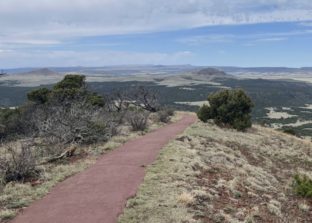
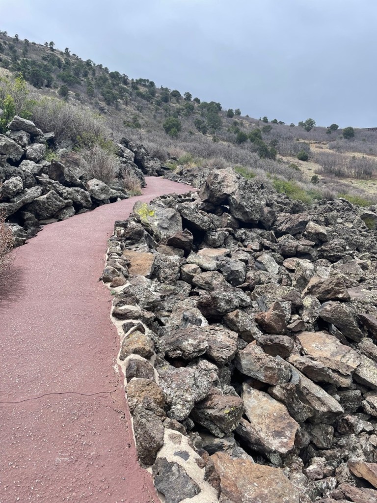
After enjoying the visitor center, Nancy and I drove the Goddard’s six-wheeled towing unit up a road that spirals around and up the Capulin cinder cone. It’s an interesting drive that brought us to a small-ish parking lot at the top of the crater, with a trailhead for the one-mile Crater Rim loop. The easy hike provides great views of the Raton-Clayton Volcanic Field, and many of its geologic features.

During its 10-year-long eruption history, Capulin ejected volcanic ash as well as small gravel-sized cinders and larger rocks, called bombs, thousands of feet into the sky. In all, the ejected material covered almost 16 square miles of what is now New Mexico. The cinders, which measure 2-64 millimeters in size, built the majority of the cone’s structure by falling back to earth and piling up around the eruption site. Volcanic bombs measure in excess of 64 millimeters (2.5 inches). Upon its return to the ground, this bomb, roughly the size of a car engine block, landed on the rim of the crater. This spot, then, would have been a good one to avoid at the time. The western side of the rim (where the parking lot is located) is about 300 feet lower than the opposite side; the scientists believe that’s due to wind gusts picking up cinders and then dropping them while Capulin was erupting. The Goddard’s six-wheeled towing unit can be seen on the right side of the parking lot on the other side of the rim. On the left side of the photo, on the farthest horizon, you can see the snow-capped Spanish Peaks, located a few miles west of Walsenburg, Colorado. We’d move the Goddard to camp at Lathrop State Park, very close to the Spanish Peaks, following our stay in Raton.

This is a variety of chokecherry (Prunus virginiana), a large shrub or short tree that was formerly found all over the volcano but now grows primarily in the crater. It blooms between April and June, and its fruit is used for jellies and teas. Spanish-speaking ranchers who settled in this area called it by its Spanish name, “capulin.”

Viewed here looking southeast from the rim of Capulin, Sierra Grande (elev. 8,720 ft.) is the only shield volcano as well as the largest volcano in the Raton-Clayton Volcanic Field. Rather than an eruption of ash, cinders, and lava rocks, the mountain was made over the course of many fluid lava flows from 3.8 to 2.6 million years ago. The panhandle of Oklahoma is about 50 miles east of Sierra Grande (to the left in this image). The ripples in the land between Sierra Grande and Capulin are called pressure ridges; they’re formed when flowing lava on the surface begins to cool while hotter lava continues to move underneath the hardened rock.

From 1821 until 1880, the Santa Fe Trail connected Independence, Missouri, with Santa Fe, New Mexico. Traders, settlers, and the military used the trail to move through what was then the homeland of several different native American cultures, including the Comanche, Cheyenne, and Jicarilla Apache. This is looking east from the top of Capulin; the dark streak on the horizon on the left side of the image is Black Mesa, Oklahoma, about 80 miles from the volcano. When travelers heading west on the Santa Fe Trail saw geologic features like Black Mesa or Capulin, they knew they were approaching their destination in northern New Mexico and their journey across the Great Plains was nearing an end.

This pretty yellow flower, prairie thermopsis (Thermopsis rhombifolia), was growing next to the Rim Trail on Capulin. It is one of the first flowers to blossom in the national monument each spring.

Charles Goodnight and Oliver Loving, two Texas cattlemen, wintered their herds near Capulin Volcano in the 1860s while driving cattle from Texas to Colorado and Wyoming. More than a quarter million head of cattle found their way north over the Goodnight-Loving Trail. The outstanding novel “Lonesome Dove,” by Larry McMurtry, which was adapted into a very good miniseries, was inspired by the development of Goodnight-Loving, the greatest of the western cattle trails..

This is looking north from the rim of Capulin. Folsom was once a robust town with many businesses and a railroad, but a flood on August 27, 1908, destroyed most of the community’s buildings. That damage, however, was why George McJunkin was out inspecting pastures in the area and came upon the unusually large fossilized bison bones that would upend American archeological thought. Baby Capulin (elev. 6.870 ft) is another cinder cone that was probably formed from the same magma chamber as Capulin Volcano, but perhaps 10,000 years later. A violent meeting of magma and groundwater resulted in the creation of Mud Hill, the structure topped with a crescent of evergreen trees just this side of Baby Capulin. The horizon in this photo is in the state of Colorado, the border of which is about 20 miles away.

Each of the hills, mesas, and mountains in this view looking northwest from the Rim Trail on Capulin is the result of volcanic activity. Beginning with the first eruptions about 9 million years ago, magma from the eruptions flowed down valleys and then hardened as it cooled. Over the ensuing millions of years, the pre-existing sedimentary rock eroded away, through the action of water and wind, much faster than the harder volcanic rock, leaving behind the exposed buttes and mesas of the Raton-Clayton Volcanic Field.

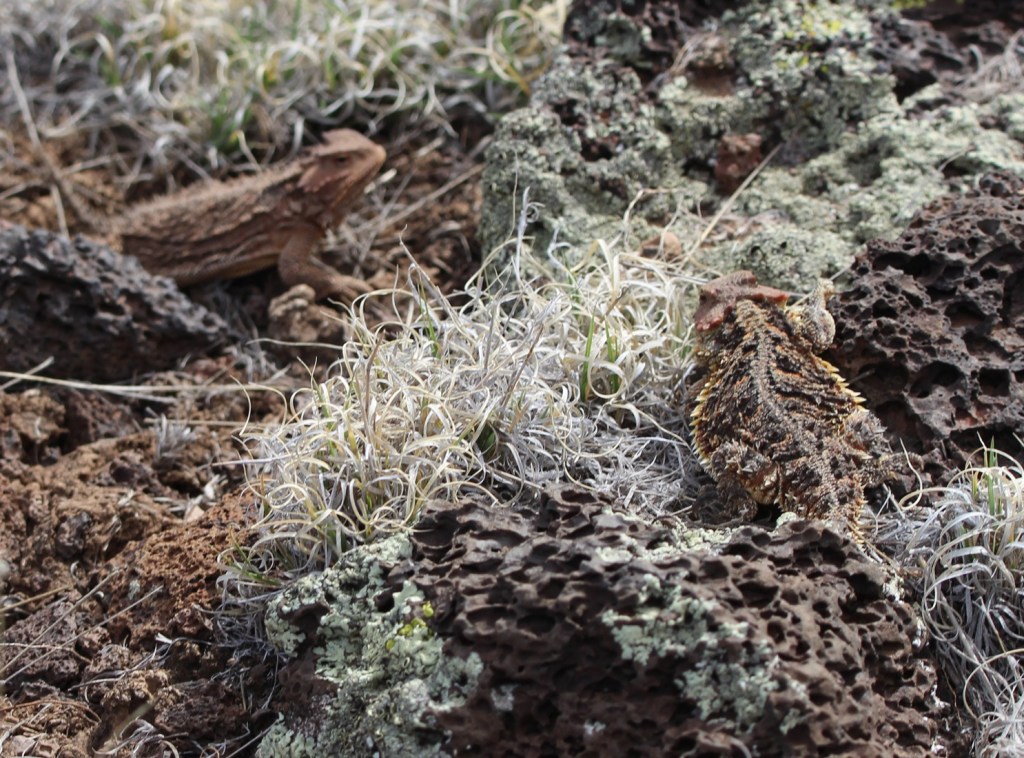
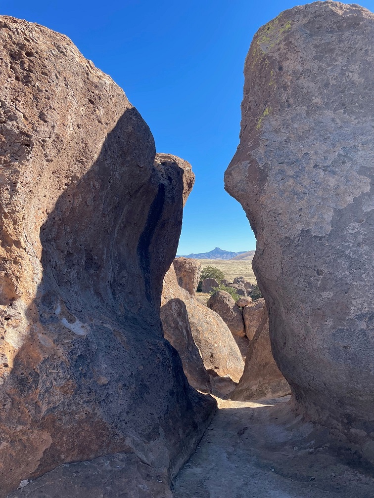
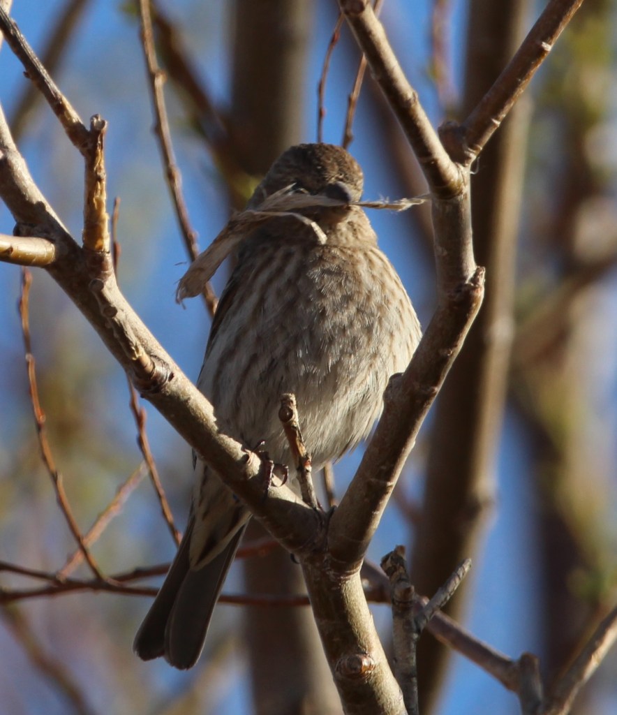
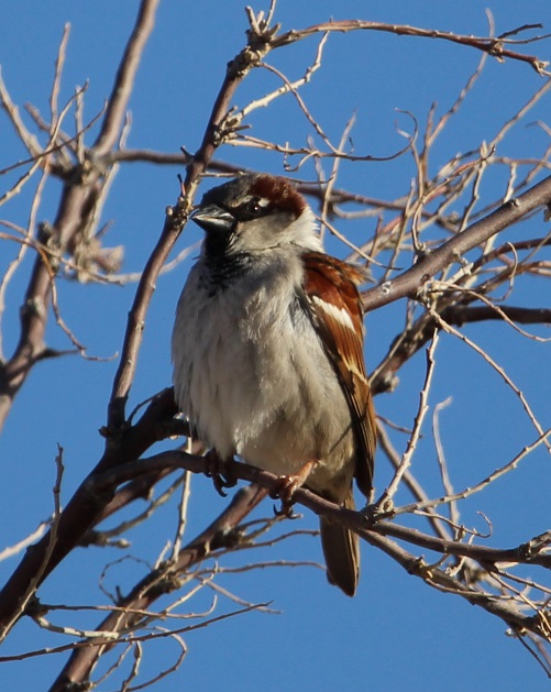
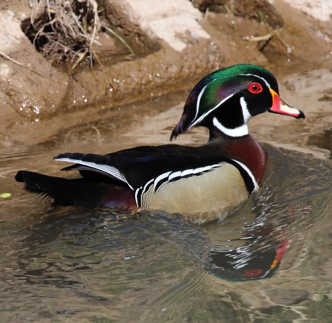
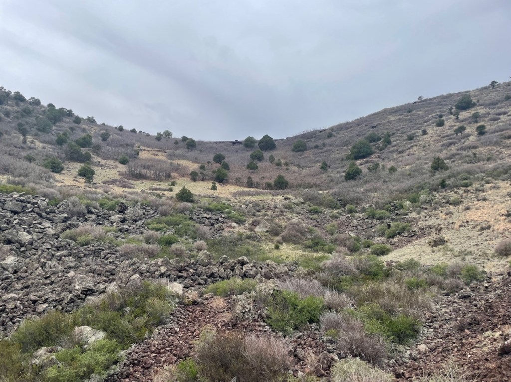
Upon returning to the rim’s parking lot, Nancy and I decided to take a picnic lunch into the bottom of the crater. It’s a very pleasant hike as well, with many interesting rock formations and chances to see additional wildlife.

If you’re into basalt, you could do worse than enter the crater of Capulin Volcano. This picture was taken near the vent of the volcano, at the bottom of the crater.

This image was taken at the lowest part of the Capulin crater. The rim parking lot is just over the crater’s far side.

When we were hiking on the rim trail, we saw what were clearly six or eight mule deer, along with some lighter-colored animals, down in the crater. We thought the other animals were perhaps desert mountain sheep. During our lunch inside the crater, however, we discovered, upon being much closer to them, that the lighter-colored animals were also mule deer – they are the lightest-colored deer I’ve ever seen. A ranger at the visitor center (yes, we went back with questions after lunch) said that several years ago, a blond-colored mule deer showed up in the national monument. It must have some strong DNA. A Spanish-speaking family happened to be at the bottom of the crater at the same time as us, and I asked them what the Spanish words for mule deer are; they replied, “venado bura.” ¡Ese es un venado bura muy rubio!

Following our lunch in the bottom of the crater and our fact-finding mission back to the visitor center, Nancy and I went on a third hike at the foot of Capulin. You can see the start of the road that spirals up the side of the volcano, along with a few of the tens of thousands of volcanic bombs that erupted from Capulin.

We’d been to Capulin Volcano National Monument before, but we can’t remember when – it was at least 15 years ago and probably more. Nancy and I did agree, however, that we got much, much more out of our visit in 2024, but we don’t know why. It’s not like we were desperate for volcanos; we’d seen plenty in the summer and fall of 2023, and the spring of 2024, in Idaho and western New Mexico. I wonder if those experiences, along with visiting other national parks and monuments that don’t happen to feature volcanos, helped us appreciate Capulin all the more. It’s a great, great national monument, filled with opportunities to learn about our planet’s violent past as well as see some really beautiful plants and animals.. Raton, New Mexico, is less than five hours directly south of Denver, Colorado, via Interstate 25, and then Capulin is about half an hour from Raton.

Iridium Layer Site

Raton, New Mexico – May 3, 2024

A little more than 66 million years ago, a metallic asteroid the size of Mount Everest slammed into what is today the upper Yucatan Peninsula in Mexico and things really haven’t been the same since.

For one, the impact directly or indirectly caused the extinction of three-quarters of all organic life on Earth, including all of the dinosaur species that couldn’t fly. A dust cloud from the impact entered the planet’s atmosphere and blocked the Sun for months, preventing photosynthesis in plants, causing catastrophic climate change, and immediately or eventually killing any terrestrial animal weighing more than 55 pounds, except for some cold-blooded amphibious species such as sea turtles and crocodiles. The impact also caused tsunamis to crash against the coastal areas of the planet, and, because the asteroid crashed into a bed of gypsum, immense quantities of sulfur trioxide were thrust into the atmosphere to later fall as acid rain for days.

The Santa Fe Trail, a major trade, military, and settlement route connecting Kansas City, Missouri, and Santa Fe, New Mexico, cut through the middle of what is now Raton, New Mexico. The area had a post office called Willow Springs from 1877 to 1879, then it was changed to Otero for a couple of years before being renamed Raton in 1880. The city became a center for the railroad, mining, and ranching industries in northeastern New Mexico. This is looking southeast from the hilltop on which the iridium layer is located. All of the mountains on the horizon are extinct volcanoes that arose and erupted many millions of years after the end of the Cretaceous Period.

In short, Earth was a place best avoided for the near- and medium term following the planet’s encounter with an asteroid. In addition to being much colder because of the dust cloud blocking the sun, the lack of plant life due to the cessation of photosynthesis doomed herbivorous dinosaurs like triceratops and titanosaurs, and later the carnivorous genera, like abelisaurids and tyrannosaurids, that preyed upon them.

A lone hiker (it’s Nancy) stands a silent vigil near the K-Pg boundary. The city of Raton has placed this helpful sign to assist in identifying the inch-thick layer of clay containing high concentrations of the element iridium. The layer is sandwiched between sandstone dating back to the Cretaceous Period, when dinosaurs ruled the Earth, and sandstone and coal from the Paleogenic Period, when mammalian species began to flourish.

Things are better today, of course (with the exception that there are no more Tyrannosaurus rexes running around, and even that’s probably for the best). The impact had a huge influence on how life on the planet, including the eventual species of H. sapiens, was able to emerge and evolve.

When I was a kid, an asteroid crashing into the Earth was only one of several hypothesized reasons for the disappearance of the dinosaurs. The existence of a particular layer of sediment, originally discovered in Italy but since found around the world, was a major factor in the popularity of that hypothesis: dinosaur fossils, footprints, and other artifacts could be found below this layer, but not above. That particular layer of sediment, which has since been found in many locations around the globe, is unique in that it contains as much as 160 times more of the element iridium than other layers of the Earth’s crust. Iridium (atomic symbol Ir and atomic number 77) is a metallic element found commonly on asteroids flitting about the cosmos, but it’s not found naturally occurring on Earth except when one of those asteroids flits into the planet.

However, until the actual crater for the possible asteroid impact 66 million years ago was discovered, the theory remained only one of the possibilities for what is now called the Cretaceous-Paleogene (K-Pg) extinction event (again, when I was young the K-Pg event was called the Cretaceous-Tertiary, or K-T, event; the “K” is used instead of “C” for Cretaceous because the German word for “chalk,” from which the Latinate “Cretaceous” is derived, is “Kreide”). Some scientists believed that the layer, and the mass extinction event that it documented, could have been caused by the explosion of a relatively nearby supernova, or by gradual climate change, or by a reversal of the planet’s geomagnetic poles (you can understand how magnetic north becoming magnetic south, and vice versa, would be undesirable).

In the early 1980s, a crater more than 90 miles in diameter (about the combined area of Massachusetts, Connecticut, and Rhode Island) and between 6 and 12 miles deep was discovered near the town of Chicxulub (pr. “cheek-shoe-LOOB”) on the Yucatan Peninsula, and chemical and geologic analysis of the impact site showed that scientists finally had their hole in the ground proving that the age of the dinosaurs was ended by an asteroid collision. Researchers believe the Chicxulub asteroid was probably about six miles wide – tiny compared to the Earth, but it was hurtling along at about 12 miles per second so it was ready to do some damage.

Incidentally, I read an interesting book several years ago about past extinction events on Earth, one of which was the Chicxulub impact, and the book’s author wrote that the explosive nature of the asteroid collision was so violent that vaporized bits of organic matter on the planet’s surface could have been ejected into space. The author asked a researcher if it’s possible that there are tiny bits of dinosaurs on the Moon, and the researcher said that yes, it is possible that there are tiny bits of dinosaurs on the Moon.

But I digress. Life on Earth was drastically changed after the asteroid impact, and, with the exception of smaller flying lizards that could more easily find food and shelter (and which would evolve into our feathered friends of today), the dinosaurs were no more – and an age in which mammals could diversify and grow in species number had begun.

Despite the signage, it’s a little difficult for laypersons like ourselves to positively identify the exact layer containing iridium. However, we believe it to be the one-inch-thick layer of light-colored clay material directly above the very dark layer of rocks pictured in the center of this photo (if any experts happening to read this posting dispute this, I’ll happily correct this information). The iridium layer contains, in addition to large quantities of the titular element, shocked quartz and other materials indicative of an asteroid strike. All of the material under that layer is at least 66 million years old; everything above it was deposited after the age of the dinosaurs.

Because iridium exists on the planet only because of asteroid collisions, it’s one of the least-common elements on Earth – it’s four times as rare as gold. Iridium is one of the densest metals on the planet: a cubic inch of iridium weighs just over three-quarters of a pound (12.96 ounces, to be precise). Only one element, osmium, is more dense than iridium and it’s just barely so; osmium (Os) and iridium are both twice as heavy as lead (Pb, which has that symbol because of its Latin name, plumbum). Iridium’s resistance to heat and corrosion lends itself to uses in metallurgy (such as crucibles for less-dense metals) and electronics.

Many years ago, the steel nibs of fountain pens were tipped with alloys containing iridium in order to take advantage of the element’s hardness and resistance to corrosion. Most nibs then, as now, were made from steel. Over time, constant usage of the pen would wear down even the steel of a nib – so manufacturers tipped the nibs with harder metals like iridium to prolong their usage. However, iridium has become so difficult and expensive to source (and, given where the element comes from, we really don’t want more iridium on the planet anytime soon) that fountain pen nib manufacturers now use alloys of ruthenium, osmium, and tungsten (but sometimes, confusingly, call those alloys “iridium”). This is a 10x magnification of one of my fountain pens, a Pilot Custom 823. The nib itself is made of 14k gold for flexibility while writing, but the tipping, or the somewhat rounded extreme end of the pen, is made of harder alloys.

The K-Pg layer was first discovered in Italy but since then many other outcroppings of the iridium layer have been found around the world. One of those occurrences is near the small town of Raton, New Mexico (pop. 6,000), where we camped in the Goddard in the spring of 2024. Raton (Spanish for “mouse”) is about six miles south of the New Mexico-Colorado border in the far northeastern corner of the Land of Enchantment.

Nancy and I visited the site of the iridium layer late one afternoon in early May. I’d secured a permit to visit the site the day before at Raton’s municipal office. It turned out we didn’t really need a permit because it simply supplied the combination to a locked gate on the road and permission to park at the iridium layer site, and we didn’t think that there’d be room for the Goddard’s six-wheeled and 22-feet-long towing unit. We instead parked the towing unit downhill from the iridium layer site and hiked past the gate and then a mile or so to the site itself (the walk the day before from our campsite to the municipal office to acquire the permit, which we didn’t need, and back was 5.5 miles). Both were lovely walks (I saw a small group of mule deer in the front yard of a house in Raton on the way back to our campsite).

It further turned out that we could have driven the towing unit to the site, as there was plenty of room to park and turn around. But, as I mentioned, they were lovely walks.

We didn’t see much in the way of wildlife on our visit to the iridium layer, but we did encounter several of these rock wrens (Salpinctes obsoletus) on our walk back to the Goddard’s six-wheeled towing unit. These little birds weigh only about half an ounce, with a wingspan of 9 inches. Northern New Mexico is at the very northern edge of their year-round residency area; they are migratory into southwestern Canada.

Since this posting is sort of about dinosaurs, I’ll include a couple more photos of the dinosaurs’ descendants that I took at our campground in Raton. This is a chipping sparrow (Spizella passerina), of which we saw many in Raton. There are two major groups of chipping sparrows in North America, eastern and western, and each of those groups have different varieties. As someone who struggles with sparrow species identification, I appreciate the chipping sparrow’s distinctive lil’ red cap.

There were also plenty of common ravens (Corvus corax) in the campground and Raton. These are large birds – measuring up to 25 inches long, weighing 3.2 pounds, and boasting a wingspan of up to 5 feet – and they are remarkably long-lived as well: more than 23 years in the wild. Many people have trouble differentiating ravens from their smaller cousins, American crows, but ravens are on the whole larger, with wedge-shaped tails and much larger beaks in proportion to their heads. Like many other corvids, ravens are noted for their problem-solving abilities.

The few dinosaurs that survived the Chicxulub impact are the ones that were able to take to the skies, and their evolutionary descendants include rock wrens, chipping sparrows, and common ravens, as well as American white pelicans, common ostriches, Anna’s hummingbirds, emperor penguins, and others that comprise the 11,000 species of birds with which we share this planet.

One might wonder about why a one-inch layer of dirt that’s found around the world is important. I think it’s instructive to consider what life on Earth would be like had the planet not been pummeled by an asteroid 66 million years ago. Dinosaurs were the dominant lifeforms on Earth for around 175 million years, from their first appearance during the Triassic Period about 240 million years ago to being (mostly) destroyed by the Chicxulub asteroid. That’s an awfully long time to dominate; in fact, our existence as humankind is closer to the time that Tyrannosaurs were alive than the time between the Stegosaurus genus and Tyrannosaur genus were both alive; the former was even fossilized by the time T. rex had evolved. It’s very possible that gigantic, ground-shaking, and ferocious (and small-brained) lizards could still be the most dominant animals on the planet, and that mammals, although they’d first appeared on Earth well before the Chicxulub asteroid collision, would never have had the opportunity to gain a strong foothold with which to start their evolutionary path.

In short, you can probably thank the Chicxulub asteroid for you being here today. Also, it wouldn’t hurt to hope that a similar impact doesn’t occur anytime soon.

El Malpais National Monument

Near Grants, New Mexico – April 2024

El Malpais (pr. el-mal-pie-EES) National Monument, located near the town of Grants in northwestern New Mexico, showcases a number of different geological features in its nearly 180 square miles – but it’s best known for its impressive lava flows dating from 60,000 to only 4,000 years ago.

While Native Americans have lived in the El Malpais area for 12,000 years, early 17th-century Spanish explorers coming north from Mexico found the region nearly impassable by their horse-drawn wagons and carts. Those explorers gave the region its name, which means “the bad land” in Spanish and refers to the rocky topography left behind by the extensive lava flows.

El Malpais National Monument was established on Dec. 31, 1987, and about 100,000 people visit it each year.

We camped for a week in Grants and visited several different features of the national monument. The highlight, however, was a great hike that took us to the top of a cinder cone from which much of the monument’s lava had flowed.

The El Calderon Trail is located on the western side of the national monument – it happened to be only a 20-mile drive from Grants. We’re still trying to adjust to being on trails that aren’t in Colorado: there were two other vehicles in the trailhead’s parking lot when we arrived at 10 AM, and in the entire course of the 5-mile loop hike, we saw nearly as many dogs (two) as we did people (three).

This iGoogle Maps satellite image, in which a quarter-inch represents two miles, shows nearly the entirety of El Malpais National Monument. The monument’s visitor center fs indicated at the top, and just to the left is the town of Grants, New Mexico, where we parked the Goddard for a week in April 2024. Grants is on Interstate 40 about halfway between the Arizona/New Mexico state line and the city of Albuquerque, New Mexico. Everything represented in dark greenish-black in the lower two-thirds of the image is basalt, or lava rock; the greenish hue is provided by plant life amongst the basalt. The town of Grants, too, is surrounded by basalt.

Shortly after the trailhead, the El Calderon trail passes by several caves that are actually lava tubes and are now home to bat populations. Lava tubes are formed when flowing lava exits an existing lava vent covered with a roof of lava rock, leaving behind a cave-like structure.

Here we see a brave hiker (it’s Nancy) at the entrance to Bat Cave in the national monument. This lava tube is a summer home for thousands of Mexican free-tailed bats that emerge at night to hunt for insects. There is still evidence of a guano mining operation in Bat Cave; bat droppings are high in nitrates and therefore valuable as fertilizer. We learned at Mammoth Cave National Park in Kentucky that guano was also once used in the production of gunpowder. To protect the flying mammal population, Bat Cave in El Malpais National Monument is closed to human visitors.

Much of the El Calderon trail looks like this: relatively flat, with expansive views, through a moderately wooded forest with several different species of pine trees and evergreen shrubs.

There weren’t many wildflowers in bloom when we hiked the El Calderon Trail on April 20, but we’d just missed the blossoms of the tree cholla (Cylindropuntia imbricata). Also known as cane cholla, this cactus typically grows to a height of 3 feet, but can reach 15 feet. The flowers are a very bright magenta color, and the yellow fruits, shaped roughly like a pinecone, can last on the plant for a long time. They apparently don’t taste great, but the Native Americans of present-day Arizona and New Mexico did use them as a food source.

This is a TALES OF THE GODDARD LIZARD ALERT. I’d walked by this pair of horned lizards on the lava rocks lining the trail without seeing them but they didn’t escape the notice of Gunther, who Nancy had on a leash behind me. I was able to get several photos of them before we moved on down the trail. Their camouflage really is amazing – if they hadn’t moved as I passed by, Nancy said Gunther probably wouldn’t have seen them either.

This is a close-up of the lizard in the background of the above photo. There are 21 species of horned lizards in the world, 15 of which are native to the United States. Five of them reside in El Malpais National Monument, and, without being familiar with any of them, I’ll just say this is one of those five species (although based on the coloration and locality I’m leaning toward a greater short-horned lizard, or Phrynosoma hernandesi). Horned lizards are often called horned toads, but they’re not toads or even amphibians at all: they are reptiles. It’s somehow reassuring to know that dinosaurs still walk among us, however small they may be. Females of the short-horned lizard species grow to about 7 centimeters (2.75 inches) SVL, while males grow to only 5 centimeters SVL. What’s SVL, you ask? I had to look it up as well: it’s an abbreviation for a herpetology term called snout-vent length (basically the length of the lizard not including the tail).

The entire trail was lined with readily available lava rocks, which made for interesting viewing while hiking because of all of the different textures. Each was different, but the trailbuilders used rocks that were roughly a foot in height and width. One can only imagine the scene 115,000 years ago, when these rocks were being created: what did it look like, sound like, and smell like?

We’ve seen plenty of lava tubes in Hawaii, Idaho, and now New Mexico, but I don’t think we’ve ever seen a distinct lava trench. They are formed in the same way as lava tubes, but the roof of the tube collapses soon after the lava of the tube cools. Water collects in the bottom of these trenches, allowing trees and other foliage to grow larger than their counterparts outside the trench.

This is the side of the El Calderon cinder cone, from which rivers of magma flowed about 60,000 years ago to create immense rivers of lava that found their way 20 miles north to the present-day town of Grants. A cinder cone is formed when gravel-sized bits of lava are shot hundreds of feet into the air from a volcanic vent in the ground. The billions of tiny cinders fall back to earth and eventually form a cone-like structure; El Calderon is 300 feet high. The two different colors of cinders – red and black – indicate different mineral composition and different eruption periods. The trail includes an optional loop around the top of the cinder cone — it was a 300 foot gain in elevation, but the views were well worth the effort.

This is a view looking northeast from the top of the El Calderon cinder cone (the side of the cinder cone pictured above is directly below this position). The red cinders contain high levels of oxidized iron: essentially, rust. On the far left of the photo one can just barely make out the snow-covered top of Mount Taylor (elev. 11,305 feet), about 30 miles away on the other side of the nearer hills. Mount Taylor is an extinct volcano that last erupted about 1.5 million years ago – long before the volcanic activity on El Malpais National Monument occurred. It is a mountain sacred to a number of Native American pueblos, including the Acoma, Zuni, Hopi, Laguna, and Navajo.

This is a view looking down into the interior of El Calderon, fairly close to where the previous photo was taken but in the opposite direction. It’s a peaceful basin filled with pine trees and grasses now, but it was the source of all of those lava cinders shooting upwards into the sky when the volcano was active 60,000 years ago. El Calderon translates to “the cauldron” in Spanish.

Time for lunch – trailside! We heard, but could not see, a couple of different birds singing in some nearby pines during our lunch. Afterwards, I got a couple of pictures of them. The pictures didn’t turn out well at all (they were still far away and the skies were overcast), but it turns out that they were gray flycatchers (Empidonax wrightii), and, judging by the grass in their beaks, they were building a nest.

We saw these white growths on nearly every rubber rabbitbrush (Ericameria nauseosa) plant we saw on the hike. Nancy asked what they were and I replied that they were spider egg cases, each just waiting to pop with up to 100 individual spiderlings. She refused to believe me, which was probably the right thing to do, but it meant that I later had to look up what they really are. It turns out my wild guess wasn’t very far from the truth: they’re called galls, and they are home to larvae of a fruit fly. The galls, produced by the plant’s reaction to irritating chemicals introduced by the parasitic insect, act as both a home and a food source for the larvae. They don’t appear to harm the rabbitbrush plant at all.

It’s a little difficult to make out in this picture, but there’s a tree species we weren’t expecting to see in northern New Mesico on the other side of the fallen log, just left of center. It’s an aspen tree, which is made possible by what the scientists call “the edge effect,” or additional moisture that collects along the area where lava fields meet conventional landscapes. The edge effect allows plants that need additional moisture, like aspens, to thrive in otherwise harsh environments.

I thought the smooth side of this hunk of basalt was interesting: it indicates that the lava was moving fairly quickly as it cooled. Lava fields, after they cool and begin to erode, make for fairly good habitat for plants: the basaltic rocks hold a lot of water and trap a good variety of airborne seeds.

The skies above us unfortunately still chose to be overcast when we saw this western bluebird (Sialia mexicana) perched on an oft-used branch, but the bird’s bright colors still impressed us. Western bluebirds are members of the thrush family, and their diet consists of worms and berries found on the ground as well as insects plucked from the air.

The trail on the right side of this photo is the 2,700-mile-long Continental Divide Trail, which meets and shares some distance with the El Calderon Trail. If one were to follow that path, one would wind up at the Canadian border with Montana. We elected to continue on our loop to the El Calderon trailhead instead.

The hike to El Calderon was one of the more rewarding trails Nancy and I have been on in a long time: fantastic views, lots of fascinating geologic features, a good variety of plants, and a bit of wildlife to observe.

There is a lot of geology to appreciate about El Malpais National Monument, and not all of it has to do with lava. On a weekday evening, Gunther and Nancy and I drove to the east side of the monument to see two sandstone features: La Ventana and a sandstone bluffs overlook.

About 160 million years ago, the El Malpais area looked a lot like today’s Sahara Desert: covered with hundreds of feet of sand that, compressed by other layers of sediment, eventually formed sandstone. This arch, formed by the weathering effects of freezing and thawing water trapped in the sediment over millions of years, is 135 feet across and only 25 feet wide at its thinnest point. Spanish explorers called this arch “La Ventana,” or “the window.” It is one of the largest natural stone arches in the state of New Mexico.

This is a sandstone bluff overlook that provides great views of the basaltic lava flows hundreds of feet below. More than 200 volcanic vents have been identified in the national monument, and this sandstone is tens of millions of years older than any of them.

Nancy and I both have more than a passing interest in geology, and especially volcanoes, so El Malpais National Monument was a great place to spend a week. We spent the summer of 2023 surrounded by volcanic features in Idaho, and it was fun to once again be amongst these reminders in New Mexico that our planet continues to reshape itself all the time.

City of Rocks State Park

Faywood, New Mexico – January 8, 2023

One day – I think it was a Tuesday but I could definitely be wrong – about 35 million years ago, a volcano began erupting in what is now southwestern New Mexico.

Somewhat later, on January 8, 2023, Nancy, Gunther and I visited City of Rocks State Park, located about 20 miles south of the caldera that produced the eruptions. The pumice and other rocks produced by the volcano’s eruptions 35 million years ago form the main feature of the state park, which also has a number of interconnected hiking trails, developed campsites, a botanic garden, and even an astronomical observatory.

We’d planned to visit he park, which is located halfway between Deming and Silver City, New Mexico, just a few miles east of U.S. Route 180, several times in 2021 and 2022 when we were camping in Deming and Silver City. However, the 35 mile-per-hour winds each of those days convinced us to find something else to do. The morning of January 8 was bright and calm, and we made the short trip to the state park. We’re all glad that we did.

You’ll find plenty of prickly pear cactus at City of Rocks State Park in New Mexico, along with a wide variety of other plants. In the background, a vehicle provides a sense of scale for the namesake rocks near the park’s visitor center.

The park, at an elevation of just over 5,200 feet, gets its name from several tall outcroppings of rock that have eroded over the past 35 million years into pinnacles and other formations, separated by lanes that resemble city streets between tall buildings.

Here we see an amateur geologist, with her professional dog, on one of the park’s trails. They appear to be in disagreement about which direction to proceed. The park has about five miles of trails, some of which wind directly through the rock formations. Many of the pinnacles are 40 feet tall.

Paths between the rocks can get pretty tight. During the main phase of the volcano’s eruption, more than 240 cubic miles – about twice the volume of Lake Erie – of pumice and ash were ejected. This eruption also resulted in the “Kneeling Nun” formation east of present-day Silver City, 20 miles to the north. The pointed mountain seen between the two rocks is Cookes Peak (elev. 8,408 feet), a significant landmark in southwestern New Mexico. The mountain is directly north of the city of Deming.

The volcanic eruption that formed the formations of City of Rocks likely lasted several years and was about a thousand times larger than the Mt. St. Helens event in Washington on May 18, 1980. The eruption blanketed this area in a deep layer of hot ash and pumice. As those volcanic materials cooled into a rock called tuff, it shrank somewhat and vertical cracks in the stone were created.

They still haven’t agreed on a direction in which to hike. The park has a huge variety of succulents, like the soaptree yucca at the left of the trail, as well as many grasses common to the southwestern United States.

Over the last several tens of millions of years, the erosive forces of nature – water, wind, and organic growth – broadened the small fissures between the rocks into larger and larger crevices until the natural pathways seen today were created.

Now they’re both headed the same direction. The amateur geologist is standing in a crevice that is a conduit for water flowing through the rock formation. It’s that water, which carries abrasives like sand, that helped carve the rocks into the shapes we see today. Other contributors to the erosion include wind, which can also carry sand, as well as plant (and non-plant) life and the cycle of freezing and thawing water.

Many different groups of native Americans have lived in, or at least passed through, the area now known as City of Rocks. About 12,000 years ago, the last of the Ice Age glaciers were retreating and large mammals like mammoths and mastodons roamed this region. It’s likely that Paleoindians, like Clovis or Folsom peoples, hunted the large animals. Between 8,000 and 1,000 years ago, small bands of the Desert Archaic culture lived in the area and, toward then end of that era, began to build pit houses. Finally, the Mimbres culture occupied the area between the years 200 and 1150 AD. In addition to hunting animals and gathering food from plants, the Mimbres cultivated crops like beans, squash, and maize. They also built one-story above-ground dwellings.

Do you like lichen as much as I’m likin’ this lichen? There are about 20,000 known species of lichen in the world, and at least four of them can be seen in this photograph. Lichen, which is plant-like but not an actual plant, contributes slowly but significantly to the erosion of rocks by chemically degrading the stones’ minerals. The scientists estimate that between 6-8 percent of the earth’s land surface is covered by lichen. Actual plants, like succulents, grasses and shrubs, also contribute to erosion by their seeds finding purchase in small crevices in the rock and then, as the plants mature, the growing roots of the organism can cause further fracturing of the minerals.

Getting up-close and personal with the rocks allows one to see some pretty fascinating natural patterns caused by erosion. I sure hope that whoever dropped those keys comes back by to pick them up! (Just kidding – they’re mine. Still need to go back and pick them up.)

Because the park is 25 miles from the nearest city of any size, it’s a popular site for stargazing at night. This structure is an astronomical observatory located near the main campground in the park. The roof slides back onto the supports in the back to reveal the telescope. It was not in operation during our visit (as you can see, it was daylight), but the park does host regular star parties during which the observatory is open and other amateur astronomers bring their own telescopes to share views of the night skies.

This magnificent succulent specimen, about 20 yards off the trail, is desert spoon (Dasylirion wheeleri). I didn’t want to get off the trail to take a closer picture, so this will have to do. The fronds of desert spoon were used by native Americans to weave baskets and mats, and its inner core can be fermented into an alcoholic drink, similar to tequila, called sotol. It is found in southern New Mexico and Arizona, as well as parts of Texas and Mexico. The plants themselves grow to about 5 feet tall, but the flowering spike can soar 16 feet into the air.

Here’s another interesting succulent found along the trail. This long-spined, purplish prickly pear is called long-spined purplish prickly pear (really) (Opuntia macrocentra). It, too, is found in Arizona, New Mexico and Texas, along with Mexico. Like other prickly pears, the fruit of this cactus is edible and is enjoyed by animals and humans alike.

But it wasn’t simply succulents we saw – we also spied several species of sparrows! Here’s a chipping sparrow (Spizella passerina) perched in some mesquite. We’ve enjoyed seeing plenty of these pretty little birds in southern New Mexico this winter.

While most of the pictures in this posting were taken with the camera on my phone, I used my digital camera to take this photo of Cookes Peak. The tall spindly shrub in the lower left corner is ocotillo (Fouquieria splendens), which can grow to more than 30 feet in height. It is native to the Chihuahuan and Sonoran deserts in the United States and Mexico. Native Americans used different parts of the plant to address a variety of ailments, and ocotillo can also be planted to serve as a natural fence.

A short spur off the main trail took us to the top of a 300-foot hill that provided a tremendous 360-degree view of the area. In this photo, the rock formations of City of Rocks are in the midground (the white streaks above the center of the photograph are campers’ recreational vehicles parked amongst the rocks, and the light brown building to the left of the RVs is the park’s visitor center). The tallest mountains on the left horizon are the Cobre Mountains, 16 miles away, and the Pinos Altos range, 30 miles in the distance, is just to the right of the Cobre Mountains.

This eye-catching grass is cane bluestem (Bothriochloa barbinodis), a valuable forage for ranchers but one of the first grasses to disappear if a pasture is overgrazed. The seed heads catch the sun in such a way as to look absolutely illuminated from within.

When we walk by a creosote bush (lower left), I like to rub my fingers on the leaves – they smell just like the air outside after a rainstorm. Along with seemingly every other plant, Native Americans found many medicinal uses for creosote. In the background is Table Mountain, the tallest point in City of Rocks State Park. The distinct layers of rock seen on the mountain’s slopes are due to different volcanic ashflows more than 30 million years ago..

If you plan to visit City of Rocks State Park, you’ll want to do make plans to do so soon-ish. The erosional forces that created the cracks between the rocks continue to degrade the stones even today (I mean, you saw all the lichen), and in several million years the whole area will just be flat.

Nancy and I definitely enjoyed our time in the park – it was a lovely day, with highs in the low 60s and very calm breezes, and the 4-mile hike gave all of us some great views and good exercise (Monday, January 9, was a day of relaxation and recuperation for Gunther). We plan to take the Goddard to the park in the next few years for some actual camping – it has more than 40 developed sites – and it has some other trails that we haven’t yet enjoyed.

White Sands National Park

Alamogordo, New Mexico – November 24, 2022

(Editor’s note: alert readers may note that I haven’t posted any updates on this blog for several months. We did lots of things between visiting the Barbed Wire Museum in May and White Sands National Park in November, but I’m going to post this now and fill in the months in between.)

On Thanksgiving Day, Gunther and Nancy and I went to White Sands National Park. It’s near the town of Alamogordo (Spanish for “fat cottonwood”), New Mexico, where we camping for a week. We were a bit surprised at the number of people who’d also chosen to visit the park on Thanksgiving, but, judging from the languages and accents we heard, we think a lot of them were tourists from Japan.

White Sands was first declared a national monument in 1933 and was re-designated as a national park in 2019. Nancy and I visited the then-monument during a trek through New Mexico in 2015, but were happy to share the experience again with Gunther. White Sands is the most-visited of the two national parks in New Mexico; a typical year sees 600,000 people stroll, slide, stumble, and tumble down its dunes. During the last two years, the pandemic increased that visitation to more than 700,000 visitors annually. (Carlsbad Caverns National Park, the state’s other national park, receives about 440,000 visitors each year. Two of those were Nancy and me; more to come on that.)

White Sands National Park is on the northern edge of the Chihuahuan Desert, which encompasses about 175,000 square miles. This desert, the largest in North America, stretches 1,200 miles from Alamogordo southward well into Mexico.

We took a walk on the park’s Interdune Boardwalk, which provides a lot of introductory information about the park’s ecosystems, and then hiked a two-mile loop in the dunes themselves along a marked trail where backcountry camping is permitted. There’s not a path in the dunes; the wind would scour away any trail in the sand within a couple of days. Instead, the route is marked with tall posts.

That’s a grass known as little bluestem (Schizachyrium scoparium) in the foreground. Little bluestem is very common throughout the Great Plains and the intermountain west, and can survive in the desert here at White Sands National Park because the water table is typically only two or three feet below the surface. While on our hike, we noticed that the sand between the dunes was actually pretty wet. The Tularosa Basin, which includes the town of Alamogordo as well as the national park and White Sands Missile Range, is bordered by the Sacramento Mountains on the east (in the background of this photo) and by the San Andres and Oscuro mountain ranges on the west. The Tularosa Basin is about one-third larger than the state of Connecticut.

Some more rather staggering numbers regarding White Sands National Park: the sand has an average depth of about 30 feet, some of the dunes are 60 feet high, and the scientists figure that the dunefield contains about 4.5 billion tons of sand.

This photo, taken from the passenger seat of the Goddard’s six-wheeled towing unit, shows not snow, but sand. White Sands National Park features the largest gypsum dunefield in the world: at 275 square miles, it’s so big that it can be seen from space. (Great Sand Dunes National Park in southern Colorado measures about 30 square miles and contains several different minerals.) Only about 40 percent of the White Sands dunefield is in the national park; the rest is in the U.S. Army’s White Sands Missile Range (WSMR), which surrounds the park, and is strictly off-limits to the public. WSMR has an area of 3,200 square miles and is the largest military installation in the United States (it’s 32% bigger than Kit Carson County in eastern Colorado). The national park is occasionally closed to visitors because of missile testing on the range. The world’s first atomic bomb, Trinity, was detonated on the northern edge of the missile range on July 16, 1945, as a test prior to the United States releasing atomic bombs in Japan to bring World War II to an end.

Here we see a visitor to White Sands National Park and her ill-behaved dog (it’s Nancy and Gunther) on the Interdune Boardwalk, a short elevated trail with many exhibits along the way. A good variety of desert plants, including shrubs, grasses, and cacti and succulents, thrive in some parts of the dunes.

The sand is remarkably white, and remarkably fine – most of the grains are smaller than crystals of table salt or sugar. Where did all of the sand come from? The answer lies, as many do, with the fact that this part of the planet was covered by a vast inland sea during the Permian Period (about 300-250 million years ago). The waters eventually evaporated away and left immense deposits of gypsum (also known as the mineral calcium sulfate) in the former seabed. Tectonic activity then uplifted the mountain ranges on either side of today’s Tularosa Basin. Over tens of millions of years, rain slowly dissolved the gypsum deposits in the mountains and ancient rivers carried the minerals to today’s White Sands National Park. The dunefield is relatively new, geologically speaking: it’s only 10,000 years old.

Gypsum has a number of beneficial uses for humans: it’s the prime component of drywall, which is used in building construction, plaster of Paris, and toothpaste. It’s also found in all kinds of food, including canned vegetables, white flour, ice cream, and in the production of both beer and wine; people ingest almost 30 pounds of gypsum during their lifetimes.

The mineral’s usefulness led to the designation of White Sands as a national monument in order to protect the area, and its plants and animal ecosystems, from commercial development.

Soaptree yucca (Yucca elata) is a really interesting desert succulent. Native Americans had more than 100 uses for the plant, including as a source of food, fibers for the manufacture of textiles, and true to its name, soap. The stem of the soaptree yucca, which grows underneath the sand, can be many times longer than the height of the plant above ground. As sand moves and threatens to cover the plant, the soaptree yucca continues to elongate its stem so that the plant’s photosynthesizing leaves stay above ground.

The seed pods of soaptree yucca (shown here in their dried form at the end of November) had many uses for Native Americans, and they’re also important to the desert ecosystem. The park is home to 800 different animal species, 650 of which are moths. Thirty-five of the moth species are found only at White Sands. Several different types of moths are responsible for pollinating the soaptree yucca, and they also lay their eggs in the flower pods.

One thing the scientists don’t know is why Gunther enjoys running on the sand so much. He did this at Great Sand Dunes National Park in Colorado, and he’s done it on beaches at reservoirs and lakes. He’s kind of a nut.

The wind carves the sand on the dunes into all kinds of interesting patterns of ripples, shifting nearly imperceptibly but constantly with every gust. I included the footprint in this crop of the photo to provide some scale; who knows who left it, and how many thousands of years has it been imprinted in the sand? (I left it, about five seconds before taking this photo.)

Here was a fun little surprise: I wasn’t expecting to find rubber rabbitbrush (Ericameria nauseosus) in the desert sand, but here it is. We planted several of these at our home in Denver, and they were hosts to hundreds and hundreds of bees, along with lots of butterflies, during their late summer blooms. Rabbitbrush’s pollen is important source of food for butterflies during their migration. Native Americans used the yellow pollen to dye textiles, and they used other parts of the plants to make baskets and arrow shafts.

We saw a few invertebrate species of animals, including some beetles, but we didn’t see any mammals during our hike in the dunes. The park is home to American badgers, coyotes, black-tailed jackrabbits, desert cottontails, bobcats, and several different rodents. Most of the larger animals beat the heat by being nocturnal: staying in their burrows until nightfall. I think some kind of bird left the tracks on the left, and I’m fairly certain the photo on the right shows tracks from a northern Chihuahuan desert wolf. (I’m just kidding with you right now; they’re Gunther’s.)

The northern Chihuahuan desert wolf Gunther stopped running around long enough for me to take this picture on our two-mile hike on the dunes. The lower areas between the dunes provide a sheltered and well-watered place for plants to grow. The black dot at the top of the dune on the left side of the photo is another hiker.

White Sands National Park is an incredible treasure. A short hike up a 60-foot sand dune rewards one with a wonderful view of mountains, sky, and … more sand dunes. Nancy and I wondered, while on the two-mile hike, what it would be like to camp on the dunes. It would probably be an eerie experience — quiet except for the wind and occasional coyote yip. The stars would be beyond beautiful at night, though – something to consider for another trip to the park.

Spring Birds of the American Southwest

March and April, 2022

The Goddard spent the fall and winter of 2021-2022 in New Mexico and then Arizona, and in the spring we headed back north to visit Colorado for a while. Spring is a great time to watch birds: they’re very active as they gather material for nests and later find food for their fledglings. Leaves on trees also begin to emerge as the weather warms up, which I was to discover makes photographing birds much more difficult than in the fall and winter.

Here are some birds we saw doing their spring thing in Arizona, New Mexico, and Colorado.

Holbrook, Arizona

Our campground in Holbrook was next to a residential area, which doesn’t happen very often because usually campgrounds are on the outskirts of towns. It gave us a chance to walk by houses and see birds perched in the trees.

This female house finch was busy gathering materials for a nest at our campground in Hollbrook. Finches have really pretty songs, and they’re enjoyable to listen to in the morning. House finches are an interesting story: they’re native to the American southwest and Mexico, but profiteers captured some finches in the 1940s and attempted to sell them as “Hollywood finches” to bird enthusiasts in New York City. Rather than face prosecution for violating a federal law regarding migratory birds, the people released the finches into the wild and the birds established themselves on the U.S. east coast. In the ensuing years, they’ve moved both east (from the southwest) and west (from the east coast) to be found across nearly the entire country.
Here is the mate of the house finch, watching the sunrise the same morning. I’m sure he later helped build the nest, too. The reddish coloration of male house finches changes with the seasons and is dependent on the birds’ diets; as you’ll see, some male house finches are redder than others. For their size, finches have some powerful beaks.
This is a very common bird, the house sparrow, but it’s a very pretty one all the same. Mornings are a great time to take photographs of birds because the sun is low in the sky to provide dramatic lighting, and the birds themselves are fairly active.

Grants, New Mexico

The campground at which we stayed in Grants, New Mexico, at the end of March had an adjacent walking trail that wound through a lava field. A relatively recent volcanic eruption, perhaps only 4,000 to 5,000 years ago, produced the black basaltic rock that is everywhere around Grants. The campground’s trail attracted a lot of birds that perched on the trees and shrubs within the lava field, including this female white-crowned sparrow that was singing a pretty song one morning. It was the fifth species of sparrow I’d seen during our stays in New Mexico and Arizona. We really enjoyed this trail, which also provided great views of the surrounding mountains. A national monument, El Malpais (Spanish for “the badlands”) is very near Grants, and we look forward to visiting it in the future.
Here’s the other male house finch I alluded to earlier. Dunno what he’s eating to get all of that red coloration, but he’s definitely the reddest finch I’ve ever seen. This was in the campground at Grants; I have a bunch of photos of different birds perched on different types of water valves at campgrounds, for some reason.

Albuquerque, New Mexico

Our next stop on our return north was Albuquerque, which Nancy and I really enjoy visiting. There’s a lot to see and do there, and plenty of great Mexican restaurants and grocery stores to enjoy.

We returned to Albuquerque’s excellent Botanic Garden at the city’s BioPark, which also has a zoo and aquarium situated along the Rio Grande near downtown. In early April the garden had thousands of blooming bulbs, including daffodils, tulips, crocus, and others, as well as a lot of neat birds. This is a male white-crowned sparrow; compare him to the pretty female white-crowned sparrow from the Grants lava field, two photos above. This guy was hunting for bugs on one of the garden’s trails.
We watched this mountain bluebird bring a grub to its nest in a tree near the Botanic Garden’s farmstead exhibit. I really like the hue of blue, which contrasts nicely with their rusty chests, on these birds.
Gunther and I went for a walk on a trail along the Rio Grande bosque one afternoon and I heard this fellow singing in a cottonwood tree. I couldn’t tell what kind of bird it was at the time because it was so far away, but I got a couple of photos with my telephoto lens. I was a little surprised to see, after looking at it on my laptop, that it’s a spotted towhee. I’d never seen one in a tree before; I’ve only seen them on the ground, scratching through leaves while looking for bugs. (Of course, the next day we went to the city’s Botanic Garden and we saw another spotted towhee there, in a tree.) Spotted towhees are really pretty birds – they’ve got a lot of patterns and colors going on.
On that same walk we saw several wood ducks, including this very striking drake, swimming in a canal adjacent to the Rio Grande. I’d never seen wood ducks prior to our first stop in Albuquerque last November. They’re just incredibly beautiful birds (and the hens are quite pretty as well).

Las Vegas, New Mexico

In mid-April we made our way to Las Vegas, which we had also stayed at the previous fall. It was incredibly windy during our stay there in the spring (and the area would be subjected to several wildfires shortly after we left), so we didn’t venture out much. I did take a few photos at the campground, though.

This is a western bluebird, perched on a power line and watching me as I watched it. This is the same species from the cottonwood tree in the Albuquerque Botanic Garden. I’m writing this post while camping in central Arkansas, and I kind of miss those clear blue skies of New Mexico and Arizona. We sure don’t miss the wind, though.
Writing about blue skies: this mountain bluebird nearly disappears into them. We’ve seen this species in Colorado several times, including at the cabin near Eleven Mile Reservoir. You can see that the wind was blowing: look at the feathers on his chest.

Lathrop State Park, near Walsenburg, Colorado

We returned to Colorado around the end of April, choosing to camp once again at one of our favorite state parks. Located west of Walsenburg in the southern part of the state, Lathrop State Park has two large lakes, good hiking trails, and incredible views of the Spanish Peaks and Blanca Peak, each of which still had snow. The park attracts an enormous number of permanent and migratory birds each year.

We’d seen a couple of American robins, our first of the spring, at the Albuquerque Botanic Garden, but I couldn’t get any good photos. There were plenty of robins at Lathrop. I’ve learned to recognize their calls, which are really distinctive once you’ve heard them enough.
I hiked through the cactus and brush (you’ll notice that most of these songbirds at Lathrop are perched on juniper) north of our campsite one morning and took this photo. I had no idea what kind of bird it was until I looked it up: it’s a tufted titmouse, at the very northern edge of its range in southern Colorado. I’d never heard of them, let alone seen one before. Neat-looking bird, although you don’t see many species, outside of bluebirds and blackbirds, that are all one color.
Here’s another new bird to me, from the same morning hike: it’s a Bewick’s wren. I couldn’t get on the other side of it to take advantage of the morning sun, but I kind of like this backlit effect anyway. I’d never seen too many species of wrens before we started full-timing in the Goddard; I’ve since seen several, and they’re very attractive little birds.
This is a cropped photo taken with a telephoto lens from a long, long way from this bird, but I’d never seen one before. This is a pied-billed grebe swimming on one of the park’s lakes, and it spent more time submerged than swimming on the surface. I saw eight bird species at Lathrop State Park that I hadn’t yet seen in 2022, and three of them (the last three pictured) were species I’d never seen at all.
There were lots and lots of chipping sparrows at Lathrop. I’m not sure if there were more of these or if there were more American robins at the park (and there were a lot of blackbilled magpies, too). Very pretty calls from these little birds.

By the time we left Lathrop State Park on April 24, I’d seen 51 different species of birds in three different states in 2022. It had become obvious that being around water, whether it’s a river or a lake, greatly increases both the chance of seeing birds and the opportunity to see different species of birds. That would become even more clear at the next Colorado state park at which we’d camp.

Gila Cliff Dwellings National Monument

January 16, 2022

President Theodore Roosevelt established Gila Cliff Dwellings National Monument in 1907 to protect ancient Native American-created structures in the Gila Wilderness of southwest New Mexico. It’s a fantastic destination for anyone interested in the history and culture of the southwest United States (and getting there is rewarding as well).

Nancy and I visited Gila Cliff Dwellings National Monument on a Sunday in mid-January. Because dogs aren’t allowed on the trail to access the dwellings, we decided to board Gunther that weekend. This national monument is very isolated: despite being only about 45 road miles from Silver City, New Mexico, the drive takes about an hour and 45 minutes because of a large number of extremely tight turns.

The road (part of The Trail of the Mountain Spirits National Scenic Byway on New Mexico State Highway 15) is paved and well-maintained, although we saw plenty of ice and snow along the roadside.
The drive isn’t only through dense forests: there are also plenty of extraordinary vistas to enjoy. This is looking to the northeast from NM Highway 15. It’s at least another half hour to the monument from here.
Due at least partially to the Covid-19 pandemic, the monument’s visitor center was closed (which we knew prior to leaving Silver City that morning). We proceeded to the trailhead that takes hikers to the dwellings themselves, but first stopped at a pullout to read about a 1966 excavation that uncovered evidence of nearly 2,000 years of consistent human habitation at this particular site. Evidence of a pithouse structure dating from the year 200 was found, along with other buildings from between 650 and 1000, as well as Pueblo rooms from the period between 1000-1300, and finally a relatively modern three-room adobe homestead dating to the year 1883. The highway on the right side of the photo, which leads to the cliff dwelling’s trailhead, was built in 1966 over some of the excavated ruins; the stone outlines in front of our pickup represent the location of the Pueblo structure dating from between 1000 and 1300. This site is just a few steps from the Gila River (to the left of this photo), so it had easy access to consistent water for all of those inhabitants over the centuries.
The monument has a bookstore adjacent to the trail leading to the dwellings, and this American crow (Corvus brachyrhynchos) was hanging out on the bookstore’s roof. There was a time that I didn’t think too much of crows (the big park that we once lived next to in central Denver had a very large and vocal group of them), but I’ve since begun to appreciate them more. They’re very smart and adaptable birds. While Anglos tend to have negative connotations of crows, many Native American cultures view them with quite a lot of respect. I took this guy’s appearance before our hike as a positive sign, although it’s very possible he was just eyeing my pre-hike peanut butter and jelly sandwich.
This is the trailhead view of the cliff where the dwellings are located, although the dwellings themselves are on the other side of the cliff and not visible from this point. The Mogollon Mountains, which include the Gila Cliff Dwellings National Monument, are located in the caldera of a supervolcano that erupted about 28 million years ago. The eruption, one of several that occurred at about the same time in the same area, had an explosive power 1,000 times that of Mount St. Helen’s eruption in 1980. The volcanic material fell to the ground and, because it was incredibly hot, welded together into a rock called tuff. Later volcanic eruptions covered the tuff with another type of volcanic rock called andesite. All of the ground level of this area was once near the top of the cliffs. Following the eruptions, millions of years of erosion by water, wind and other forces created the sedimentary stone that’s in this and other cliffs. Harder types of rocks at the top of the cliff keep the ground there from eroding as quickly as the softer rocks below. A creek flowing through the area gradually carved out a canyon, and also dislodged huge boulders to expand holes in the cliff that would become caves. About 700 years ago, the Mogollons built their dwellings in those caves.
This is the West Fork of the Gila River, which starts a few miles just north of the dwellings and which one crosses over a bridge to begin the hike. The West Fork joins the Middle Fork of the Gila River a couple of miles east of this bridge near the monument’s visitor center, and they converge with the East Fork a few miles further downvalley. We’d see more of the Gila River in the weeks to come.
The short hike, a one-mile loop that passes the dwellings, is one of the more pleasant ones Nancy and I have been on in a long time. It’s shaded by trees and by the walls of the steep canyon through which Cliff Dweller Creek, a year-round source of water that converges with the Gila River, flows. The canyon and surrounding area are home to a number of species of animals like deer, turkey, and javelina – all of which provided the Mogollon in their day with food as well as materials with which to build tools. Between the animals, the trees and plants, and the water of Cliff Dweller Creek (the Mogollons likely called it something else), the cliff dwellers had everything they needed to make a home.
I regret not keeping count of how many bridges cross Cliff Dweller Creek on the way to the dwellings, but it was at least a dozen. Having helped build parts of quite a few trails, Nancy and I appreciated the work that went into developing and maintaining this one. Even though we were in southwestern New Mexico, we were glad we both had jackets for this hike – it was chilly in the shade.
To wit: I thought the material on the canyon wall on the left was evidence of a popular place for birds or maybe rodents; as we walked closer I realized that it was frozen water coming from a spring that feeds the creek.
After a very pleasant walk in the canyon, the trail rises gradually to provide this view (with a telephoto camera lens) of the dwellings. The person at the structure on the left provides a sense of scale; we were to find that she’s an National Park Service volunteer named Lena. The black streaks arising from the caves are evidence of human habitation: carbon from cooking and heating fires from 700 years ago and even further back. Soot on the cave ceilings indicates that humans lived in these caves for thousands of years before the Mogollon arrived and made improvements.

Archeologists believe, based on studying designs on pottery found within the ruins, the Mogollon people who built and lived in these dwellings originally came from the Tularosa River region, which is about 60 miles north of the monument. From dendrochronology that dates timbers used in the construction of the dwellings, researchers believe the structures were built between the years 1276 and 1287.

About 40 structures, ranging from large communal rooms to small storage areas, were built in five natural caves within the cliff. The dwellings provided homes for 12-15 families.
Lena, the NPS volunteer, said that about 90 percent of the present-day dwellings is original; the rest has been work done by NPS to help protect and fortify the structures. It’s notable that walking around the structures within Gila Cliff Dwellings National Monument is permitted and encouraged; that’s not the case with all NPS cliff dwelling sites because of (wholly understandable) concern about destruction from human traffic. Nancy and I have really enjoyed visiting some of the more remote NPS locations in New Mexico and Arizona, in part because of the lack of crowds.
This wood beam, or viga, is original to the cliff dwellings, and along with a series of other vigas and additional materials supported another floor above this room. The tree that the wood log came from was felled 500 years before the signing of the Declaration of Independence. I didn’t place anything next to it for a sense of scale (it’s 750 years old), but I’d say about 18 inches of the viga is protruding from the wall.
Here is an intrepid researcher, from her tenuous perch high atop a wooden ladder, peering into the depths of one of the structures. What clues will she find as to what really happened?
This is a view looking through the natural cave opening to the canyon wall on the other side of Cliff Dweller Creek below. The holes in the walls of the structure are where vigas were placed to provide support to another floor of the still-existing room.

Despite putting a lot of effort into the construction, the Mogollon lived in these dwellings for only a short time before moving southward in about the year 1300. While research continues to determine reasons for their departure, most evidence points to a widespread and prolonged drought that forced many Native Americans into larger communities in present-day northern Mexico.

Present-day Native Americans say that the Mogollon never left; their descendants became the Zuni and Acoma Pueblo tribes of present-day New Mexico and the Hopi tribe in present-day Arizona.

The Mogollon weren’t the last Native Americans to live in this area. Evidence shows that the Apache moved to the upper Gila River in the sixteenth century. The storied Apache leader Geronimo was born very near the cliff dwellings, at the headwaters of the Gila River, in the early 1820s.

Because of the nearly two-hour drive from Silver City, the largest municipality close to the dwellings, Gila Cliff Dwellings National Monument is not a destination one goes to by accident. However, it’s well worth the effort to get there, and we’re both looking forward to a return trip in the future.

Big Tree Trail

January 15, 2022

Silver City is situated on the southern border of the Gila National Forest, a 3.3-million-acre region in southwest New Mexico. This national forest, which is just slightly smaller in acreage than the state of Connecticut, includes 170 miles of the Continental Divide and ranges in elevation from 4.500 feet in the Chihuahuan Desert to nearly 11,000 feet at the summit of Whitewater Baldy. In its boundaries are three national wilderness areas (in which the only travel permitted is by foot, horseback, or canoe; there are no roads):

  • Gila Wilderness, which was the nation’s first designated wilderness (established on June 3, 1924); 558,065 acres
  • Aldo Leopold Wilderness, named for the great conservationist who’d urged the establishment of the Gila Wilderness; 202,016 acres
  • Blue Range Wilderness, which adjoins Arizona’s Blue Range Primitive Area along the borders of the two states; 29,304 acres

The Gila National Forest also includes Gila Cliff Dwellings National Monument, the home to Mogollon Native Americans in the 13th century which was established as a national monument in 1907.

It’s also home to a number of developed campgrounds, one of which is the Cosmic Campground: the first designated International Dark Sky Sanctuary in North America as well as the first to be situated in a national forest. Dark Sky Sanctuaries are areas established to preserve their light-free environments at night; they’re great for stargazing and other astronomical research.

Nancy and I planned to go to Gila Cliff Dwellings National Monument, where dogs aren’t allowed, on Sunday, January 16, and the dog-boarding business in Silver City didn’t accept dogs on Sundays, so we dropped Gunther off on the morning of January 15 (he had a terrific time on the weekend, by all accounts) and headed to one of the many hiking trails in the Gila National Forest, Big Tree Trail.

True to its name, the Big Tree Trail leads to an alligator juniper tree that towers over most of the other trees in the area. The trail connects with a number of other named trails in the immediate area, making for a number of different one-way and loop hiking options. Our hike turned out to be a five-mile loop, and it was a fantastic experience.

The trail is mostly level and wide, with great views of the mountainous region all around. There are a number of different types of pine and spruce trees, along with a wide variety of grasses, shrubs, and even lichen (note the yellow lichen on the rock in lower right). We didn’t see much in the way of wildlife, but did spot and hear a couple of woodpeckers at work.
Before we get too far down the trail, however, I wanted to share this photo of the parking lot at the trailhead for the Big Tree trail. This was about 9 AM on a Saturday morning. That’s our pickup on the right and the Jeep on the left arrived a couple of minutes after we did. Anyone who’s tried to find parking at a trailhead within an hour of a Front Range city in Colorado, especially on a weekend, will understand why I wanted to take this photo.
This is not the Big Tree, but Nancy and I both remarked on its pleasing symmetry. It was a beautiful day for a hike.
While there are great vistas to be enjoyed, the trail is also heavily wooded in places and it’s difficult to see what’s ahead of you. However, it was readily apparent, even before seeing the wooden fence around it that this is indeed the Big Tree. It’s in a very pretty grove about two miles from the trailhead. The U.S. Forest Service, which ought to know, ranks this tree as the second largest alligator juniper in all the land. It’s 63 feet tall, and its trunk has a diameter of 70 inches and a circumference of 18 feet.
The crown spread of the Big Tree is 62 feet: it’s nearly as wide as it is tall. Perhaps the Big Tree’s most impressive statistic, though, is its age: according to the scientists, it’s 600 years old. The Big Tree had already been growing in this forest for 70 years when Columbus set sail for the New World. Standing under its boughs was a mighty rewarding experience for both Nancy and me.
You may rightly wonder how the alligator juniper (Juniperus deppeana) got its common name. If you figure it out, please let Nancy or me know.
Anything green on the ground (that’s not evergreen) in the middle of January tends to stick out. Although most of the foliage on the trail was dormant on our hike, I noticed this little green plant under the Big Tree (that’s one of the corner fenceposts on the left; Ken’s hiking poles are on the right). It’s white horehound, which has been valued for its various (and purported) medicinal properties for centuries. It’s also used in the making of horehound candy, which Ken really, really likes.

After a pleasant snack break at a picnic table underneath the Big Tree, we began our return to the trailhead.

We took a different route back, which included a stretch of trail along this bosque growing next to a seasonal waterway. It’s probably quite lovely to listen to the cottonwoods when they’re leafed out.
I liked the different colors of lichens on this basalt. There are about 3,600 known species of lichens in the world. Lichens are actually two different organisms in a symbiotic relationship: fungi and algae. Fungi help in the decomposition of organic matter but they don’t produce their own food; the algae do that for them. The basalt rock was ejected from a volcanic eruption millions of years ago; the Gila National Forest was the site of many eruptions over the millennia.
This picture was taken close to the trailhead on our return to the pickup. This pretty cluster of black-spined agave reminded us, although we’d walked through patches of snow on our hike, that we were still in the Chihuahan Desert.

The Big Tree hike was immensely rewarding, and Nancy and I are looking forward to enjoying more hikes in the area when we return to Silver City.

Motor Tour of Copper Country

January 9, 2022

True to its name, Silver City, New Mexico, was founded in the summer of 1870 by silver prospectors who’d found some mineral deposits in the area. Native Americans had been extracting minerals, including silver, copper, and gold, from the area for centuries, to be followed in later years by Spanish and Mexican miners. The silver deposits soon played out for the Anglos, but the town kept the name even as extraction interests turned to the prodigious amounts of copper to be found in the area.

And make no mistake: copper is now king in Silver City. The Chino Mine is 15 miles east of Silver City; it’s the third-oldest active open pit copper mine in the world. The Tyrone Mine, another open-pit operation, is 10 miles south of Silver City. Many residents of Silver City and the area are employed by the industry and references to the resource can be seen everywhere: the roofs of many houses and businesses are made of copper.

Copper has been taken from the ground for 10,000 years, but 95% of the copper extracted by humans has been done so in the last 100 years and more than half of that has been done in the last quarter century. That’s the impact of continually improving mining technologies and processing techniques. Those improvements will need to continue: there are vast stores of copper within a mile of the earth’s surface, but most of it is economically unfeasible to extract using current mining processes.

What’s the value in copper? Why do companies expend great effort and expense to dig it out of the ground? Copper has two qualities that make it extraordinarily useful: it’s malleable, and it’s a great conductor of both electricity and heat. It can be bent or twisted or flattened to whatever shape is desired, and then used to conduct electricity in power lines of all sizes or used to fashion cookware or rooftops. Forty-three percent of the copper produced in the United States is used in construction and 19% is used in electronics. Byproducts recovered from copper mining include molybdenum (which is an element used for hardening steel and other alloys of iron): almost half of the molybdenum produced in the United States is a byproduct of copper mining rather than mining for molybdenum directly. Seven percent of the gold produced in the country comes from copper mining.

Copper is, of course, also used in alloys with other metals to produce coins.

A few days ago, I was sorting through several collections of coins in the Goddard (we go through a lot of quarters to do laundry) and came across this 1942 penny. It’s 80 years old, and, although it looks like it’s seen some pretty heavy usage in the last eight decades, it’s held up pretty well because it’s made of metal. Pennies in general have an interesting history. The first pennies minted by the U.S. government, produced in 1787, were 100% copper and about half again as large as today’s coins. Shortly before the U.S. Civil War, in 1856, the composition changed to 88% copper; in 1864, the alloy changed again to 95% copper and 5% zinc. This is what the penny in the picture is made from. Because of the need for copper in the production of war materiel, pennies minted in 1943 were made of zinc-coated steel (and, because of their size and color, were easily mistakable for dimes). Coins returned to the normal production process in 1944. In 1982, the mint started using 5% copper and 95% zinc, and pennies made today are made with a base of 97.5% zinc and only 2.5% copper plating.

We spent the last month of 2021 and will spend the first few months of this year in the heart of the United States’ copper-producing region. New Mexico is the No. 3 copper-producing state, and Arizona is the No. 1 producer; 60% of the newly extracted copper in the country comes from the Grand Canyon State.

On January 9, we took Gunther on a tour by motor of the sights to be seen of present-day and historic copper mining operations around Silver City. The city has produced a handy printed guide with suggested stops along the highways and byways in the area.

Although it was a source of copper for centuries, the Chino Mine began operations as an open-pit mine in 1910. It was developed by mining engineer John M. Sully and entrepreneur Spencer Penrose. The latter’s name will be familiar to Colorado residents: he’s the same Spencer Penrose who made a fortune in gold mining and processing in Cripple Creek, Colorado, in the late 1890s. Along with tremendous profits from later copper processing operations in Utah, Nevada and Arizona, as well as New Mexico’s Chino Mine, he invested his fortune in Colorado Springs to build the Broadmoor Hotel and many other institutions in and around the city.

This is a Google Earth image of the Chino Mine (top right corner) and Tyrone Mine (bottom left corner) in southwestern New Mexico. Both are open-pit operations. Silver City is the gray area just to the left of top center. For scale, the short horizontal line at the extreme right bottom corner, in the black band, represents a distance of two miles. The campground we stayed at is just south of the Tyrone Mine; we couldn’t see it from our campsite, but we could see parts of it when walking Gunther around the campground.

Both the Chino and Tyrone mines have been owned and operated by a variety of companies since they were developed; the current owner of both concerns is Freeport-McMoRan, Inc. The Chino Mine has about 2,200 acres of reclaimed tailings (the rocks left over from excavation), while Tyrone has more than 4,000 acres of tailings and stockpiles.

This is a view of part of the Chino Mine, looking east – the mine’s many layers on which humongous ore haul trucks drive are in the middle third of the photo. In the upper third, just left of center, is a rock structure called “The Kneeling Nun” – it appears to be a figure kneeling toward the large monolith to the right. The huge monolith and The Kneeling Nun were formed about 35 million years ago from a volcanic eruption that resulted in about 220 cubic miles of tuff, which is volcanic ash that has solidified into rock. City of Rocks State Park, located between Silver City and Deming and which we’ll have to visit the next time we’re in the area, includes part of that tuff formation. The Kneeling Nun structure separated from the rest of the tuff monolith over the years to form the present-day figure.
Here’s a closer view of The Kneeling Nun using my 300mm telephoto lens. Putting aside for a moment the volcanic eruption from 35 million years ago, the legend of The Kneeling Nun, or Santa Rita, is an important one to the residents of this part of New Mexico: briefly, some Spanish soldiers under the command of Coronado were moving through this area and one of the soldiers was badly injured in a battle with Native Americans. He was brought to a monastery near the present-day site of the mine where a nun, Rita, tended to his wounds. They fell in love, which was forbidden for both, and their relationship was reported by another jealous soldier. Rita asked for forgiveness but was condemned to death. She prayed to be turned into stone, and her wish was granted. Shortly thereafter, an earthquake destroyed the monastery and only the rock formation of Santa Rita remained. Santa Rita is the placename of a town adjacent to the Chino Mine, which also goes by the name of the Santa Rita Mine.
This is a view of the Chino Mine from an overlook with informative displays about the mine’s operations. That’s the tire from a haul truck on the left. If you’ve never been next to a modern-day haul truck, just know that they are huge. The top of this tire’s opening – not the top of the tire, but the tire’s opening – is about six feet from the ground, and a quarter of the tire is set into the ground. In most mining operations, the trucks and excavation machinery are kept going around the clock to maximize efficiency. While we were at this overlook, a haul truck drove by on the road on the other side of the fence. We waved, and the driver honked his horn!

The Chino Mine was one of the operations where the processes of open-pit mining (as opposed to shaft mining) were first developed in the early 20th century. The Cresson Mine above Cripple Creek, which is an active gold mine, is also an open-pit mine, as are many coal mines in Wyoming. Since 1910, more than two billion tons of ore have been removed from the Chino Mine. As is the case with open-pit gold mining, the copper ore is taken via haul truck (and sometimes conveyor belts) to a concentrator, which chemically removes the valuable mineral content from the ore. This process takes the concentration of copper in the ore from its naturally occurring .6 percent to 25% percent copper. That material is then taken by rail (because of the mines, Silver City and, to a lesser extent, Deming, got a lot of early railroad development) to a smelter in Arizona to extract the nearly pure copper element. The Chino Mine produces about 100 million pounds of copper each year.

I should note that while mining companies dig tremendous holes in the ground for their open-pit operations, they are also required to reclaim the areas after the mining operations have ceased. This involves returning much of the tailings to the mined area and reseeding it to restore the area to a nearly natural revegetated condition. Reclamation efforts have already started at both the Chino and Tyrone mines. We’ve seen mature reclaimed mine sites in both Colorado and Wyoming, and it is indeed very difficult to tell that anything like a big hole in the ground was ever there.

There are many historical mines in the Silver City area that are no longer active, and haven’t been for a number of years. The mines’ headframes, the structures that support the machinery that raises and lowers mining equipment, ore, and miners from the mine, can still be seen on the hillsides, as can their tailings piles.

Following our visits to the Chino Mine’s overlooks, we attempted to go to an old cemetery north of the mine but took a wrong turn and ended up driving a ways on a rough dirt road through the Gila National Forest. It was a very pretty drive, but since our pickup is our only mode of transportation and we definitely need it to pull the Goddard, we decided to turn around and get back on pavement.

We drove to Hanover, New Mexico, which is a couple miles north of the Chino Mine. This is St. Anthony’s Catholic Church in Hanover; I couldn’t find much information about it, including when it started, online. The sign on the front door stated that services had been suspended until further notice, probably because of Covid-19.

This is a shrine constructed behind St. Anthony’s. Note the historic ore cart in the foreground; mining has been an integral part of this area’s economy and culture for many, many years, as further evidenced by the mining equipment shown in the background at left center. That’s the Empire Mine, which was a major producer of mainly zinc but also copper, molybdenum, and other metals beginning in 1915. Also note the bench on the left, next to the shrine’s gated entrance …
… which is where we all enjoyed a sunny spot to have a picnic lunch (Gunther got some Milk Bones) and think about our adventures that day. The bench appears to be appropriately made of brass, which is an alloy of zinc and copper.

I used to work at a nonprofit organization in the mining industry, and Nancy has had an interest in mines for many years. It’s interesting, then, to both of us to see mining operations, those currently running and those from yesteryear alike. Mining is critical to our nation’s economy and to our daily lives: as a flyer produced by the nonprofit that I worked at stated, “If it can’t be grown, it must be mined.” Our vehicles, our cellphones, our homes’ electrical wiring: none of those would be possible without mining for copper and other mineral resources.

Monesterio de Nuestra Señora Santa Maria de Guadalupe

January 8, 2022

We took a day trip to visit Silver City, New Mexico, in December while we were still staying in Deming, which is about an hour south of Silver City. We stopped at the town’s visitor center, as visitors do, and the very helpful volunteer there happened to mention that there’s a monastery north of Silver City. She added that visitors could enter the chapel for the Divine Service, which was conducted in Gregorian chants. That really piqued our interest, as it would anyone who was around in the 1990s and had the “Chant” CD (and everyone had that CD in the 1990s). We didn’t have time to visit the monastery that day, but we resolved to do so when we were staying in Silver City in January.

And so we did.

Our Lady of Guadalupe Monastery, founded in 1991, is about 10 miles north of Silver City on some very winding National Forest dirt roads. The monastery is home to a number of Benedictine monks who spend their days (which start at 3 AM) in worship and at work, including farming, construction, woodworking, and other pursuits. While in the Goddard that morning, we looked at the schedule for the monastery’s Divine Office online and endeavored to be at the 12 noon service.

While we were still a few miles from the monastery, parts of its buildings kept popping out through the forest trees.

The drive to the monastery, especially when we saw parts of the buildings emerge from the forest, reminded both Nancy and me of approaching Neuschwanstein Castle when we were in Bavaria in 2008. Although it’s only 10 miles from Silver City, the trip takes about 30 minutes because of the road conditions and tight turns.

This is the entrance to the monastery. Although the monastery is deep within the woods surrounded by the Gila National Forest, the cactus and ocatillo (the spindly succulent on the right, which is more closely related to blueberries than to cacti) reminded us that we were not far from the Chihuahan Desert.

Although Silver City is in southwestern New Mexico, the monastery is at an elevation of about 6,700 feet and, because of the deep shade afforded by the surrounding pine trees, there was still some snow on the ground from a New Year’s Eve snowfall. We arrived just a few minutes before noon and found our way to the chapel, as the bells from the tower overhead were calling the monks to the service.

The arched entrance and bell tower of the monastery’s chapel. St. Benedict founded his first monastery, apparently without the intent of founding an entire order, in about 529 in Italy.

There were a few monks already in the chapel when we entered, and more gradually entered until there were perhaps 12 or 14 when the service began. I didn’t want to take photos, and I won’t write too much about the service itself other than to say that it was indeed conducted in Gregorian chants and in Latin (I recognized the word “Amen” and that was about it), and it was an extraordinarily calming and restorative experience that Nancy and I enjoyed immensely.

This is the view looking northwest at the Gila National Forest from the chapel’s entrance. This monastery is one of about 100 Benedictine houses in the United States.

Website Built with WordPress.com.

Up ↑