Our country’s national monuments and parks provide opportunities to appreciate nature in a variety of forms: mountains and cliffs, seashores and inland beaches, forests and grasslands, along with the animals, plants, and rocks that provide those landscapes with so much interest. The really good monuments and parks, however, present those opportunities along with an introduction to the cultural forces that helped shape them as well. Despite its small size, Capulin Volcano National Monument in far northeastern New Mexico (it’s less than 20 miles south of the border with Colorado) is a shining example of the best that the National Park Service has to offer.
The 1.25-square mile national monument is located in the Raton-Clayton Volcanic Field, an eight-thousand-square-mile area containing dozens upon dozens of volcanos that erupted over the last nine million years. We visited Capulin Volcano National Monument, featuring the region’s best-known volcano, during our stay in Raton, New Mexico, in May, 2024
This is a region where the grasslands meet the mountains – the Great Plains end and the Rocky Mountains begin. Along with its relatively recently created cinder cone volcano, Capulin (pr. kah-poo-LEEN), the monument preserves an incredibly diverse environment for plants and animals, and interprets the area’s human influence extraordinarily well. This is an area through which a great many people passed, whether they were on foot pursuing giant Ice-Age mammals in search of food, in horse-drawn wagons making their way from Missouri to New Mexico on the Santa Fe Trail, or on horseback following great herds of cattle on their way from Texas to northern pasturelands and railroads.
But let’s forget about people for a while and talk about volcanoes. Just below the now-quiet surface of the Raton-Clayton Volcanic Field, the Earth’s crust is relatively thin and unstable, so, in the distant past, magma roiling near the surface of the planet made its way upward in a variety of ways. Volcanic features are everywhere you look in the region: it’s home to about 125 cinder cones, volcanic necks, and a single shield volcano. Chances are that if a geologic structure rises higher than the surrounding grassland, it was once an active volcano.
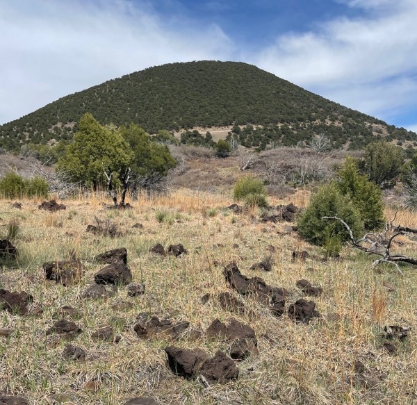
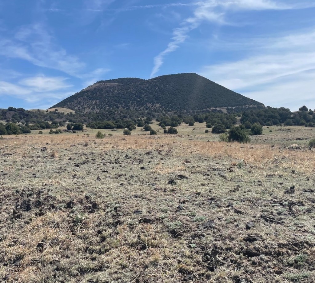
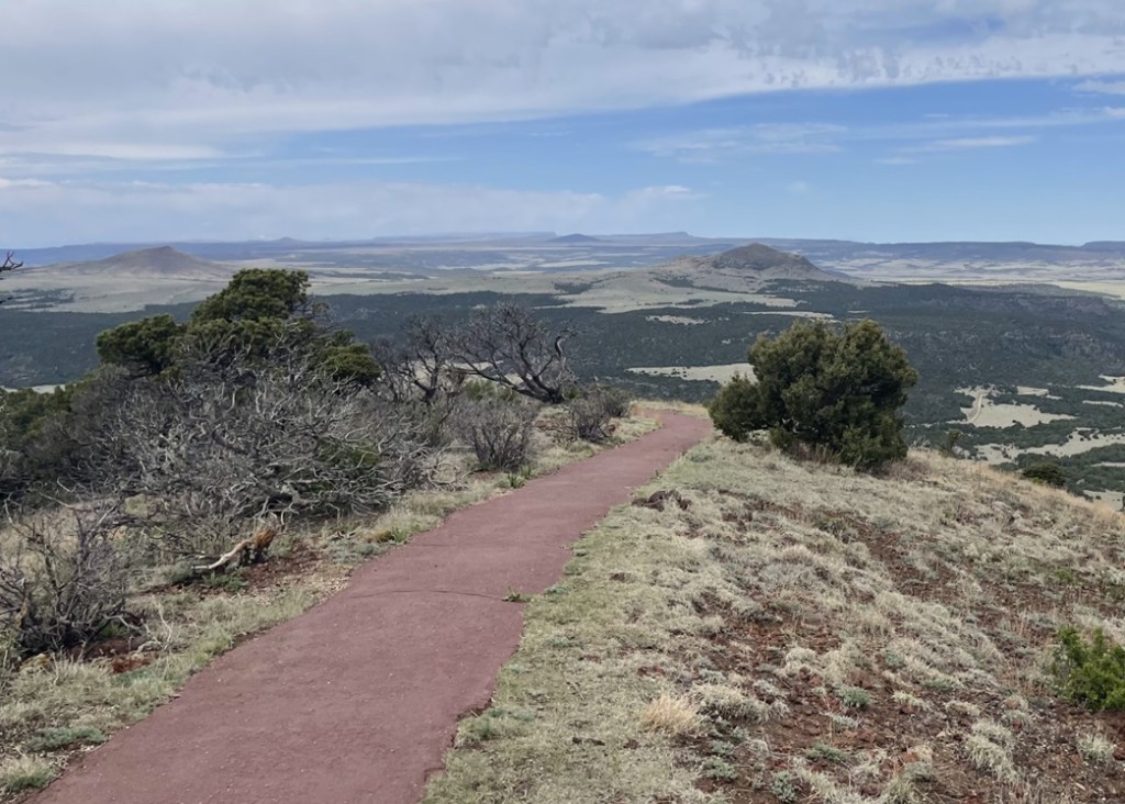
The cinder cone of Capulin Volcano rises almost 1,300 feet – about the height of New York City’s Empire State Building – above the northeastern New Mexico plains . The crater’s rim measures about a mile in circumference, and the crater itself drops 400 feet below the rim. The highest point on the volcano is 8,142 feet above sea level, and standing at different points on that rim affords views not only of a goodly part of New Mexico, but of Colorado, Oklahoma, and Texas as well (they all kind of look the same, to be honest – someone should probably repaint the states’ borderlines).
Erupting about 60,000 years ago, Capulin is the youngest large volcano in the Raton-Clayton Volcanic Field. Geologists consider Capulin extinct, but the rest of the field is considered only dormant and the potential exists for additional volcanic activity in the future. Considering, however, that Capulin erupted that long ago, it’s unlikely that we’ll see anything happening anytime soon.
Capulin Volcano National Monument: By The Numbers
Date established as a national monument
August 9, 1916
Total area
793 acres (1.25 square miles)
Yearly visitors
67,000
Highest point
8,142 feet (top of cinder cone)
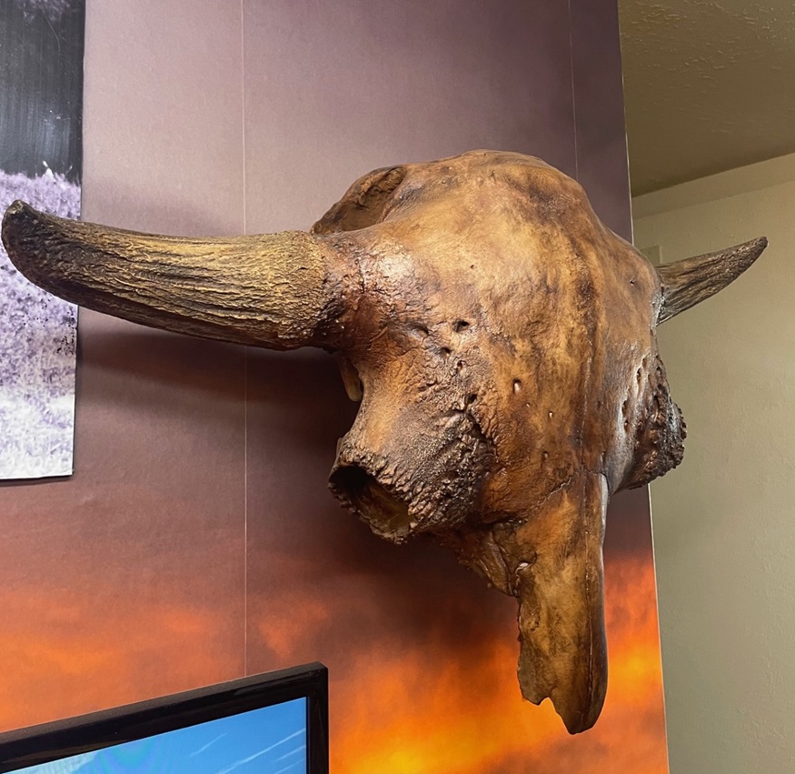
The monument has a very fine visitor center with a number of interesting displays that explain the geological, biological, and cultural history of the area. This is a recreation of the skull of a Bison antiquus, which lived in the region about 10,000 years ago during the Pleistocene Epoch . They were about 30 percent larger than modern-day bison (and I don’t know how close you’ve been to a bison, but they’re pretty good-sized themselves; bulls regularly weigh more than 2,000 pounds). Fossilized bones from Bison antiquus were first discovered in 1908 by George McJunkin, a former Black slave who became a bronco-busting and bilingual ranch hand in New Mexico. That find would become one of the most important archeological discoveries in the nation’s history. McJunkin was inspecting pasture conditions following a torrential rainstorm when he happened upon the fossils. He knew he’d discovered something important, but couldn’t get any experts interested in the discovery and he died in 1922 without realizing exactly what he’d found. In 1927, an expedition from the Denver Museum of Natural History (now Denver Museum of Nature and Science) found, in the same area, fossils of the same species. However, those newly discovered fossils had projectile points embedded in them, which proved that humans lived in this area during the Ice Age – about 7,000 years earlier than first believed. The projectile points and the native American culture that used them were named after the New Mexico town near where they were discovered: Folsom, which is about six miles north of Capulin Volcano National Monument.Located where the northeastern New Mexico grasslands meet the Sangre De Cristo mountain range, Capulin Volcano National Monument provides habitat for a wide variety of wildlife. Spotted towhees (Pipilo maculatus) were by far the most plentiful birds we saw while visiting Capulin, but the national monument is home, either year-round or for migratory stopovers, to more than 70 bird species. Spotted towhees are more commonly seen on the ground, scratching through leaf litter in search of insects, but in the springtime males especially will make their way to the tops of shrubs to let loose with their pretty call. This fellow was hanging out near the parking lot on the crater’s rim.
After enjoying the visitor center, Nancy and I drove the Goddard’s six-wheeled towing unit up a road that spirals around and up the Capulin cinder cone. It’s an interesting drive that brought us to a small-ish parking lot at the top of the crater, with a trailhead for the one-mile Crater Rim loop. The easy hike provides great views of the Raton-Clayton Volcanic Field, and many of its geologic features.
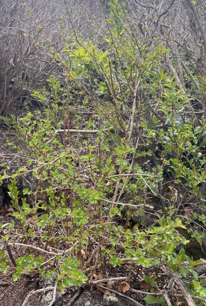
During its 10-year-long eruption history, Capulin ejected volcanic ash as well as small gravel-sized cinders and larger rocks, called bombs, thousands of feet into the sky. In all, the ejected material covered almost 16 square miles of what is now New Mexico. The cinders, which measure 2-64 millimeters in size, built the majority of the cone’s structure by falling back to earth and piling up around the eruption site. Volcanic bombs measure in excess of 64 millimeters (2.5 inches). Upon its return to the ground, this bomb, roughly the size of a car engine block, landed on the rim of the crater. This spot, then, would have been a good one to avoid at the time. The western side of the rim (where the parking lot is located) is about 300 feet lower than the opposite side; the scientists believe that’s due to wind gusts picking up cinders and then dropping them while Capulin was erupting. The Goddard’s six-wheeled towing unit can be seen on the right side of the parking lot on the other side of the rim. On the left side of the photo, on the farthest horizon, you can see the snow-capped Spanish Peaks, located a few miles west of Walsenburg, Colorado. We’d move the Goddard to camp at Lathrop State Park, very close to the Spanish Peaks, following our stay in Raton. This is a variety of chokecherry (Prunus virginiana), a large shrub or short tree that was formerly found all over the volcano but now grows primarily in the crater. It blooms between April and June, and its fruit is used for jellies and teas. Spanish-speaking ranchers who settled in this area called it by its Spanish name, “capulin.”Viewed here looking southeast from the rim of Capulin, Sierra Grande (elev. 8,720 ft.) is the only shield volcano as well as the largest volcano in the Raton-Clayton Volcanic Field. Rather than an eruption of ash, cinders, and lava rocks, the mountain was made over the course of many fluid lava flows from 3.8 to 2.6 million years ago. The panhandle of Oklahoma is about 50 miles east of Sierra Grande (to the left in this image). The ripples in the land between Sierra Grande and Capulin are called pressure ridges; they’re formed when flowing lava on the surface begins to cool while hotter lava continues to move underneath the hardened rock.From 1821 until 1880, the Santa Fe Trail connected Independence, Missouri, with Santa Fe, New Mexico. Traders, settlers, and the military used the trail to move through what was then the homeland of several different native American cultures, including the Comanche, Cheyenne, and Jicarilla Apache. This is looking east from the top of Capulin; the dark streak on the horizon on the left side of the image is Black Mesa, Oklahoma, about 80 miles from the volcano. When travelers heading west on the Santa Fe Trail saw geologic features like Black Mesa or Capulin, they knew they were approaching their destination in northern New Mexico and their journey across the Great Plains was nearing an end.This pretty yellow flower, prairie thermopsis (Thermopsis rhombifolia), was growing next to the Rim Trail on Capulin. It is one of the first flowers to blossom in the national monument each spring.
Charles Goodnight and Oliver Loving, two Texas cattlemen, wintered their herds near Capulin Volcano in the 1860s while driving cattle from Texas to Colorado and Wyoming. More than a quarter million head of cattle found their way north over the Goodnight-Loving Trail. The outstanding novel “Lonesome Dove,” by Larry McMurtry, which was adapted into a very good miniseries, was inspired by the development of Goodnight-Loving, the greatest of the western cattle trails..
This is looking north from the rim of Capulin. Folsom was once a robust town with many businesses and a railroad, but a flood on August 27, 1908, destroyed most of the community’s buildings. That damage, however, was why George McJunkin was out inspecting pastures in the area and came upon the unusually large fossilized bison bones that would upend American archeological thought. Baby Capulin (elev. 6.870 ft) is another cinder cone that was probably formed from the same magma chamber as Capulin Volcano, but perhaps 10,000 years later. A violent meeting of magma and groundwater resulted in the creation of Mud Hill, the structure topped with a crescent of evergreen trees just this side of Baby Capulin. The horizon in this photo is in the state of Colorado, the border of which is about 20 miles away.Each of the hills, mesas, and mountains in this view looking northwest from the Rim Trail on Capulin is the result of volcanic activity. Beginning with the first eruptions about 9 million years ago, magma from the eruptions flowed down valleys and then hardened as it cooled. Over the ensuing millions of years, the pre-existing sedimentary rock eroded away, through the action of water and wind, much faster than the harder volcanic rock, leaving behind the exposed buttes and mesas of the Raton-Clayton Volcanic Field.
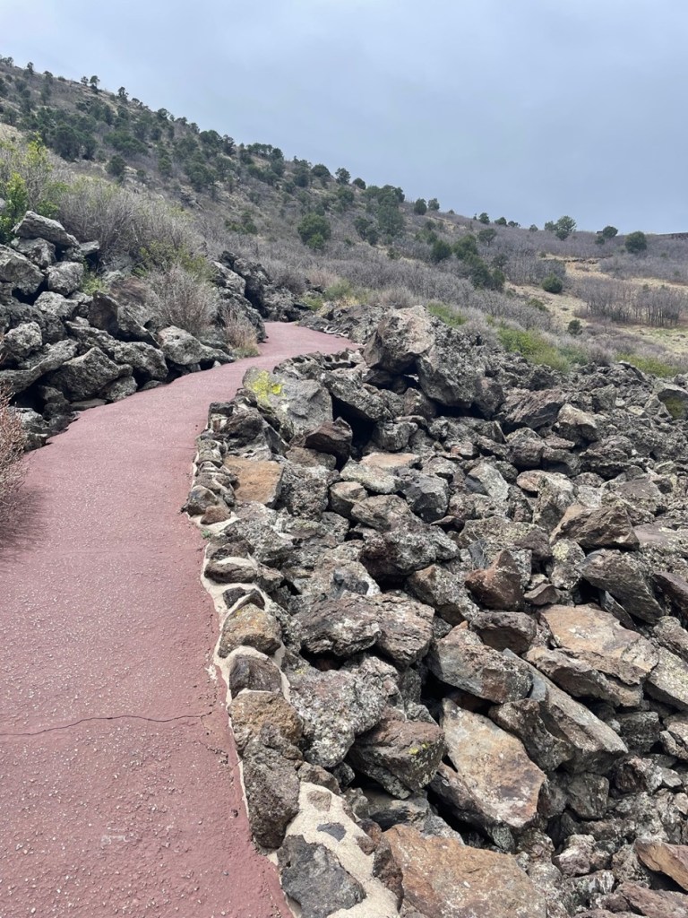
Upon returning to the rim’s parking lot, Nancy and I decided to take a picnic lunch into the bottom of the crater. It’s a very pleasant hike as well, with many interesting rock formations and chances to see additional wildlife.
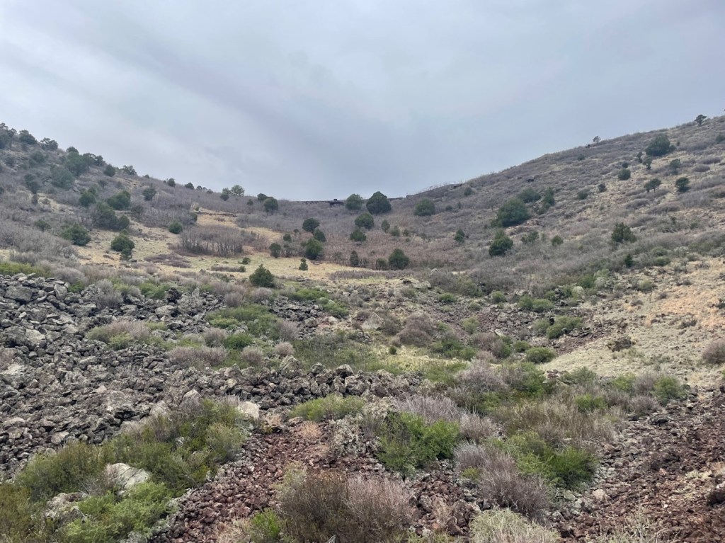
If you’re into basalt, you could do worse than enter the crater of Capulin Volcano. This picture was taken near the vent of the volcano, at the bottom of the crater.This image was taken at the lowest part of the Capulin crater. The rim parking lot is just over the crater’s far side.When we were hiking on the rim trail, we saw what were clearly six or eight mule deer, along with some lighter-colored animals, down in the crater. We thought the other animals were perhaps desert mountain sheep. During our lunch inside the crater, however, we discovered, upon being much closer to them, that the lighter-colored animals were also mule deer – they are the lightest-colored deer I’ve ever seen. A ranger at the visitor center (yes, we went back with questions after lunch) said that several years ago, a blond-colored mule deer showed up in the national monument. It must have some strong DNA. A Spanish-speaking family happened to be at the bottom of the crater at the same time as us, and I asked them what the Spanish words for mule deer are; they replied, “venado bura.” ¡Ese es un venado bura muy rubio!Following our lunch in the bottom of the crater and our fact-finding mission back to the visitor center, Nancy and I went on a third hike at the foot of Capulin. You can see the start of the road that spirals up the side of the volcano, along with a few of the tens of thousands of volcanic bombs that erupted from Capulin.
We’d been to Capulin Volcano National Monument before, but we can’t remember when – it was at least 15 years ago and probably more. Nancy and I did agree, however, that we got much, much more out of our visit in 2024, but we don’t know why. It’s not like we were desperate for volcanos; we’d seen plenty in the summer and fall of 2023, and the spring of 2024, in Idaho and western New Mexico. I wonder if those experiences, along with visiting other national parks and monuments that don’t happen to feature volcanos, helped us appreciate Capulin all the more. It’s a great, great national monument, filled with opportunities to learn about our planet’s violent past as well as see some really beautiful plants and animals.. Raton, New Mexico, is less than five hours directly south of Denver, Colorado, via Interstate 25, and then Capulin is about half an hour from Raton.
Craters of the Moon National Monument, located midway between Twin Falls and Idaho Falls in the south-central part of Idaho, is one of those National Park Service sites that you kind of have to want to get to. The monument and its associated preserve receive only about 220,000 visitors each year; for comparison’s sake, Rocky Mountain National Park northwest of Denver receives more than 4 million visitors annually. Craters of the Moon is not on any Interstate highways, and it’s about 90 miles from Twin Falls and more than a two-hour drive from Idaho Falls. I imagine many of its visitors are on their way to or from Yellowstone National Park, which gets about 3.3 million visitors each year.
Thousands of years ago, these rocks were part of a slow-moving river of magma. Craters of the Moon National Monument doesn’t have especially tall volcanoes – it has about 20 cinder cones that top out at about 700 feet in height – but it does have immense flows of basalt resulting from lava that escaped through fissures in the earth. As they cooled, the magma flows hardened into these beautiful rock structures.
Still, it’s a unique and beautiful place that clearly shows that the area was the site of tremendous volcanic activity in the planet’s relatively recent past. We parked the Goddard in Arco, Idaho, about an hour’s drive northeast of Craters of the Moon and visited the monument not once but twice in a week. Why? Lava! And cave-like geologic structures!
The year 2024 marks the hundredth year since the establishment of the monument. The monument and preserve protects 753,000 acres (about 1,200 square miles) of south-central Idaho for visitors to experience what it could be like to walk on another world. The scientists have dated some of the lava flows and have determined that the area experienced an extended period of geologic activity – and one that was quite recent, geologically speaking. The oldest lava flows yet recorded are from eruptions 15,000 years ago, and the most recent flows occurred just 2,100 years ago.
Our first impression of the national monument: everything is black, due to the miles and miles of basalt that’s all around. It’s really difficult for plant life to establish itself in relatively new basaltic soil; total vegetation coverage on the entire monument is less than 15 percent, and on cinder cones like this it’s only 5 percent. Here we see an intrepid hiker (it’s Nancy) making her way up the slope of Inferno Cone, a tall cinder cone in the monument. Cinder cones are the most common type of volcanic structure on Earth. The lava emissions at what is now Craters of the Moon were less explosive than many other eruptions around the world, so the slopes of the cinder cones are gentler. It’s a little less than a half-mile to the top of the cone, from which one can see 360 degrees all around Idaho (and on especially clear days even the peaks of the Teton Range, 100 miles away in western Wyoming, can be spotted). The sun, pictured in the upper right of this image, is no joke: its rays can heat the black basalt to temperatures of 150 degrees. Winters can be harsh as well, with plenty of snow and frigid temperatures.
Craters of the Moon contains the largest lava field in what is known as the Great Rift, a 53-mile-long fissure in Idaho running from the southeast to the northwest. The relatively quiet (as quiet as a volcanic eruption can be, anyway) release of gas and magma created these lava flows over a period of many thousands of years. This part of Idaho has several other such lava fields and the soil that has resulted from those older flows results in regions famed for growing fine potatoes. (There were a couple of grocery stores in Idaho in which the smallest baking potatoes weighed a pound.)
In time, the soil in the national monument may break down enough (through the work of erosional forces like wind, water, and plant growth) to allow more plants to survive. Until then, it’s pretty desolate but in a beautiful way, and any potato harvests in this particular part of Idaho will be many years in the future. Incidentally, it’s believed that the caldera underneath Yellowstone National Park, which is responsible for the geysers, paint pots, and other hydrothermal features there (and possibly a mass extinction event if it erupts while humankind is still around), is connected to the hotspot that created Idaho’s lava fields. Over millions of years, the North American Plate has been moving slowly while the hotspot heats up the landform currently over it: 10 or 11 million years ago, that hotspot was underneath what is now Craters of the Moon National Monument.
In order to survive, plants and animals have to be extraordinarily adapted to make it in both extreme heat and cold. This is dwarf buckwheat (Eriogonum ovalifolium), a plant only four inches tall that can boast a root system up to three feet in diameter. That root system works to get as much moisture to the rest of the plant as it can, and this plant is so efficient at doing so that plants can’t survive within about three feet of each other – they wind up being so evenly spaced that they appear to have been hand-planted. Additionally, the plants light-colored leaves reflect, rather than absorb, the sun’s rays. Note the texture of the black basaltic soil.
Craters of the Moon was established and named as a national monument almost 50 years before NASA put astronauts on Earth’s actual moon, so it wasn’t until the very late 1960s and early 1970s that it was discovered that the moon’s surface isn’t anything like southern Idaho. The moon has been shaped by impacts of meteorites rather than volcanic eruptions. But the national monument did serve as an ideal training ground for astronauts so they could practice selecting rock samples in an unfamiliar environment.
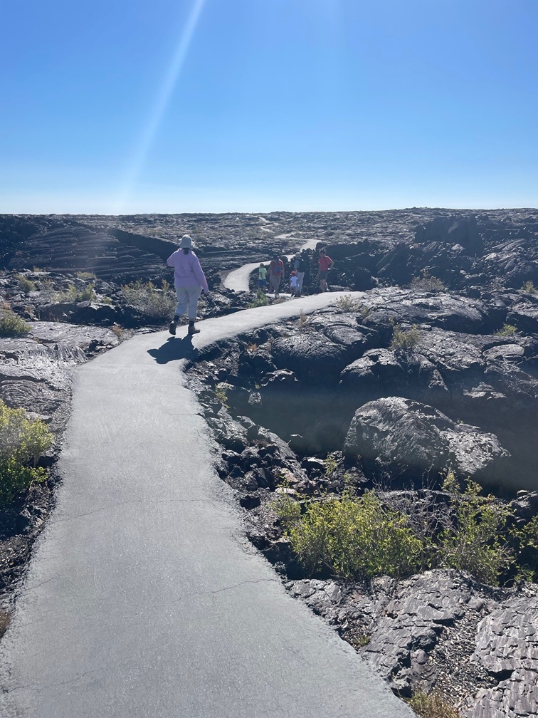
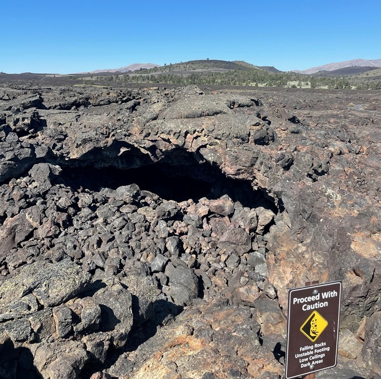
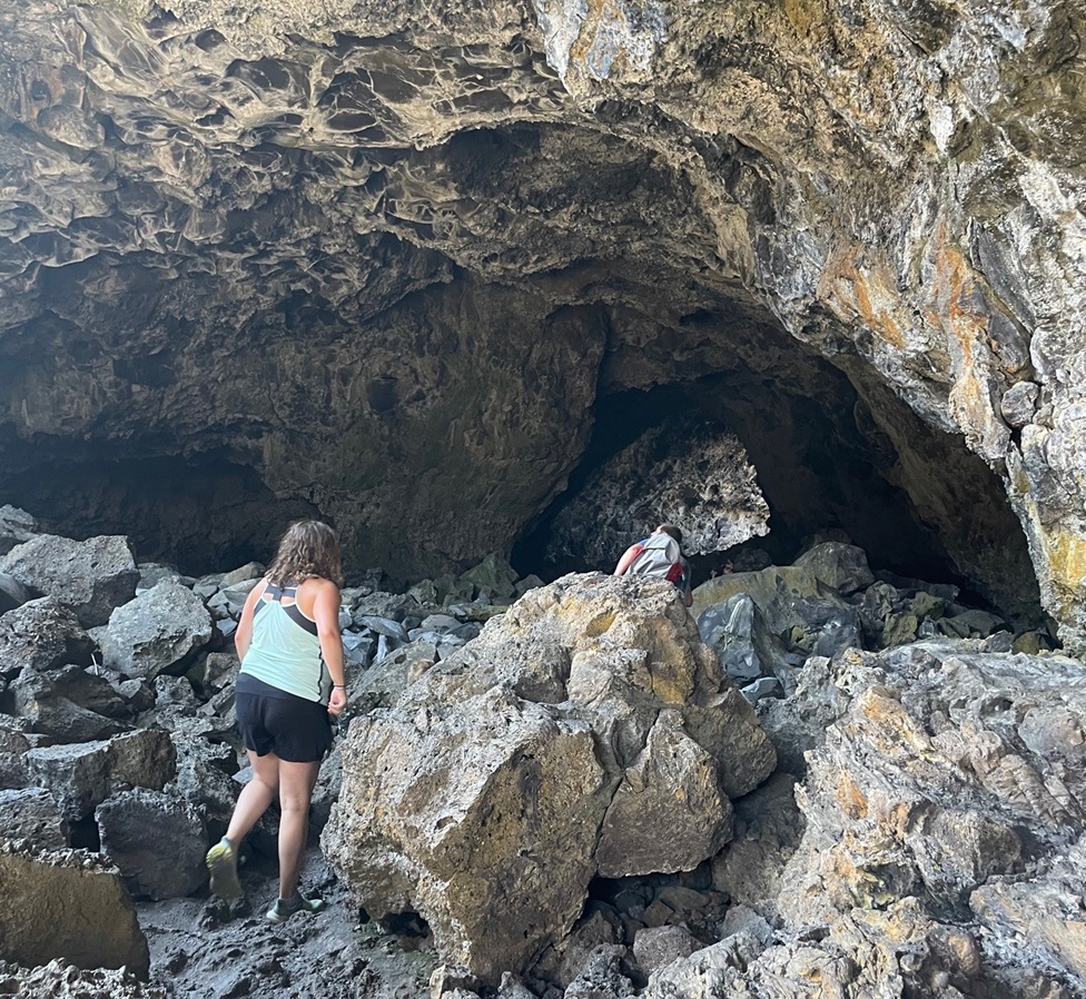
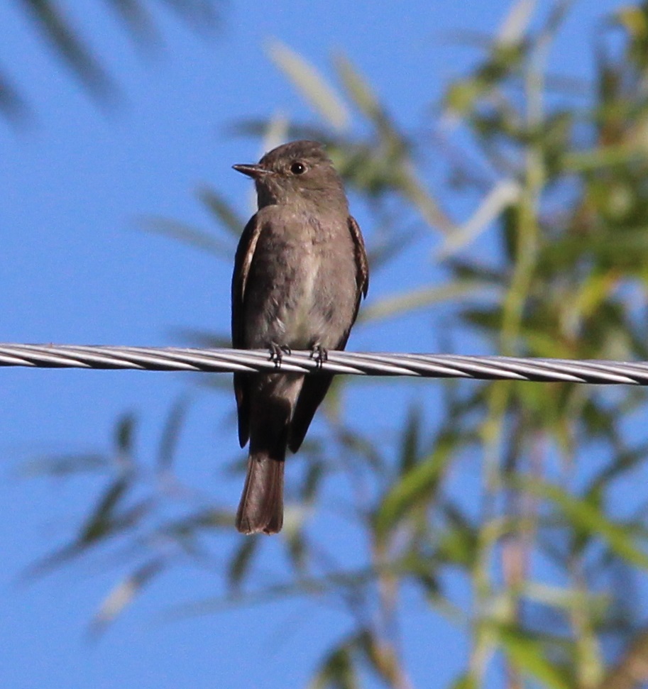
While we hiked up Inferno Cone, we saw a few turkey vultures (Cathartes aura) circling in the beautiful blue sky and perching in this dead limber pine tree. I took several pictures of this bunch, but they apparently had more important things to look at than me and they never turned around. These birds can have wingspans of up to six feet in length. Turkey vultures aren’t the most attractive representatives of the avian world, but their diet of nearly exclusively carrion is essential to preserving the natural order of things.This is known as a spatter cone, formed when jets of lava spout vertically from the earth – for scale, that’s a person on the trail in the shadow of the cone. The monument and preserve contains about 25 cones of the spatter and cinder (such as Inferno Cinder) varieties.We happily joined a ranger-led hike to some lava tubes. We’d seen lava tubes in Hawaii many years ago, and were more than a little surprised to see them again in Idaho. This was a pretty nifty asphalt trail that wound through the basalt formations and led to the tube structures.Here is the opening to a lava tube that we didn’t enter, and you can probably see why we didn’t. The jumble of large rocks near the opening are the result of the overlying rock atop the tube collapsing into the void and down to the ground. This lava traveled 18 miles from its source, the spatter cones pictured above.Here’s the lava tube that we did enter. It was a really impressive cave-like structure, formed when a river of lava continues to flow underneath a layer of magma that has already hardened on top of it. When the supply of lava is cut off, the opening through which the lava flowed remains to form these interesting structures. The empty spaces are home to bats, just like a cave. We didn’t see any bats, but I did capture a photo of a rock pigeon in the lava tube. You know what a rock pigeon looks like, so I won’t post it. It was kind of neat to see a species of bird that’s common on big-city streets in a lava tube in very rural Idaho, though.While the first day we visited the national monument was clear with blue skies, the second day was mostly overcast and chilly. On a short hike around the lava flows, we saw several of these birds performing some impressive aerobatic maneuvers, presumably catching insects in flight. We couldn’t tell what kind of birds they were until this one landed in a tree. It’s a nighthawk, of which there are several species in North America. I don’t know which particular one this is (I’m guessing it’s a common nighthawk), but we were pretty excited to see it – we’d never seen a nighthawk before. They’re a mostly nocturnal species, so maybe the cloud cover was enough to make them active during the day.One of the hiking trails we enjoyed led to this impression of trees that were growing thousands of years ago and then were downed in the flowing magma, leaving behind these distinct patterns of bark growth in the basalt.I didn’t take this photo at the national monument, but rather at the campground in Arco where the Goddard was parked. I’m including it because it was another new-to-us bird, a plain-looking little fellow with the splendid name of western wood-pewee (Contopus sordidulus). They are about six inches long, weigh just a half-ounce, and have a wingspan of about 10 inches. Like other birds in the flycatcher family, this species is particularly skilled at snagging insects in flight.
Craters of the Moon National Monument has a lot going for it, and we were fortunate to be able to include it in our summer 2023 itinerary. We saw plenty of other places with lava flows both (relatively) new and old in Idaho – we spent more than two months in the southern and southeastern part of the state – but it was fun to be able to walk across the basalt and wonder what the environment must have looked like when the lava was flowing. Interestingly, the volcanic features at Craters of the Moon are believed to be only dormant – not extinct – and geologists expect the region to become active once again within the next thousand years, and some believe it could be within the coming century.