The ABQ BioPark includes the city’s Botanic Garden, Aquarium, and Zoo. The first two attractions are next to each other, just a short distance from the Old Town Plaza of Albuquerque. We visited the Botanic Garden on Nov. 14 and had a lovely time. We’ve been to a couple of other botanic gardens in the American Southwest (Tucson and Phoenix), and Albuquerque’s is definitely a jewel – even though our visit was during the offseason when there were very few flowering plants.
A number of structures, representing plants, animals, and holiday decorations, for the garden’s holiday light display were already out, although the nightly display didn’t start for another week or two. Still, it was pretty neat to see the structures close up and ready to go.
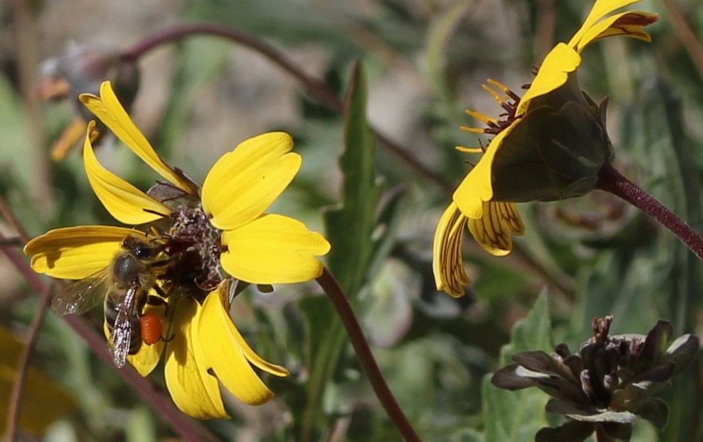
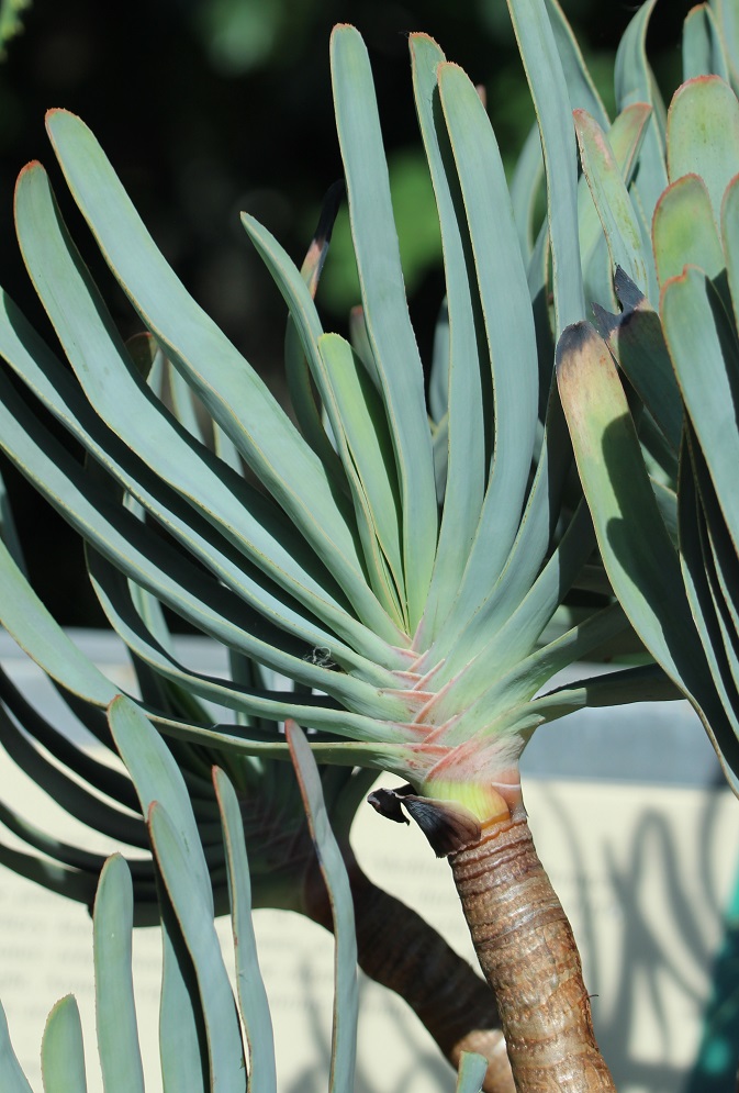
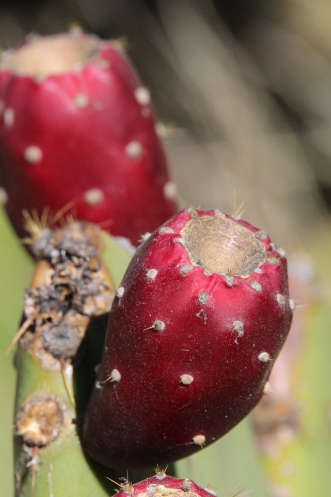
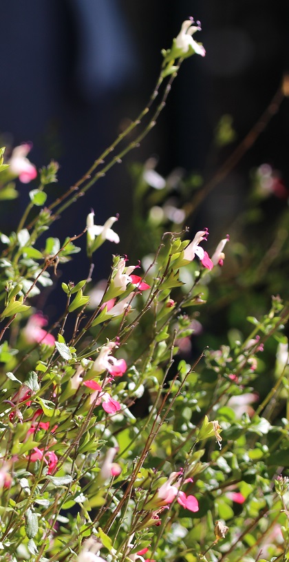
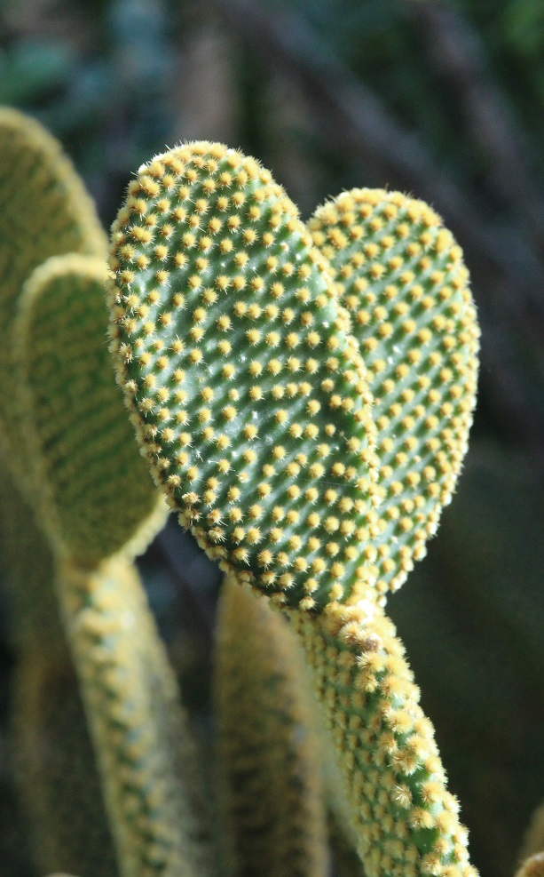
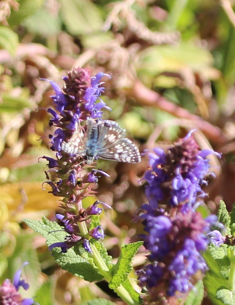
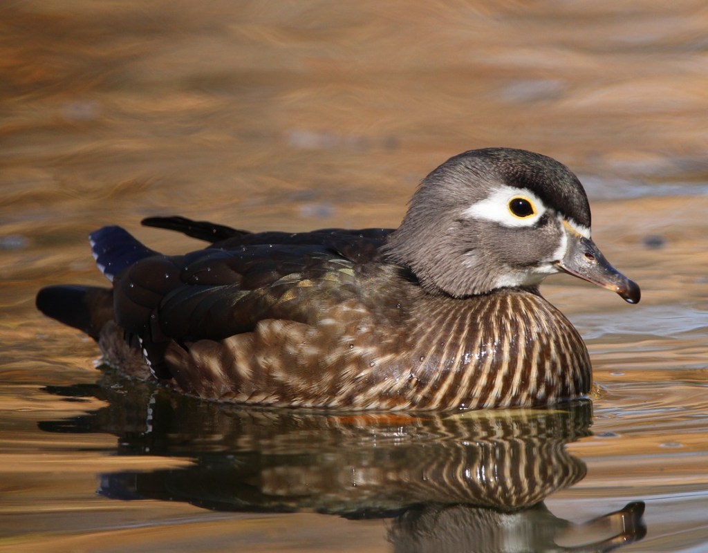
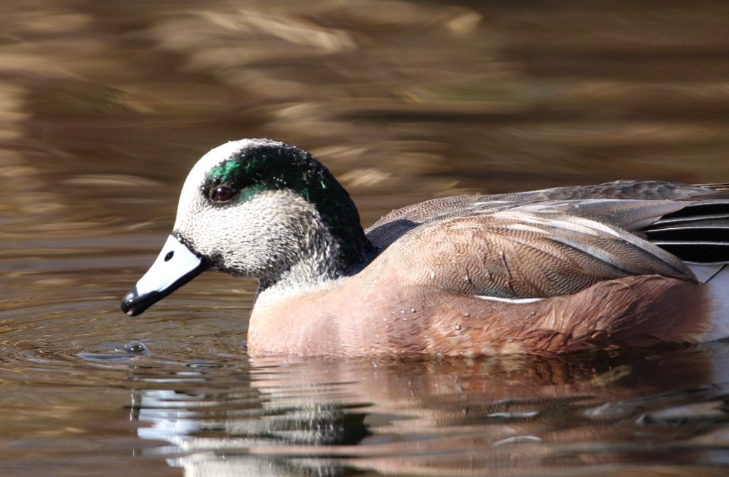
Although it was mid-November, there were still a few plants in bloom like this Chocolate Flower (Berlandiera lyrata) hosting a bee that, judging from the amount of pollen on its legs, had already been very busy that morning.This fan aloe (Kumara plicatilis) is a native of South Africa. It’s one of many eye-catching succulent plants that were on display in a couple of different buildings at the garden.The fruit of the Texas prickly pear (Opuntia engelmannii) makes for good eating by animals and humans alike. When we were on a guided tour of Old Town Albuquerque the previous weekend, one of our fellow tourists (who was apparently not from the United States) picked one of these off the host cactus with his bare hand. He regretted that decision.This was another outside plant that was in full bloom and attracting bees – it’s Autumn Sage (Salvia greggii).This distinctive cactus was potted inside a building. It’s Opuntia microdasys, or bunny ears, and it’s native to Mexico.The thing I love most about going to botanic gardens is seeing all of the different wildlife that enjoy the plants as well. This is a common checkered-skipper (Pyrgus communis) pollinating a woodland sage (Salvia nemorosa) plant. These butterflies are found from Canada all the way into Mexico. The photo’s blurry, but the butterfly wasn’t being very cooperative in holding still.In the very pretty Japanese garden area, the Nanking cherry trees (Prunus tomentosa) were full of fruit. These are enjoyed by birds and humans too; they’re more closely related to plums than to true cherries.By the time you hear the wingflaps, it’s already too late. Much as we did the day before at Rio Grande Visitor Center State Park, we heard a lot of sandhill cranes flying overhead. These were low enough to photograph.I saw my first-ever wood duck at the state park on Saturday but didn’t get a decent photo. There were plenty of wood ducks in one of the Botanic Garden’s ponds. They’re remarkably beautiful birds. This is a hen and drake pair.As incredibly gaudy as the drakes are, the wood duck hens are very attractive as well. This little lady seems to have a contented smile.Wood duck drakes are just amazingly beautiful, but they look like they were put together by several different committees of very talented artists who didn’t communicate very well in the design process.Here’s another bird that was new to me: the American wigeon. They are found throughout North America except the furthest reaches of northern Canada. This is a drake …… and here’s a hen. The very pretty light blue bill of the wigeon shows up better in this photo. She’s on the move to someplace that must be very important to be.Here’s another new-to-me bird: the black phoebe (Sayornis nigricans). They’re about six inches tall and the males and females have the same coloration. Black phoebes are found in the southwestern United States, and central New Mexico is about as far north as they go. This one was hanging out on a sculpture in the pond, keeping an eye out for flying bugs.I’ll close this posting with yet another photo of a wood duck. The lighting’s no good on it (although the mahogany color at the base of the tail is very pretty), but I really like that the duck is looking up – I don’t see ducks doing that very often. You may well wonder what this one was looking up at, so I may as well tell you: the duck was looking up at a little boy named Owen. How did we know the duck was looking up at Owen? Because Owen was standing behind a fence over the pond, tossing dried leaves to the ducks. How did we know the boy’s name was Owen? Because we heard his name being called about 300 times by his little friends. We hope that Owen and his friends slept well that night, because we know they had a very active day at the ABQ BioPark Botanic Garden.
On Saturday, Nov. 13, we drove a few miles from our campground to Rio Grande Nature Center State Park in Albuquerque. It’s located on the west side of the city, along the Rio Grande River. More than 300 species of birds have been seen in the park, although only about 60 can be observed year-round. The Rio Grande starts in the San Juan mountains of southern Colorado and flows through the San Luis Valley before turning southward to roughly bisect the state of New Mexico. It splits the cities of El Paso, Texas, and Ciudad Juárez, Mexico, to begin the border between the United States and Mexico. The river is just under 1,900 miles long before emptying into the Gulf of Mexico, but only about 20 percent of the water that enters the river actually reaches the gulf because of irrigation, municipal usage, and storage in reservoirs.
In the arid regions of New Mexico, of course, the river is an invaluable resource for wildlife and human habitations alike. The Albuquerque area receives about 8 3/4 inches of precipitation annually, so the river plays a critical role in making an abundance of life possible. These photos were taken on Saturday perhaps two miles away (as the sandhill crane flies) from the stark desert environment of Petroglyph National Monument that we visited the previous weekend.
Rio Grande Nature Center State Park features a bosque (pr. BOSS-kay), or cottonwood forest. Cottonwoods like this have been growing in the bosque alongside the Rio Grande for a million years. In our travels southward from Denver and attempting to stay just ahead of freezing temperatures at night, we’ve inadvertently happened to time our stays in Lathrop State Park, Las Vegas and Albuquerque, and, where I’m writing from a few miles south of Truth or Consequences, to be just barely after peak color. It’s been wonderful.Sandhill cranes are migrating southward through New Mexico now to spend the winter here, in Texas, and in Mexico. There are hundreds of thousands of cranes in the state – the Bosque del Apache National Wildlife Refuge, just north of Truth or Consequences, could have 10,000 cranes on it right now. This set of three was preparing to land in the Rio Grande on Saturday.This crane is coming in hot for a Rio Grande splashdown. Some subspecies of sandhill cranes have wingspans exceeding seven feet, which allows them to soar efficiently while riding thermals to keep them aloft. We heard many, many more cranes than we saw on Saturday – we think they were just flying too high to discern in the sky.Adult male and female sandhill cranes look alike (both of them have the distinctive red forehead); adult males come in at about 10 pounds and females weigh a pound less, and they can grow to about four and a half feet tall.Juvenile cranes have yet to develop the red forehead, and their plumage has rusty-brown feathers. Sharp-eyed viewers will spy a great blue heron lurking along the bank on the far side of the river.… and here it is, slightly less blurry and strutting upstream. Great blue herons grow to about four and a half feet tall and weigh up to about eight pounds. They live in the American southwest all the year round.
The visitor center at the state park has a couple of ponds that provide for really good waterfowl viewing. I saw many mallard ducks, Canada geese, and was pleasantly surprised to see my first-ever wood duck. The park has some easy walking trails (some allow dogs, and others do not in order to reduce pressure on wildlife) and is a great oasis in the city, with plenty of opportunities for wildlife viewing (I also took some photos of a spotted towhee, but the pictures turned out to be a better representation of the tree limbs he was perched on rather than the bird itself).
We visited the National Museum of Nuclear Science & History in Albuquerque. It’s a museum that had formerly been located on Kirtland Air Force Base, southeast of Albuquerque, but closed on Sept. 11, 2001, and then temporarily relocated to Old Town Albuquerque before opening in a new facility in 2009. It’s a very impressive museum, with many historical exhibits, plenty of room for traveling exhibits, and a great collection of World War II- and Cold War-era aircraft and missiles.
The museum starts with a historical survey of nuclear research, paying homage to the men and women who discovered the incredible power – for constructive as well as destructive purposes – of splitting an atom. There’s a good bit of exhibit space devoted to the United States’ development of the first atomic bomb, including artifacts from the U.S. Army facilities in Los Alamos, New Mexico, and Oak Ridge, Tennessee, where the materiel for the test and actual bombs was created. A short film describing the training of the crews of the Enola Gay and Bockscar, the B-29s that dropped the atomic bombs on Hiroshima and Nagasaki, was really interesting; it had interviews with many of the members of the Enola Gay crew (conducted some years ago) in which they said they viewed the operations as helping to bring a quicker end to hostilities in the Pacific. In the summer of 1945, everyone in the United States and the country’s allies wanted the war to end.
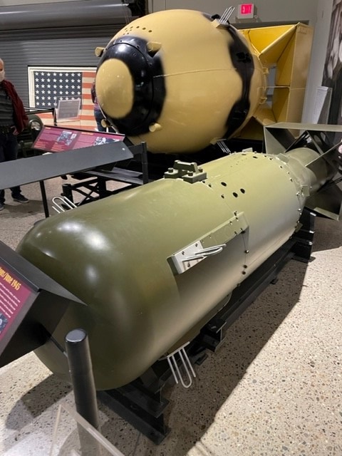
A replica of “The Gadget,” the test atomic weapon that was detonated at the Trinity site in New Mexico (now part of the White Sands Missile Range between Alamogordo and Las Cruces). It was dropped from a 100-foot tower during the operation. The test detonation, and the remarkable destruction that it caused, prompted Robert Oppenheimer, director of the Las Alamos Labratory, to reflect on the phrase “Now I am become Death, Destroyer of Worlds,” which is taken from Hindu scripture.A replica of Little Boy, in front, which was the first atomic weapon deployed in warfare, and Fat Man. Little Boy was dropped on Hiroshima on August 6, 1945, from the B-29 Superfortress Enola Gay, killing about 70,000 people (30% of Hiroshima’s population) and destroying about 75% of the city’s buildings and roads. The B-29 Bockscar deployed Fat Man over Nagasaki on August 9, 1945, killing about 35,000 people. Japan, facing an imminent invasion of the Japanese archipelago, the possibility of additional atomic bombings, and a Soviet intention to begin hostilities, announced its intention to surrender on August 15, and signed the official documents on September 2, 1945, bringing an end to World War II.
It’s not easy, but I think it’s necessary, to learn about all of the destruction caused by these atomic weapons. I was moved to see the atomic bomb replicas, realizing that the actual weapons killed many tens of thousands of civilians but also ended a war that Japan was willing to continue with perhaps many more casualties than even Little Boy and Fat Man caused. The idea of an Allied invasion of Japan’s islands, similar to the D-Day invasion of Europe, had, frankly, never even occurred to me – I had never thought about the fact that there had been plans to invade Japan that were developed because of the necessity to keep the Manhattan Project under wraps even to the majority of the U.S. military. Because Japan was running low on military resources, it’s easy to surmise that the planned invasion would have gone the way of the Allies, just as it’s easy to see the victory would have come at a horrific human cost as well.
This is one of the reasons we enjoy going to museums, I think: the information they display fill in a lot of gaps in knowledge that I didn’t even know we had.
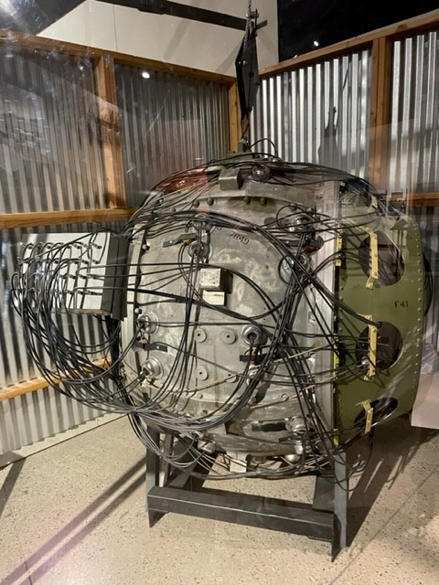
The museum had many Cold War-era artifacts inside its building, including disarmed nuclear missiles (some large, some small) that were placed in readiness in Europe in the years following World War II.
“Writing a Wrong”
There was also a traveling exhibit from the Smithsonian Institution that examined the history of the incarceration of Japanese Americans following the bombing of Pearl Harbor, Hawaii, in December 1945. “Righting a Wrong: Japanese Americans and World War II” displayed many artifacts from some of the 10 incarceration camps and many more smaller facilities in which 75,000 Japanese Americans were detained from March 1942 to March 1946. The families had to sell nearly everything they owned in their households and businesses, and carried only what they could take with them to the camps. Some decades later, the U.S. Congress recognized that the civil rights of these people had been violated and President Ronald Reagan signed the Civil Liberties Act of 1988, which formally apologized, and made restitution, to those who had been incarcerated. Some of the camps, which were all west of the Mississippi River, have been developed into U.S. national historic sites, and I believe an effort is underway to get Camp Amache, which was located in far southeastern Colorado near the Kansas border, national historic site status as well. I don’t remember when I first learned about the incarceration camps, but I do know it was well after I’d graduated from high school. It’s a dark period in American history, to me, and I think it needs all of the light that can possibly be shone on it.
World War II and Cold War Aircraft
The exterior grounds of the Nuclear Museum feature seven aircraft developed to deliver nuclear devices (or protect those that did), the sail from the nuclear submarine James K. Polk, and a large variety of disarmed nuclear missiles and rockets. I thought it was interesting that many of these photos have contrails in their backgrounds from aircraft originating from Kirtland Air Force Base.
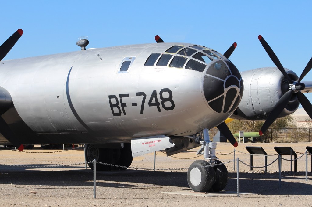
A B-29 Superfortress, which was the model of bomber used to drop nuclear weapons on the Japanese cities of Hiroshima and Nagasaki in August 1945. A replica of the 100-foot tower used to test “The Gadget” at the Trinity test site in New Mexico (see above) is at left.
A B-52 Stratofortress on display. This particular bomber was shielded as protection from possible radioactive activity because of its proximity to nuclear weapons. First flying in 1952, a total of 744 B-52s were produced by Boeing until 1962. About 50 are still in service.I was unfamiliar with this bomber. It’s a B-47 Stratojet, and it was developed to deliver nuclear weapons over the Soviet Union. They had a wingspan of 116 feet and had a top speed of 607 mph (for comparison, a B-29, powered by propellers rather than a jet, had a wingspan of 141 feet and had a top speed of 357 mph). More than 2,000 were produced beginning in 1947, and they were retired by 1977.
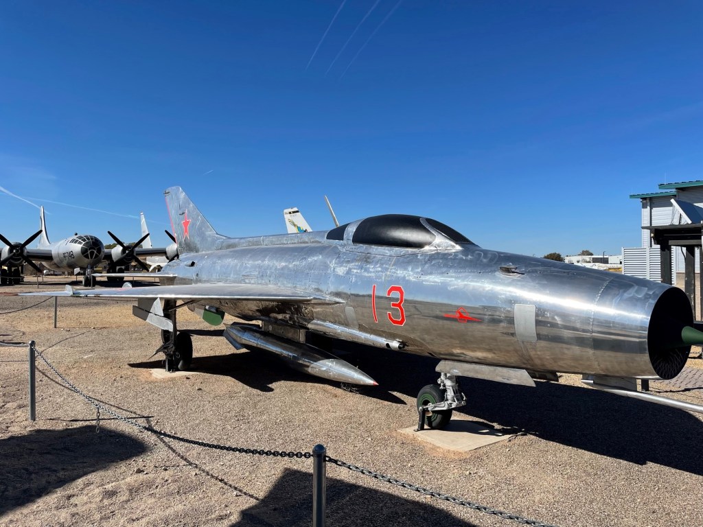
I was very happy to see examples of two of my favorite Cold War-era aircraft: the F-105 Thunderchief and the Soviet MiG-21 (they’re my favorites for no better reason than I just think they look awfully darned cool).
I managed to cut off the inlet cone on the front of this MiG-21 when taking the photo on my iPhone, which is unfortunate. The MiG-21 was developed by the Soviet Union’s Mikoyan-Gurevich Design Bureau in 1955 and is the most-produced supersonic jet in military history; almost 11,500 were built between 1959 and 1985 for more than 60 countries on four continents. This particular one has a B-29 on its six but it’s probably okay because the MiG is capable of a top speed of 1,300 mph.A total of 833 F-105s were produced by Republic Aircraft from 1955-1964, and the last one flew in 1984. It was the primary bombing aircraft of the early years of the Vietnam War. This particular aircraft originated service at Spangdahlem Air Base in West Germany in 1962. That’s the sail of the U.S.S. James K. Polk submarine, launched as a ballistic missile submarine in May 1965 and decommissioned in July 1999, stealthily emerging from the sands of the New Mexico desert to the left of the F-105, an A-7 Corsair II in the immediate background, and the building for the National Museum of Nuclear Science and History is behind the Corsair.
Much of the museum is devoted to the social impacts of living in a world protected and powered, and threatened by, nuclear power: bomb shelters, advances in nuclear medicine, and nuclear power as a source of sustainable energy.
We spent about four hours at the museum, and they were well spent. I learned much more about subjects and events that I was at least aware of, and I learned plenty more about events I knew nothing about. We talked a lot about the enormous amount of money spent on all of these weapons, and of the lives lost in combat as well as in maintaining them, but we recognize and appreciate that they were built to ensure that Little Boy and Fat Man have been the only nuclear weapons used in war.
One of the things I’ve most looked forward to doing in New Mexico, in addition to eating every kind of Mexican food there is and plenty of it, is seeing a roadrunner. I’ve gotten into birdwatching quite a lot in the last several years, and it’s exciting to see a species I haven’t seen before. It’s why I was thrilled to see the western grebe and snow goose at Lathrop State Park last month.
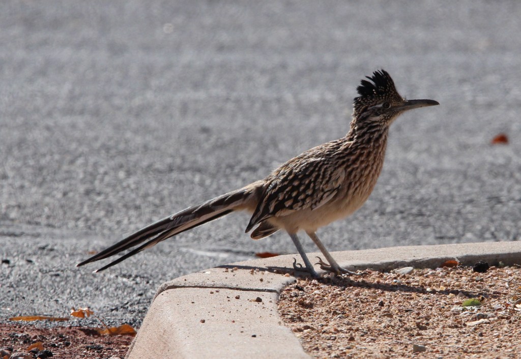
I think there are roadrunners in far southeastern Colorado, and we’ve been in New Mexico and Arizona plenty of times, but I’d never seen a roadrunner until earlier this week. Nancy was working at our dining table in our fifth wheel a couple of mornings ago and said, just out of the blue, “There’s a roadrunner.” There was indeed a roadrunner at an adjacent campsite. I luckily had my camera handy and stepped outside the trailer to take a few photos. They didn’t turn out great (the roadrunner didn’t have the best lighting), but I was still really happy to finally see one. Hopefully we’ll get plenty of more chances to see, and photograph, the New Mexico state bird.
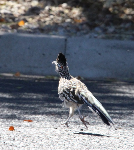
It’s a very pretty bird with great coloration. I was not expecting those savage-looking talons, but I suppose if you’re going to hunt rattlesnakes you want to come ready.A terrible photo, but I like it nonetheless because it depicts a roadrunner running on a road.
Most U.S. states have official state mammals (Colorado’s is the Rocky Mountain bighorn sheep, for instance, and New Mexico’s is the black bear) and official state birds (the lark bunting and greater roadrunner for Colorado and New Mexico, respectively), as well as other official state designations (fish, butterflies, fossils, etc.) Did you know/care that New Mexico is the only state with an official question: “Red or green?” It refers to the what kind of chile you prefer to accompany a meal, red chile or green chile. Red chile, which is commonly made from green chiles that ripen to red and are then dried, is usually hotter than green but that’s not always the case.
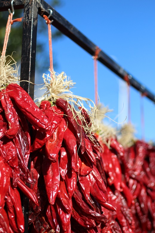
Nancy and I went to the Downtown Growers’ Market in Albuquerque on Saturday, Nov. 6. She got a bag of dried pinto beans (Nancy’s big on beans) and a small bag of chicos, which are dried and lightly smoked kernels of corn that can be added to stews along with the aforementioned frijoles. And when we sit down to a bowl of it, we can also ask each other: red or green?
This ristra, which is basically a bouquet of dried red chiles, and many more like it were on display at the Downtown Growers’ Market in Albuquerque. When southwestern cooks need to add a bit of heat to what they’re making, they break a chile or two off of the ristra and grind it into la comida.
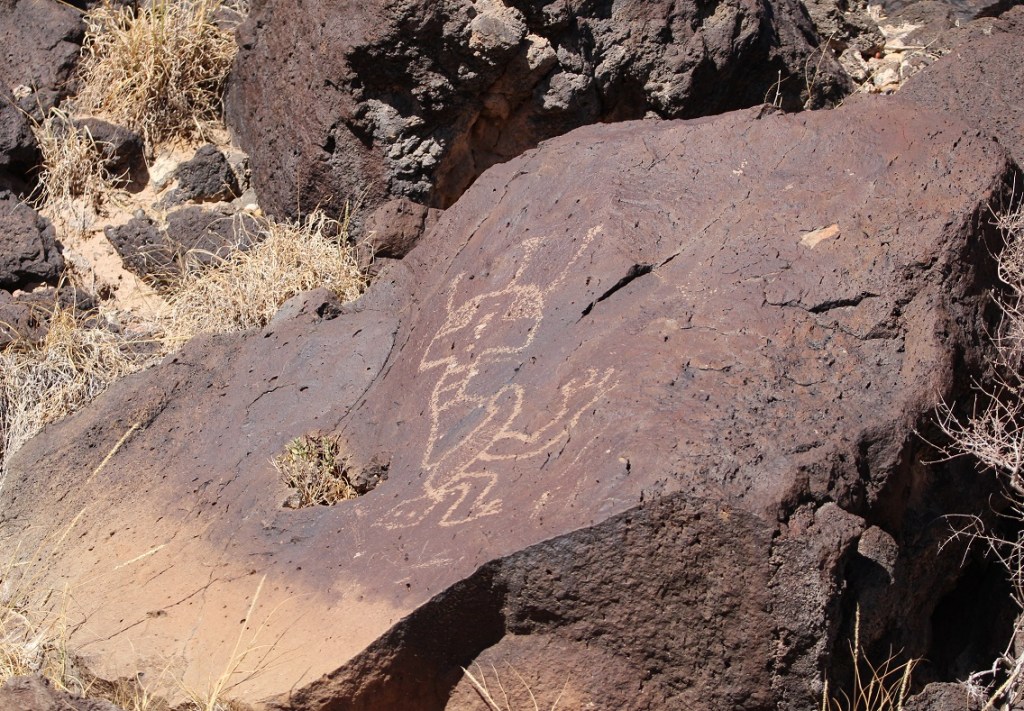
Gunther, Nancy, and Ken went for a very interesting hike on Sunday, Nov. 7, at Petroglyph National Monument on the west side of Albuquerque. It’s about six or seven miles away from the campground at which we’re staying, and a couple of the trails there allow dogs. The Rinconada Canyon trail, about two and half miles long, has several hundred of images like this carved into the rocks. Not all of them are visible from the trail, and some disappear and reappear depending on the angle of the sun.
The canyon and surrounding area are covered with fairly large basaltic rocks from volcanic eruptions that occurred a couple hundred thousand years ago. The rocks contain a lot of metallic minerals such as iron and manganese, and, when exposed to water and sun over the millennia, the rocks turn nearly black. The people who lived in this region used tools to carve abstract designs as well as depictions of animals and people into the basalt. Although some of the petroglyphs in the monument are 3,000 years old, most date from between A.D. 1300 and A.D. 1700. The people who carved them didn’t live in what is now the monument; they lived closer to the Rio Grande river that flows through present-day Albuquerque, five or six miles away.
This is obviously a bird of some kind. It’s about a foot wide.
This one is pretty wild. Although it looks like a piece of modern art, a sign on the trail stated that it’s been dated to have been carved around the same time as the other petroglyphs. It really makes one wonder what was going on in the carver’s mind. It’s maybe 18 inches tall.This rock has what appears to be a carving of a mule deer on the bottom, and some other kind of quadruped in the top left.Unless you’re next to the Rio Grande, central New Mexico is definitely a desert environment. Although it was a very pretty day in early November, we both decided we wouldn’t have wanted to be on the trail in July or August. I don’t know nearly enough about cacti to be able to say what this is, but we knew enough to stay well away from it.
It was a very pleasant hike, and Nancy and I learned a lot. Standing on the sandy trail, it was pretty easy to picture the people using stone tools to carve the designs and wonder what their day-to-day lives were like. The petroglyphs are an extraordinarily significant cultural resource to native and Mexican cultures, and the National Park Service and the City of Albuquerque are making great efforts to preserve the area and the petroglyphs. The NPS website, recognizing the cultural sensitivities involved with the carvings, doesn’t include photographs representing the human figure on its online pages.
Many readers of this site will be aware of the elevation of Colorado’s capital city, Denver: 5,280 feet above sea level, which gives it the nickname “Mile High City.” Did you know/care that distinction, however, does not make it the highest capital in elevation in the country – nor even the second-highest. The second-highest capital city in the country is Cheyenne, Wyoming, which measures 6,062 feet in elevation. The highest state capital in the nation is Santa Fe, New Mexico, with an elevation of 7,199 feet – nearly 2,000 feet higher than Denver. Santa Fe was founded in 1610, which makes it the oldest state capital as well.
As opposed to Denver and Cheyenne, however, Santa Fe is only the fourth most-populated city (pop. 87,500) in its state, trailing Albuquerque (565,000), Las Cruces (111,000), and Rio Rancho (104,000).
The Goddard passed Santa Fe on Tuesday, Nov. 2, on its way to Albuquerque.
Continue to check in to this site for more Did You Know / Did You Care!
Las Vegas, New Mexico, was the next stop on our journey southward. Las Vegas, established in 1835, was a significant stop on the Santa Fe Trail (Santa Fe itself is about 65 miles away).
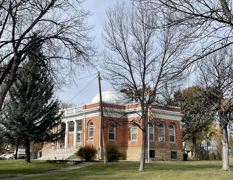
We stayed at the KOA Kampground a few miles south of Las Vegas. We’d camped there a few years ago when we had our small travel trailer and enjoyed it enough then; it was an enjoyable place once again, not the least because of a very tasty breakfast made by the campground hosts on Sunday morning (which happened to be Halloween). Later that very same day, Nancy and Gunther and Ken drove into Las Vegas proper for a bit of a self-guided tour. A Carnegie Library, built in either 1903 or 1904 (sources differ, but quietly so), occupies the center of a very pleasant grassy and tree-filled block in the middle of the city.
Carnegie Libraries were funded by the 19th century philanthropist Andrew Carnegie, who donated $40 million to build nearly 1,700 libraries between 1886 and 1917. Aspects of the library in Las Vegas, NM, recall Thomas Jefferson’s home, Monticello.
Many of the trees surrounding the library are identified by species with signage, but we visited too late in the year to see most of the trees leafed out. Still, it was a very pleasant day and we decided to walk around the block to see some of the historic houses near the library.
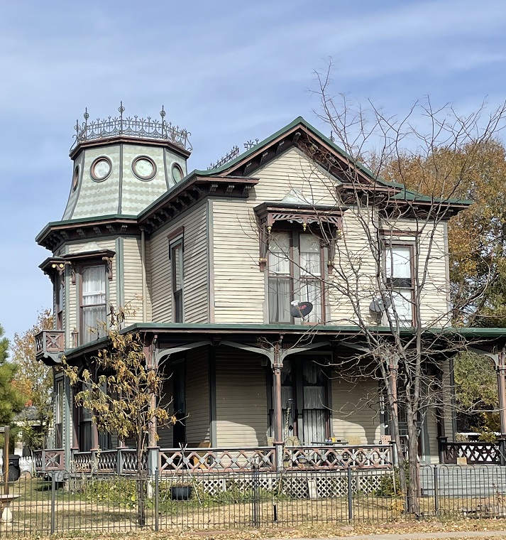
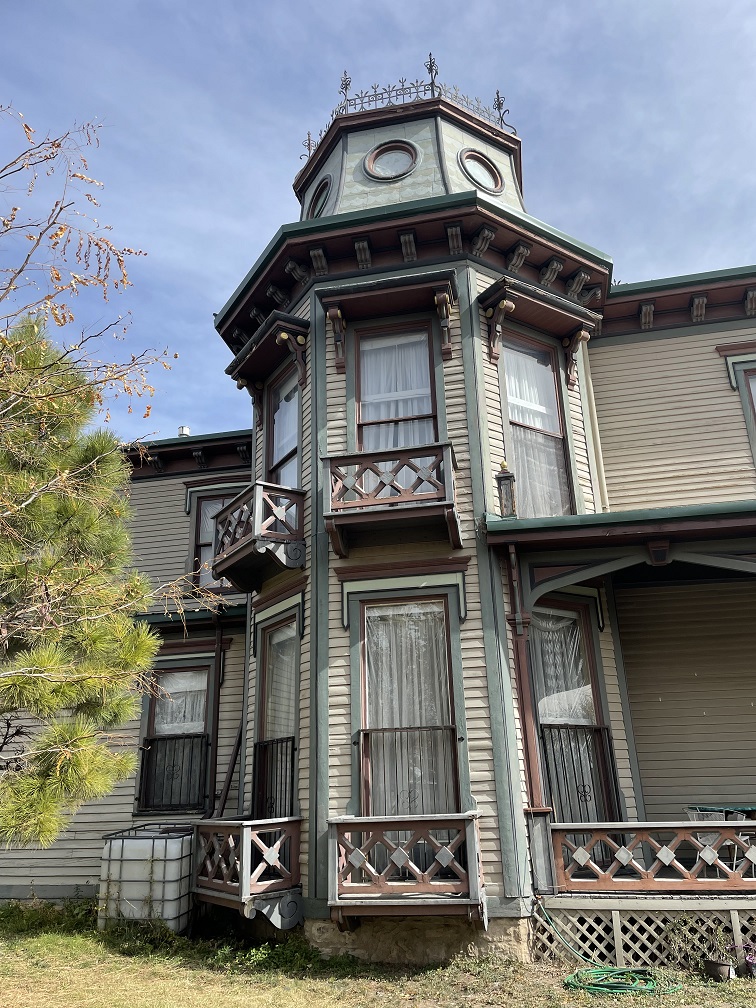
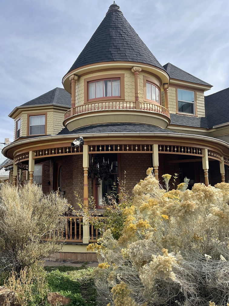
Don’t be fooled by the satellite dish and late-model Subaru Outback: this house at 512 Columbia St., just north of the library, in Las Vegas was built in 1882. According to a sign near the library, this is an example of a Picturesque Italianate Cottage. I’m inclined to agree.Perhaps it was because it was Oct. 31, but this magnificent house at 524 Columbia St., a few doors down from the Picturesque Italianate Cottage, looked especially creepy. It was built in 1881 by Charles W. Wiley, a railroad grading contractor who went on to become the mayor of East Las Vegas (as opposed to West Las Vegas, which was a separate municipality at the time). Wiley is also credited with bringing electric street lighting to the town.The building is now a bed and breakfast. It looks like a lot of work to maintain, but it’s really beautiful anyway.Many of the houses near the library had large, or even wraparound, porches. This house at 519 Washington St. has a very appealing front porch along with some other very interesting architectural features (in addition to a glorious specimen of rabbitbrush). It was built in 1898 and is 3,200 square feet.
There are a lot of really interesting historic homes in this neighborhood.
Nancy and I took a long lunch break to enjoy a hike above the Lathrop State Park campground. The Hogback Trail is a loop providing incredible views of the Spanish Peaks, the Sangre de Cristo mountain range, and the area to the north of the park including Pikes Peak (14,115 feet).
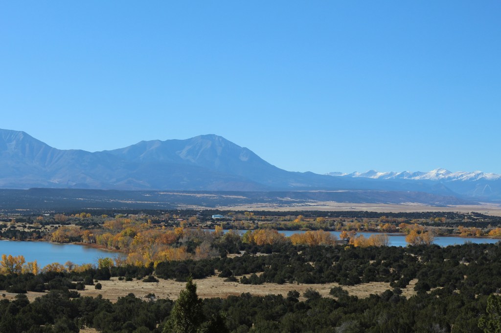
East Spanish Peak (on the left, 12,683 feet) and West Spanish Peak (13,326 feet) are a pair of mountains formed by igneous intrusions (lava flow) that overlook the two lakes of Lathrop State Park. West Spanish Peak is the easternmost mountain in the United States with an elevation greater than 13,000 feet. They were prominent landmarks on the Santa Fe Trail in the early 19th century. The Sangre de Cristo mountain range, topped with an early snowfall, is on the right.The same igneous intrusion process that formed the Spanish Peaks also formed a number of volcanic dikes in the area, including the hogback on which we were hiking.
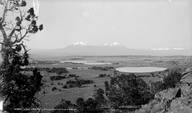
The famed photographer William Henry Jackson (1843-1942), whose images chronicled the American Civil War as well as the growth of the American West (his famous photograph of Colorado’s Mount of the Holy Cross, along with other images of the areas around present-day Yellowstone and Grand Teton national parks, convinced many people in the east that they needed to travel west), visited the area that is now Lathrop State Park in the 1880s. A short spur hike from the Hogback Trail takes one to the spot where Jackson took the photograph below; I took the one below that one about 120 years later (with the only lens and camera that I had on the hike, so it’s not a great match). Still, a pretty neat experience from a historical perspective.
We’re starting off in Colorado’s first state park, which opened in 1962. The state now has 42 parks across Colorado, and a new one, including the area around Sweetwater Lake in Gypsum, was just announced earlier this month.
Sunset at the entrance to the park. The Sangre de Cristo mountain range is on the western horizon.
Named after Harold Lathrop, the first director of Colorado’s Division of Parks and Outdoor Recreation (now Colorado Parks & Wildlife), the park has two large (for Colorado) lakes that attract a huge variety of migratory birds throughout the year. On a walk around one of the lakes, Ken saw two birds he’d never seen before: a western grebe (which had just happened to catch an early supper) and a juvenile snow goose.
In addition to the grebe and goose, Ken saw American coots, Canada geese, seagulls, American robins, and mallard ducks all enjoying a late afternoon at the lake.
Lathrop State Park is about an hour’s drive east of Great Sand Dunes National Park. On Sunday, Oct. 24, we took Gunther on a visit to the dunes, which are the tallest in North America – some are 750 feet tall.
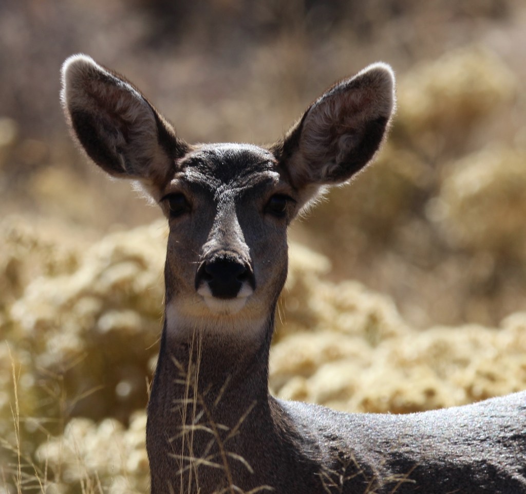
The eastern side of the Great Sand Dunes from the national park’s visitor center, about half a mile away. Mt. Herard (13,345 feet) is in the background. It’s estimated that the dunes contain 1.2 cubic miles of sand (imagine a cube with edges 1.2 miles long and then fill it with sand).We were both surprised at how many visitors the dunes received that day, given the time of year. Many were apparently from other countries, which is fairly common to experience during the off-season. The park attracts about half a million people each year.Gunther had a great time running and jumping around in the sand. We enjoyed ourselves as well, although we neither ran nor jumped.While we enjoyed a picnic lunch in the parking lot of the dunes, a small herd of mule deer paraded by. There were two bucks and probably eight or 10 does like this one.