The Organ Mountains, situated 10 miles northeast of Las Cruces, are visible from nearly every part of the city. They’re really distinctive, and, while always beautiful, look their best in the evenings as they catch the setting sun. The range extends north and south for a distance of about 20 miles, and the highest peak reaches 9,006 feet in elevation. The Organ Mountains – Desert Peaks National Monument, in three different regions, spans almost 500,000 acres of BLM-managed land and surrounds the city of Las Cruces. The Desert Peaks part of the monument is west of Las Cruces and includes the Doña Ana Mountains, the Robledo Mountains, and Sierra De Las Uvas, and the Potrillos Mountains 30 miles southwest of Las Cruces. Nancy and Gunther and I visited the Organ Mountains region of the monument in late November and enjoyed a nice 3.6-mile hike – the monument has a total of 48 miles of hiking trails.
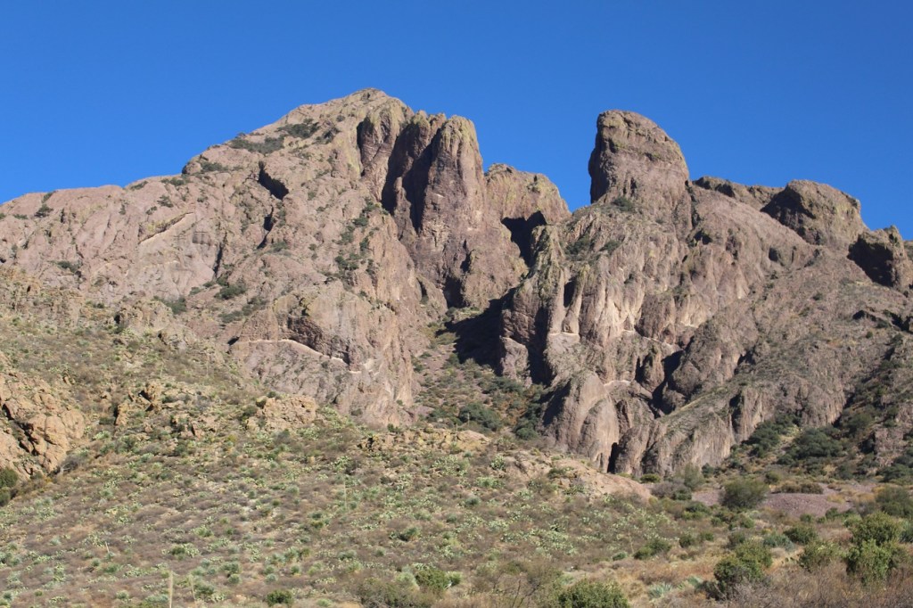
The Organ Mountains were formed from a series of volcanic eruptions that started about 36.5 million years ago and ended 500,000 years later. The mountain range was tilted and uplifted through action of the Rio Grande Rift about 18 million years ago. That tilting, and the erosion in the millennia following, resulted in the distinctive look of the mountains.
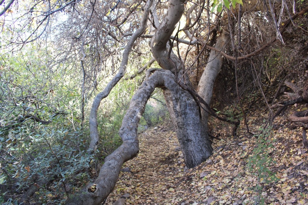
One of the first features we encountered on the trail was La Cueva (“the cave” in Spanish), at the base of a huge rock face. It started being inhabited by the Jornada Mogollon natives about 5,000 years ago. Excavations in the 1940s and 1970s uncovered fragments of ceramic pots as well as projectile points and stone scrapers. There are 243 known archeological sites in the monument. La Cueva was later used as an outlaw hideout.
This huge rock face (see the people standing outside the cave at the bottom for a sense of scale) is formed from rock that erupted about 36.5 million years ago, forming a rock type called tuff from a moving river of hot gases, ash, and rocks. Dogs aren’t allowed on the trail going to the cave, so we weren’t able to get close to it. Thanks, Gunther!
We both grew up and spent most of our lives in Colorado, so it’s been exciting to learn about all of the animals and plants of the southwestern desert region. Despite the rugged and arid environment of the monument, almost 150 different grasses, ferns, cacti, trees, shrubs, and herbs have been identified in the area.
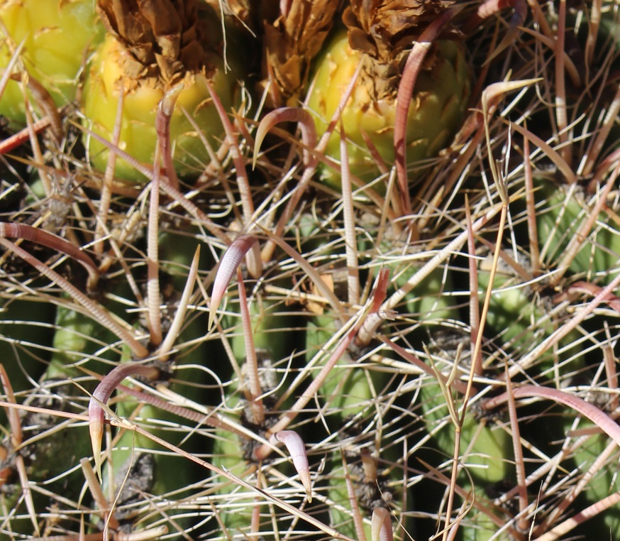
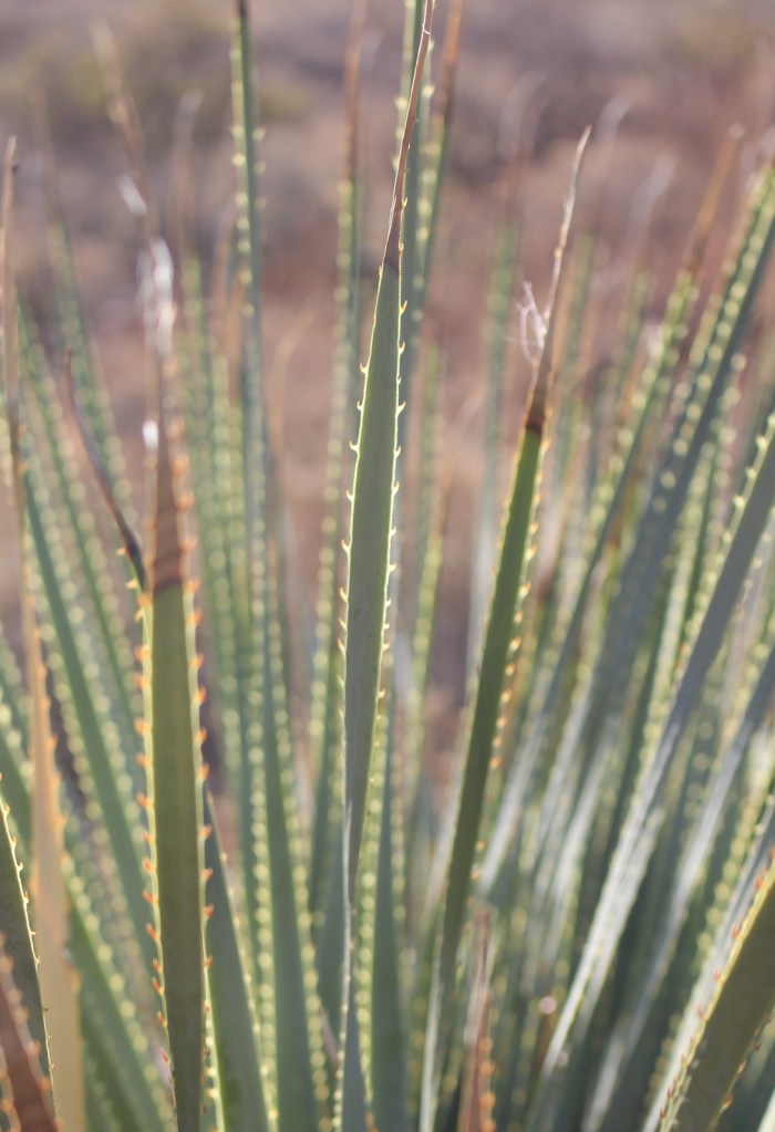
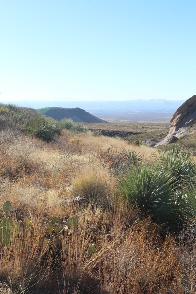
The plant in the foreground is desert spoon. Although it looks like a succulent, it’s classified as a shrub. It’s also known as sotol.The monument is located in a really harsh environment, but there’s a huge variety of plant life. Prickly pear cacti abound, of course, but there are also 15 species of grass. Prior to becoming a monument in 2014, the area was used for many years by ranchers for grazing their cattle.There were some unexpected finds of plant life. A seasonal stream runs near La Cueva, and it supports some decidedly deciduous trees (that look like they still had to work pretty hard to grow).These are the spines of a type of barrel cactus called a fishhook, and you can see how it earned that name. We have seen lots of fishhook cactus in the wild and also in cultivated gardens in New Mexico.On the trail, Nancy, always on the lookout for historic mines, recognized the mound of light-colored rocks in the lower left as a tailings pile. Just a few steps later on the trail, an interpretive sign identified the area as being what remains of the Modoc Mine. The Modoc Mining Company spent a million dollars in 1898 (more than $30 million today) to build the silver and lead mine, a three-story ore mill, and a small townsite. The mine had shafts that tunneled several hundred vertical feet, and a well drilled four hundred feet down supplied water to everything.Here’s a closeup of some desert spoon spines. As with most plant life in the Chihuahua Desert, it’s best to look and not touch. And definitely don’t lick these spoons. The Spanish word for spoon is “cuchara,” which is the name of a spoon-shaped valley in Colorado’s mountains that’s home to a former ski resort also named Cuchara.This is looking west from the monument. The city of Las Cruces is behind the dark ridge on the left. Prickly pear cactus in the left foreground; desert spoons in the right. Spoons, spoons, spoons … everywhere! … And here are some more. Desert spoons send up a flower stalk six to 17 feet tall, but their roots extend only about a foot underground.The Organ Mountains are really interesting to look at – the erosion over millions of years has resulted in some very picturesque rock formations. All of the lighter green plants in front of the mountains are prickly pear cactus.After all of the desert plants we’ve seen, it was nice to encounter this old friend growing alongside the trail. I learned about sideoats grama, and many other range grasses, as a high-school student in Vocational Agriculture class.This pretty grass is splitbeard bluestem, also known as silver bluestem. It was not one of the grasses I learned to identify in high school, so more learning for me now. In late November, of course, all of the grasses had already gone to seed but a few retained their seedheads.This is black grama, which looks very similar to blue grama that grows in Colorado. Because of its quantity and nutritive value, black grama is a very important natural grass for New Mexico’s cattle ranchers. Blue grama is my favorite species of grass (a close second is big bluestem, a relative of the splitbeard bluesteam above), probably because the mature seed heads look like eyelashes. What’s your favorite species of grass, and why is it also blue grama?
I took the grass photos toward the end of our hike. Although it was relatively short, the hike afforded an opportunity to see a huge variety of plants. We didn’t see very much wildife, but the area supports dozens and dozens of native and migratory bird species, including seven species of hummingbirds and 23 species of towhees and sparrows.
Several historic persons of note, including William H. Bonney (“Billy the Kid”) and Geronimo, are known to have passed through what is now the monument. Twenty-two miles of the Butterfield Overland Trail, which, from 1858 to 1861 ran between St. Louis and San Francisco as a forerunner of the Pony Express, passed through the region. Areas of the monument, prior to coming under BLM management, have also been used for bombing practice by the U.S. Air Force and for astronaut training (not at the same time).
We’ll definitely return to the Organ Mountains – Desert Peaks National Monument, and next time we’ll leave Gunther in the Goddard so we can visit some of the features that (understandably) are off-limits to dogs. I’d especially like to see the area in the spring during the wildflower blooming season.


Leave a comment