13 miles south of Bowie, Arizona – February 6, 2022
Apache Pass is a natural low geologic divide in southeast Arizona separating the Dos Cabezas (Spanish for “two heads”; see more below) Mountains from the much larger Chiricahua (pr. “cheer-uh-cah-wah”) mountain range. Apache Spring, a year-round source of flowing water near the pass, is the main reason many thousands of people traversed the pass beginning in 1848 through the end of the U.S. Army’s conflicts with Native Americans in the mid-1880s. Horses and people needed water to keep moving, and Apache Spring was the only dependable source of water for many miles. From the end of the Mexican War in 1848 through the end of the Apache Wars (1862-1886), Apache Pass provided a corridor for travelers between El Paso and Tucson. Once the southern route of the intercontinental railroad was completed in 1880, the pass became less important for travelers and commerce since trains weren’t as dependent on water as horses were. Until then, Apache Pass was an important point in the expansion of the American west: many thousands of people and great tonnages of goods found their way to the West by traversing the pass.
Chiricahua Apaches lived in this area for many years prior to other cultures entering the Apache Pass region. The pass was identified by both Spanish and, later, Mexican forces during their respective control of the area in the 18th and early 19th centuries.
Many Anglos first used Apache Pass on their way to the California gold fields in 1849. In 1858, the U.S. Congress authorized the development of an overland mail route, operated by the Butterfield Overland Mail Company. In operation between 1851 and 1861, the Butterfield route took advantage of Apache Spring to water its horses.
Apache Pass was also the site of the Bascom Affair, a conflict between Chiricahua leader Cochise’s band of Apaches and the U.S. Army in 1861. The Bascom Affair was the beginning of a decade of conflict between the Chiricahua and the Army, and led to the development of Fort Bowie to protect travelers using the pass and spring.
In 1872 the U.S. government struck a peace accord with the Apaches, establishing the Chiricahua Apache Reservation. For four years things went pretty smoothly, but the Apaches began to flee the reservation and conduct raiding parties into Mexico; the military presence in the pass subsequently increased. Geronimo eventually surrendered to the Army in 1886. Between the removal of the Native Americans and the completion of the railroad, the need for the U.S. military in the pass disappeared. Fort Bowie’s last garrison left the fort in 1894.
Fort Bowie National Historic Site, declared a National Historic Landmark in 1960 and located about 35 miles from Willcox,, preserves some of the building ruins and other features of a U.S. Army outpost built in the 1860s to protect travelers using Apache Pass from Native American attacks. In addition to fort ruins, this 1,000-acre site also features a number of other interesting historical areas, all of which are accessible by a 1.5-mile hike from the parking lot to the site’s visitor center.
Nancy and Gunther and I visited Fort Bowie National Historic Site in early February. It was an immensely rewarding experience, from both a historical perspective as well as a natural history view.
The site is unique in that visitors are encouraged to hike 1.5 miles to the visitor center rather than simply driving to a visitor center parking lot and then hiking from there; it’s certainly possible to drive to the center and park, but you’d miss out on a lot of natural and historical points of interest.
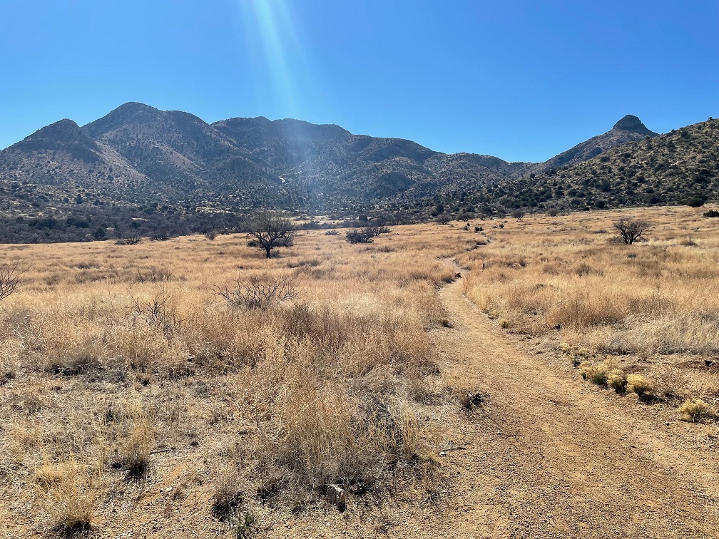
One of the first historic stops on the trail is this view of the camp site for a survey party led by Lt. John Parke of the Topographical Engineer Corps in March of 1854. The party, searching for an all-weather route for a transcontinental railroad, had marched 55 miles through the desert prior to reaching Apache Pass and the spring. The men rested at this spot for two days, enjoying both easy access to water and the companionship of the then-friendly Apaches. Parke would find an easier route for a railroad to the north of the pass, and the rail line was completed in 1880. The route, which passes between present-day Willcox and Bowie, is still in use today; there was puh-lenty of railroad traffic passing through Willcox while we stayed there.
The Bascom Affair
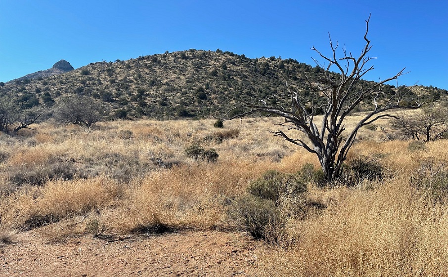
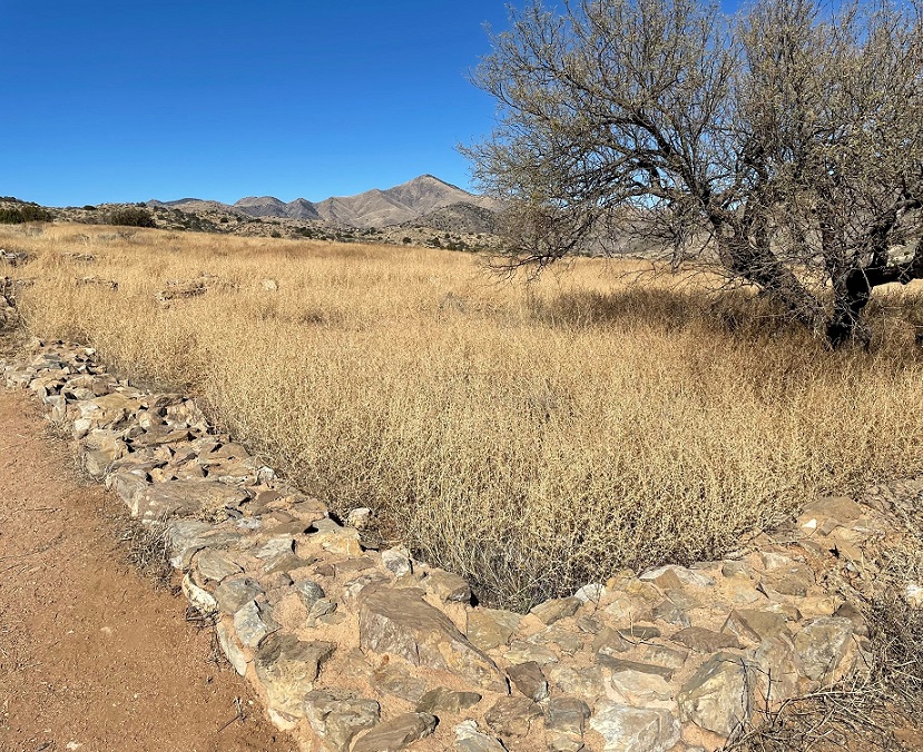
The next significant event, from an Anglo perspective, in the Apache Pass region occurred in January, 1861. A boy named Felix Martinez Ward was kidnapped by Apaches when the Native Americans raided the Ward family ranch. Lieutenant George Bascom was put in charge of the U.S. Army’s effort to find the boy. Bascom arrived in the Apache Pass area on Feb. 4, 1861, with a detachment of 54 men and camped in the area shown above. Cochise, the famous Chiricahua Apache chief, was invited to meet with Bascom. The young lieutenant accused Cochise of kidnapping Felix Martinez Ward, and Cochise denied the claim. Nevertheless, Bascom ordered that Cochise and his party be held hostage.The Bascom camp was just on this side of the hill shown above. Cochise escaped from the tent in which he’d been held and ran up the hillside. Cochise used a knife that he’d hidden to cut through the tent’s fabric; Cochise’s action is still remembered as “Cut the Tent” by the Apache today. The other Chiricahua, including members of Cochise’s family, were recaptured by U.S. forces. Bascom moved his detachment to a stage station nearby and fortified that building, apprehensive about what might occur during the night.These are the ruins of the Butterfield stage stop where Bascom and his soldiers sought refuge. Built in July 1858, the station had walls that reached up to 8 feet high. The morning after Cochise escaped, Apache warriors approached the station and told Bascom that Cochise wanted to talk. The meeting progressed for about half an hour before ending abruptly; one of the station workers had been captured by the Native Americans. Shots were fired and in the following weeks Cochise took more captives, attempting to exchange them for his family and other warriors held by the U.S. Army. Those talks failed as well, and Cochise killed the hostages; the Army retaliated by killing the Apaches in their custody.
The Bascom Affair ignited more than 20 years of conflict between the Chiricahua Apache and the United States government. Significantly, Felix Martinez Ward had indeed been kidnapped by Apaches but not by Cochise’s Chiricahua. He was raised among the White Mountain Apache and, as an adult, became a scout and interpreter for the U.S. Army.
The Butterfield Overland Mail route passed through the center of the area shown in this photo (I think the trail is a modern hiking one, not a remnant of the stage trail) and passed by the stage stop. In 1857, the U.S. government awarded John Butterfield a contract to carry mail between St. Louis and San Francisco. The stage coaches took 25 days to complete the 2,500-mile route. The Chiricahuas permitted the passage of the stages for two years; in exchange for gifts, the Apaches provided firewood for the stage station. Butterfield used smaller mule-driven coaches for this mountainous stage of the route, as opposed to larger horse-driven coaches on either end of the line.
The company received $600,000 per year to carry the mail between St. Louis and San Francisco. Butterfield started with 2,000 employees, more than 250 coaches, nearly 2,000 horses and mules, and 240 stage stations along the route.
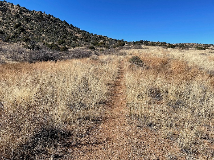
After the stage stop ruins, the next stop along the trail is the post cemetery for Fort Bowie.
The cemetery actually predates the fort, as some U.S. Army soldiers were buried here in 1862. In addition to soldiers, the cemetery held the remains of the soldiers’ families, civilians, emigrants, mail carriers, and three Apache children, one of whom was Geronimo’s two-year-old son. About a half-year after the closure of Fort Bowie, most of the remains were reinterred at the San Francisco National Cemetery. However, the graves of 23 civilians are still here.
The next significant stop on the trail to the visitor center is the ruins of the Chiricahua Apache Indian Agency.
Cochise died of natural causes in 1874 on the Chiricahua Reservation. Before his death he’d befriended a U.S. Indian agent named Thomas Jeffords, who governed almost a thousand Apaches from this agency from 1875-1876. The U.S. government removed Jeffords from this agency in June 1876 and relocated 325 Apaches north to the San Carlos Reservation. Many of the Chiricahua fled the reservation, however, and resumed hostilities with Anglos that would continue for another decade. The ruins of this agency were excavated in 1984. The building had three rooms, each with its own fireplace, and wood floors. National Park Service conservators have stabilized the ruins with plaster to slow their erosion; an ill-behaved dog at right provides a sense of scale.
A recreation of an Apache camp is a little ways further down the trail. The surrounding area, although rocky and mountainous, provided everything that the Chiricahua needed to make their home here: water from Apache Spring, wild game, edible plants, and materials for building shelter, weapons, and tools. The Chiricahua culture centered around the wife’s extended family; after marriage, the husband entered into the family and committed to supporting his wife’s relatives. While the men hunted and participated in raiding expeditions, the women maintained the wild food crops.
The camps consisted of small groups of several wickiups, built from a pole framework and covered with long grass and animal hides, like this one. Because of inconsistent food supplies and threats of enemy attack, the camps were not permanent and the Apaches moved often. Here we see a big baby absolutely terrified of what unimaginable horrors might wait in the dark depths of the wickiup recreation (there was nothing, as it turned out), accompanied by Nancy.We got Gunther as an eight-week-old puppy in early November 2019, just a couple of months before the pandemic started, so he grew up in the last couple of years not having a whole lot of exposure to new experiences. For instance, we were made to realize he’d never been very close to horses when we went to Tombstone a few days after this hike. Once he gets used to new things, he’s generally okay with them. He gets along great with other dogs and people (and horses, once he’s seen one). He’s a really good dog, although I think he prefers hikes that have a lot more walking and a lot fewer opportunities to learn about history than this one did.
The Battle of Apache Pass
In mid-July, 1862, a guard of about 100 California Volunteers marched through Apache Pass toward the San Simon River in order to build a supply depot in that area. When the column approached the Butterfield stage station, which had by then been abandoned, it was attacked by Cochise, his ally Mangas Coloradas, and about 150 Apache warriors. The Californians drove the Apaches into the hills shown above, only to find that the Native Americans had taken up new positions around Apache Spring. After another attack, the Californians finally reached the spring and drove the Apaches away once again. The Battle of Apache Pass, July 15-16, 1862, led to the establishment of Fort Bowie.
We were on this trail in early February and were plenty warm; I cannot imagine what it would have been like to engage in battle with Apaches in mid-July, and while trying to fight your way to water.
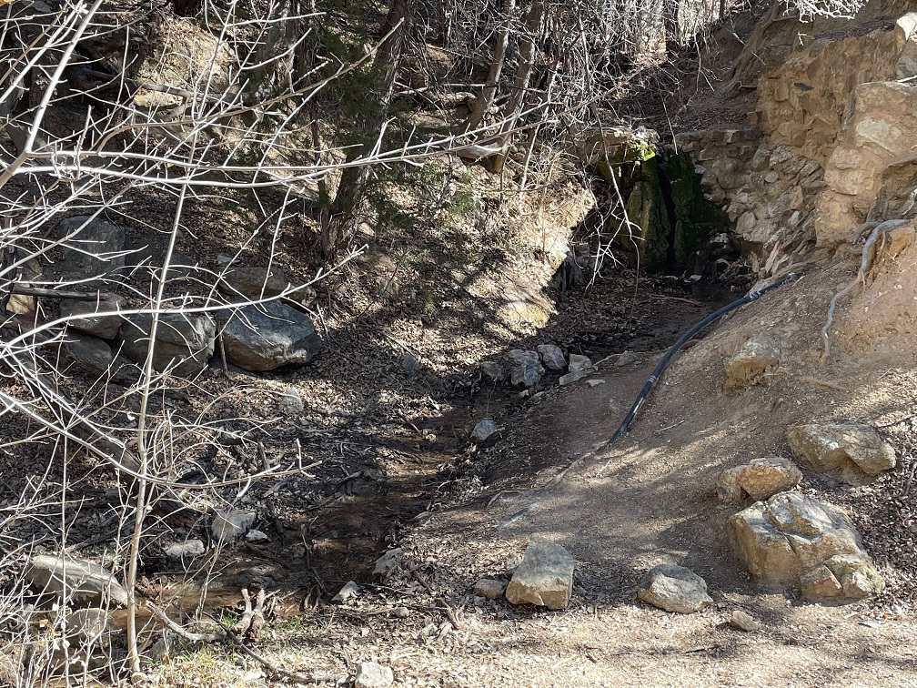
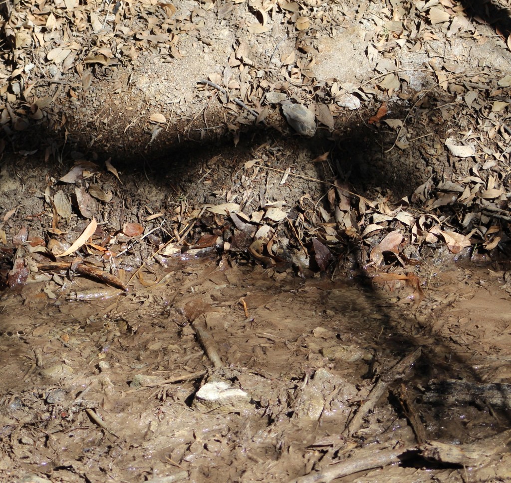
Apache Spring
This is what all the deadly fighting over the decades at this site was about: Apache Spring, the only year-round source of water in the region. Archeologists have found pottery fragments around the spring that suggest the Mogollon Native Americans were here many years before the Apache came to this area.Apache Spring averages a flow of about 5 gallons per minute, but that can vary significantly depending on the time of year and recent precipitation amounts. It’s not a big outflow, but it’s wet and that’s all that matters. This little rivulet a few yards from the mouth of the spring is about a foot wide. Fort Bowie is a quarter-mile further down the trail.
The First Fort Bowie
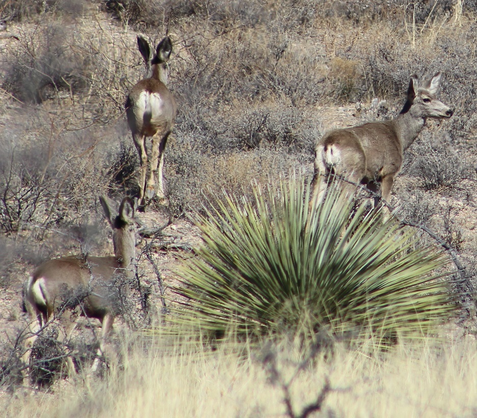
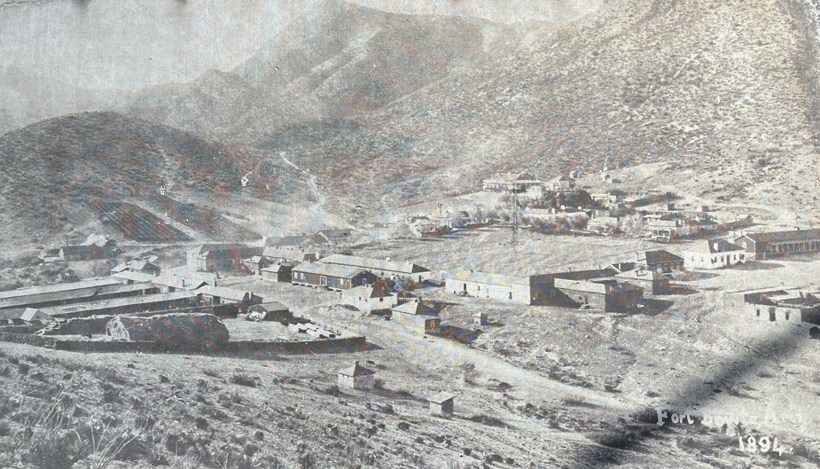
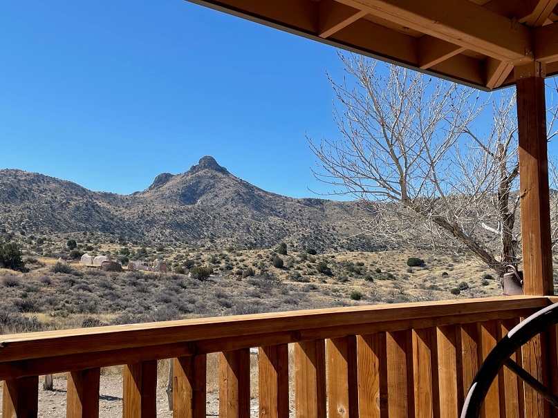
A 500-yard spur from the main hiking trail leads to these ruins of the first Fort Bowie. Construction started in July 1862 following the Battle of Apache Pass and the U.S. Army’s control of Apache Spring. A 100-man detachment of the 5th California Volunteer Infantry, under the command of Col. George Washington Bowie, completed the fort in two weeks. Incidentally, this instance of “Bowie” is pronounced “BOO-ee,” not “BOH-ee.” Also, that tree growing in the middle of the ruins is a catclaw acacia (Acacia greggii). Its Apache name is “ch’il gohigise,” which means “a bush that scratches you.” It has very sharp and claw-like thorns, but its seed pods were a significant food source for the Apache and they used the wood to make furniture and drumsticks. Bees are attracted to the catclaw’s blossoms and make a very distinctive honey.Although the Apaches didn’t control the water at Apache Spring any longer, they continued to attack travelers that weren’t being protected by the U.S. Army as they traversed Apache Pass. This first fort was only in use for six years as the California Volunteers pursued the Apaches with little success. It was apparently not an enviable duty post because of the extraordinary isolation, constant illness, poor living conditions, and consistent threat of Native American attack. I’d think, however, that the original builders would be pleased to know that the walls they constructed are still standing, in the heat of the Arizona sun, 160 years later. Regular U.S. Army soldiers relieved the volunteers in 1866 and began construction of the new Fort Bowie, 300 yards northeast of this location.This picture was taken looking to the southwest of the hill on which the first Fort Bowie was built; I’ve indicated the locations of several stops on the trail. The location of Apache Spring is not in this photo; it’s to the right of the area shown in the picture. The prominent mountain in the background is Government Peak, elevation 7,556 feet.As we approached the visitor center, we encountered a herd of 10-12 mule deer about 100 yards away. They gradually made their way up the opposite hillside, blending really effectively into the rocks and brush of the area.This is the visitor center for the Fort Bowie National Historic Site. At the end of the 1.5-mile hike, it’s an impressive structure that overlooks the site of the second Fort Bowie, and has a wonderful wraparound patio with plenty of rocking chairs and benches from which to admire the view. The building contains artifacts from the fort and other items representative of military life in the late 19th century; we didn’t spend much time in the building because due to Covid concerns NPS was understandably limiting how many people could be inside at the same time. That’s what is left of the fort’s armory on the left side of the image, well removed from the original site of the fort itself.Like the Indian agency from down the trail, there’s not much remaining of Fort Bowie. The mounds you see in the middle foreground are walls of the fort’s buildings that have been covered in plaster by NPS conservators in an attempt to preserve as much of the original construction as possible. This picture is taken from in front of the visitor center, looking to the northeast.This is a picture of a picture of Fort Bowie from January 1894, at the height of its presence at Apache Pass. For a perspective, the angular hill at the top left of the previous photo is the same one at the top center of this one. The tall building on the right side of the photo comprise the commanding officer’s quarters and in front of that structure are the officers’ quarters. The hospital is to the left and up the hillside a bit from the CO’s quarters. The low buildings at left are the corrals and stables; behind those are the ice machine and steam engine. In total, there are about 38 buildings in this photo. With the Apache Wars ending after Geronimo’s final surrender in 1886, the Army occupied Fort Bowie for eight more years. The U.S. Army abandoned Fort Bowie nine months after this original photo was taken. Area residents stripped the wood from the buildings for their own uses, and all that was left were adobe walls.Here’s a view over the ruins looking southeast from the visitor center’s railed porch, where Nancy and I sat on rocking chairs while enjoying a picnic lunch. Gunther collapsed in the shade of the porch. Some of the fort’s ruins can be seen in the mid-foreground as light tan mounds. You may have noticed the prominent rock formation in the background in previous photos; it is called Helen’s Dome, elevation 6,376 feet. The granite peak is reportedly named after the wife of an officer at Fort Bowie, and served as an important landmark for travelers approaching Apache Pass.
After the visitors center, hikers can either retrace their steps back to the trailhead’s parking lot or use an alternate route that provides a different perspective on the surrounding area. We chose the latter.
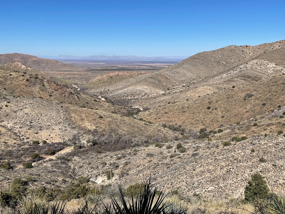
This spectacular view shows the valley of the eastern approach to Apache Pass and the Peloncillo (Spanish for “little baldy”) Range, 35 miles away on the horizon, and just beyond those mountains lies the New Mexico/Arizona border.
We also decided to drive back to The Goddard by a different route, making a loop between Willcox and Bowie on either end. It gave us a chance to see some different country, and I’m glad that we did.
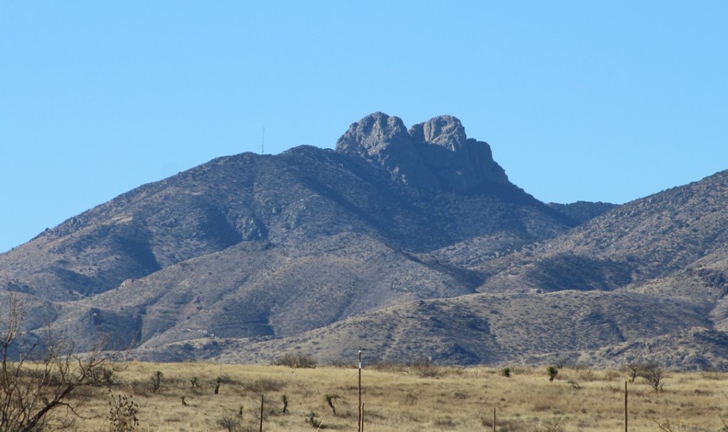
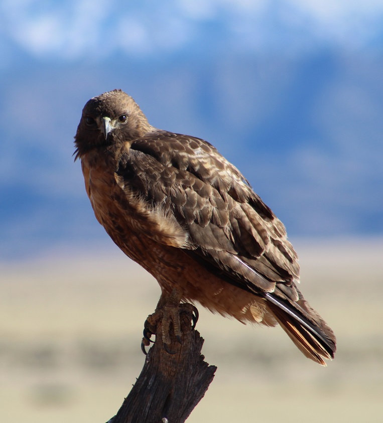
This is the rock formation that gives the Dos Cabezas (“two heads” in Spanish) Mountains their name. It doesn’t take much imagination to see faces in the rocks, especially the one on the left. This formation is about 15 miles due west of Willcox; it’s easily visible from the town (I enjoyed watching the colors of the setting sun on the formation while playing with Gunther in the campground’s dog run), but this perspective from the opposite side definitely shows you why it’s named what it is.We also passed this red-tailed hawk, perched on a roadside fencepost, on the way back to Willcox. It let me take five or six pictures before taking off. That’s snow-covered Mount Graham in the background, but from the opposite side of where we saw it while staying in Safford, Arizona.
We really enjoyed Fort Bowie National Historic Site. This was a “the journey is the destination” sort of experience — while it was interesting to see the ruins of the actual fort, the hike to those ruins, and the natural and cultural historic points we saw, was more rewarding. Hiking in the same paths that Cochise and Geronimo once walked, and learning more about the conflicts between the Chiricahua who lived here and the U.S. Army, is something that we’ll always remember.