Homolovi State Park, near Winslow, Arizona April 16, 2025
We’re camping for two weeks in Homolovi State Park, just a couple miles east of the town of Winslow, Arizona (pop. 9,005; perhaps you’ve heard of it – one of its street corners is mentioned in the Eagles’ first major hit from 1972, “Take It Easy”). This is our third time staying here in three years – we really enjoy it. After spending five months wintering in Las Vegas, Nevada, and then a couple of campgrounds on Interstate 40 in Arizona, we’re appreciating the quiet environment and dark skies of this state park (not that we didn’t have a good time in Las Vegas; in fact, we’ve reservations to be back there beginning this November).
The main feature of this state park is a cluster of four major ancient Native American villages, several miles apart and all built and occupied around the years 1290-1400. The villages were then abandoned, but it’s generally understood that the people who lived here eventually became what is now the Hopi nation – one of the tribe’s reservations is about 60 miles north of present-day Homolovi State Park. The four villages are designated Homol’ovi I-IV; the name of the state park doesn’t include the apostrophe of the village names. “Homol’ovi,” in Hopi, translates to “place of the little hills,” and the Hopi also refer to the city of Winslow as “Homol’ovi.”
The Hopi call the people who lived here – most likely their ancestors – the Hisatsinom, which means “the people of long ago.” During the period in which the Hisatsinom lived in this region, they built and occupied four or five large villages – some comprising hundreds of rooms – using rocks gathered from the ground.
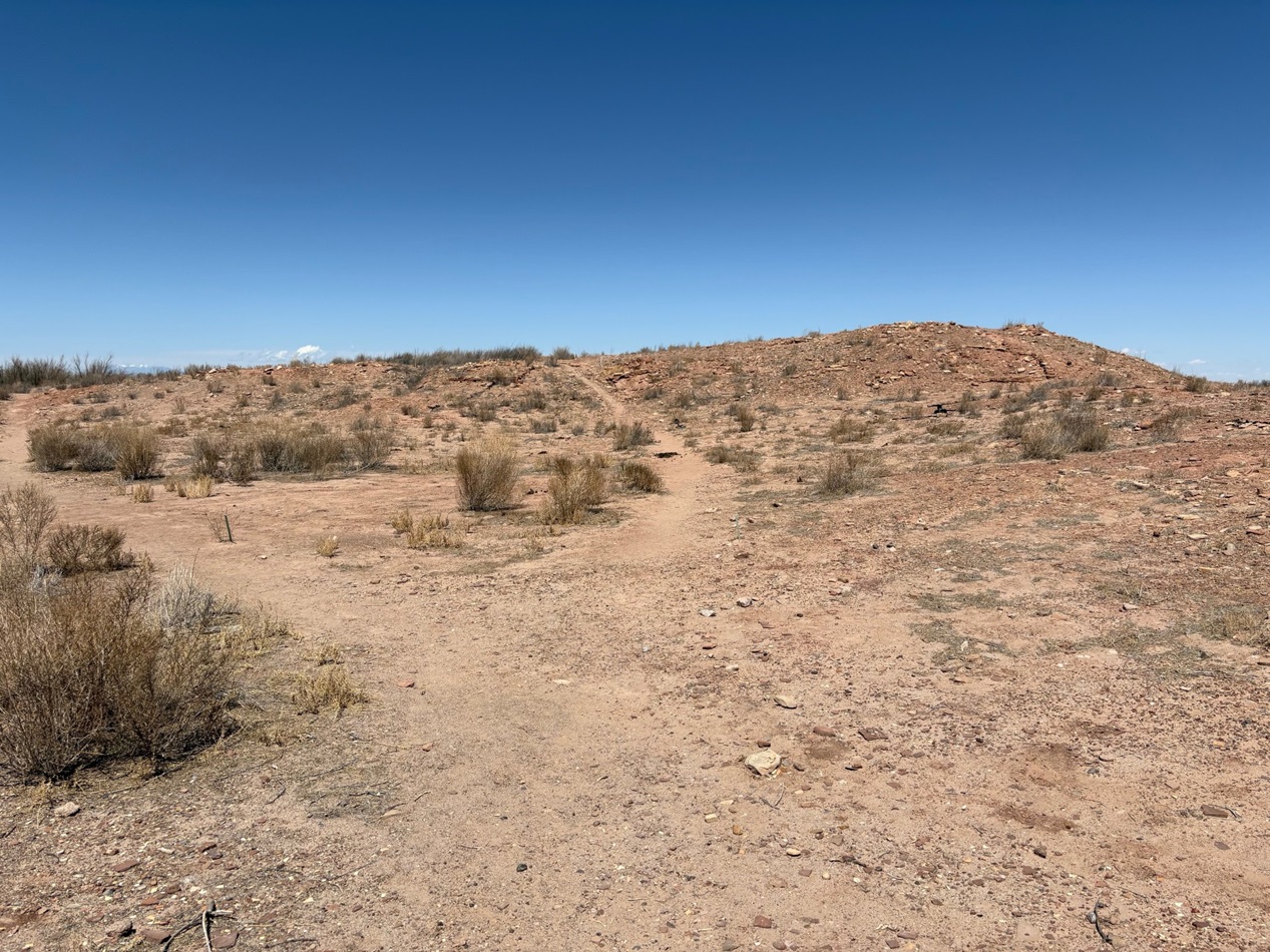
The Little Colorado River, a watercourse that drains the Painted Desert area of northeastern Arizona, flows through Homolovi State Park. I took this photo while Nancy and I were driving to Winslow; the perspective is looking north from a bridge on the former U.S. Route 66 (and now Arizona State Highway 87). The trucks and trailers just on this side of the horizon are on Interstate 40. The Little Colorado River’s headwaters are in the mid-eastern region of Arizona, very near the state’s border with New Mexico. It then flows almost 340 miles in a northwestern direction until it empties into the Colorado River in the Grand Canyon. The river flows from its headwaters all the way to the Grand Canyon only during periods of flash flooding or heavy snowmelt; much of the year it’s a braided and puddled wash. I took this photo the day after the area got some appreciable rain and snow, and the water level rose only marginally. The occasional flash flooding of the Little Colorado River, which swept away crops and structures, is probably why the Homol’ovi sites were abandoned in favor of the area further to the north and which the Hopi call home today.This is the site of a major native American village, known now as Homol’ovi I, that was last occupied about 600 years ago. At its peak, it contained about 1,100 different rooms constructed of rocks. Some of the rooms included three stories. Over the ensuing six centuries, a lot has happened to destroy these unoccupied villages. Dependable northern Arizona winds have covered the village with dirt and sand, but some structures, such as the one on the mound at the right, can still be discerned. Many of the rocks in the structures were taken by members of a nearby Mormon community in the late 1800s for use in their own buildings, and vandals have also destroyed the buildings and looted the pottery.
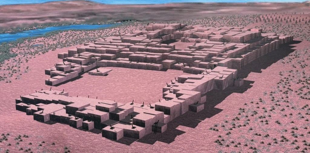
Take a look at the tall plants on the horizon at far left: directly to the right of them, you’ll see some white splotches (not the clouds, which are further to the right; the smaller white splotches of which I write are immediately to the right of the tall plants). Those are the San Francisco Peaks, still snow-covered in mid-April. The town of Flagstaff, Arizona, is at their feet. Those mountains are about 65 miles west of Homolovi State Park.I took a picture of this image, an artist’s depiction of what Homol’ovi I looked like at its peak, at an information kiosk near the site of the former village. That’s the Little Colorado River in top right. The original image gives credit to Douglas Gann of the Center for Desert Archaeology.
From about 1290 to 1360, it’s believed that Homol’ovi I grew from a village of 200 rooms to more than 700. Around the year 1360, the village now known as Homol’ovi II was established about 3 miles, or 5 kilometers, north of Homol’ovi I; that second village quickly became the biggest one in the cluster at 1,200 rooms. Homol’ovi I, however, benefited from the second village’s success, and grew to a maximum of 1,100 rooms.
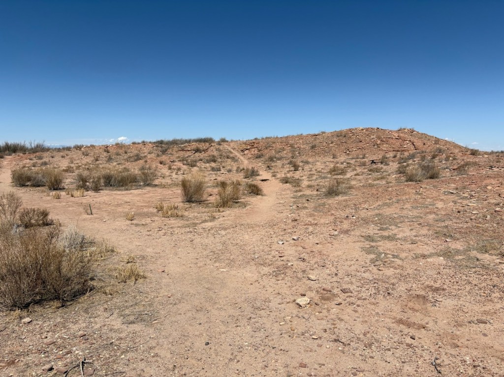
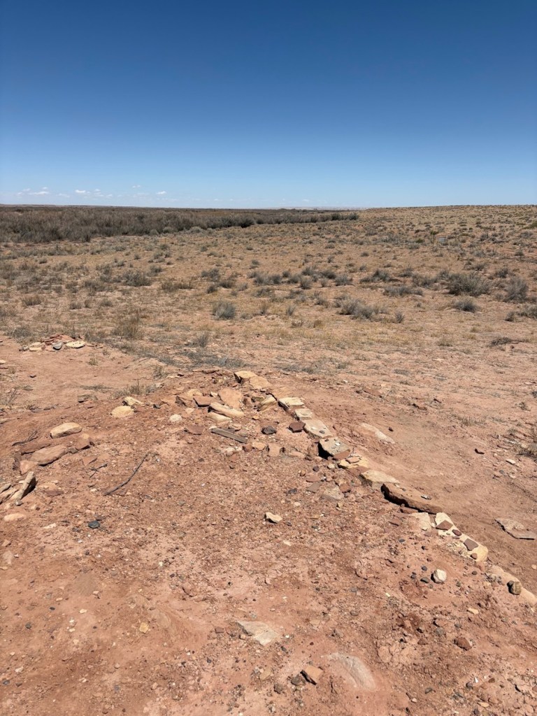
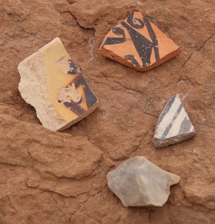
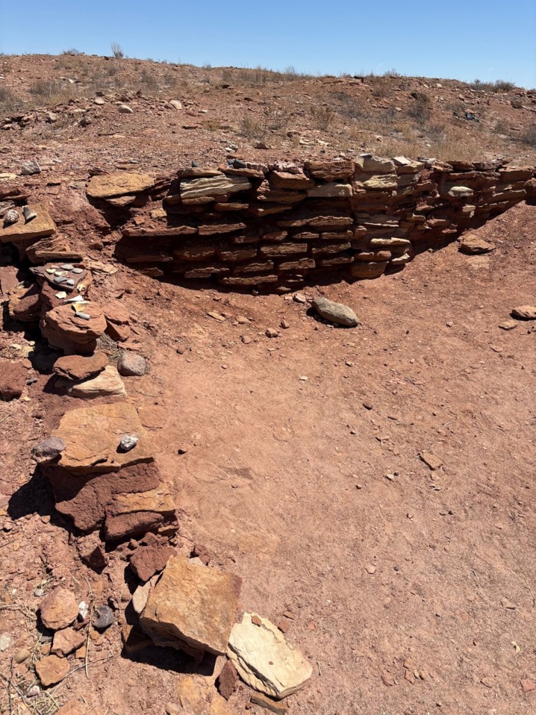
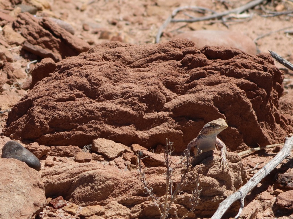
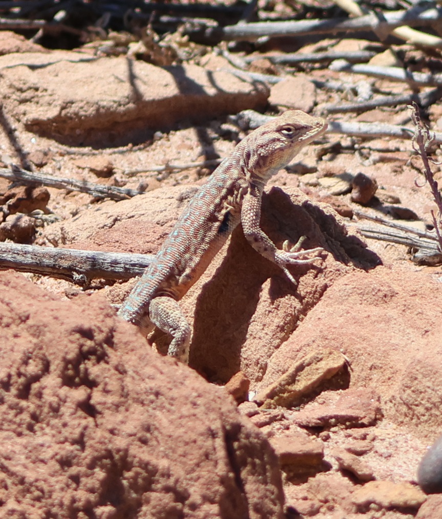
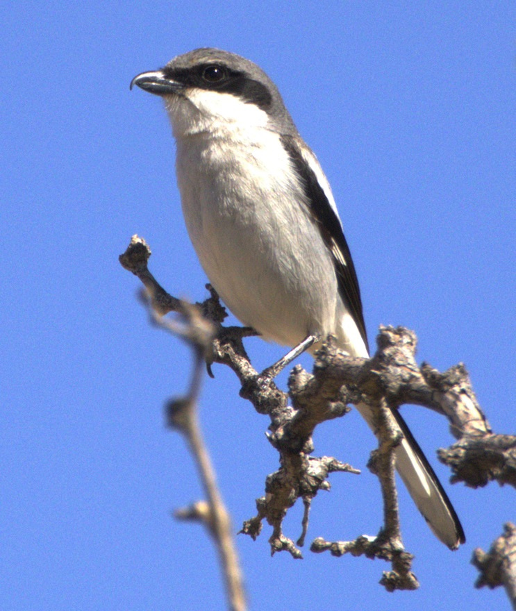
This photograph was taken from the top of the hill shown in the previous photo, still looking to the northwest. The rocks in a line are the former wall of a room. The trees near the horizon are on the east bank of the Little Colorado River; it was that river’s occasional flash flooding that likely led to the abandonment of Homol’ovi I and the other villages 600 years ago.This is a small grouping of pottery shards and what appears to be a hand-shaped rock, taken from the ground at Homol’ovi I and placed on a larger rock. The pieces of pottery are roughly the size of an American half-dollar. There are thousands of shards like these at the site, and most of them are on larger rocks like this. Archeologists and conservationists prefer that people don’t do this; instead, simply leave the shards on the ground.This is the largest exposed wall still standing at Homol’ovi I, and it’s been almost entirely rebuilt by archeologists. Note the small collections of pottery shards on some of the rocks at left: don’t do that.THIS IS A TALES OF THE GODDARD LIZARD ALERT. This little guy (and he is a guy, and I’ll tell you why I know shortly) caught my eye as he scampered across the rocks and sand of Homol’ovi I. He is a side-blotched lizard, a genus (Uta) of which there are now seven species, and he and I were to have kind of a neat interaction. This photo of my new reptile pal shows why the genus is called side-blotched lizard – observe the dark mark (or, in scientific terminology, “blotch”) on its side just behind its front leg. The turquoise-blue dots on the back are also a defining characteristic of the genus. These lizards grow to a length of about six inches, including the tail. Their diet includes insects, spiders, and other arthropods such as the occasional scorpion. They are themselves predated upon by larger lizards and roadrunners.In an attempt to give the reptile some space, I continued walking down the path through Homol’ovi I – but the beast pursued me. Observe the very pretty light-blue dots on its back. I was about six feet from the lizard when I took this photo (using a 400mm telephoto lens).Here’s a cropped version of the previous photo. Behold those beautiful blue dots as well as some detail of its fearsome front claws. After I took the photo, the lizard continued to approach me: in fact, it got to about six inches from my left foot – and then it scampered away. Turns out, that’s a common behavioral trait of male side-blotched lizards. The scientists don’t know if the behavior is intended to scare away possible intruders from its mate, or to defend its territory. At any rate, I got the hint and moved along (even though my course on the path took me in the same general direction of the lizard, who at that point was many yards away). I later described my interaction with the side-blotched lizard to Nancy, who did not at all appreciate when I poked her under her armpit to show her where the blotch on the lizard’s side was. We also shared the same belief that she would have absolutely and completely freaked out if the lizard had gotten to within six inches of her left foot.More wildlife: I always like to include some bird photos in these postings, so here are a couple of images I took in our campground at Homolovi State Park. This is a black-throated sparrow (Amphispiza bilineata), a species found in the southwestern United States and much of Mexico. They are absolutely beautiful little birds. I’ve seen them only here at Homolovi State Park and at Tuzigoot National Monument, further west in Arizona.This is a loggerhead shrike (Lanius ludovicianus), on a tree just a few feet from the Goddard’s campsite. I remember reading about shrikes when I was young, but I didn’t see one in the wild until a couple of years ago at McDowell Mountain Regional Park east of Phoenix, Arizona. I also saw some over this past winter at Clark County Wetlands Park, very close to the campground where we spent the winter near Las Vegas. Loggerhead shrikes are found nearly all over the United States.
We’re planning to join a ranger-led tour of Homol’ovi II, which has been partially excavated and reconstructed, on Saturday, April 26. I’ll write and post photographs from that experience afterwards. We were on the same tour a couple of years ago, but, because of our travels and opportunities to see ancient Native American sites in the southwestern United States since then, we have a better perspective of what we’ll see.


Leave a comment